Alfred Cove, Western Australia

Last updated

Alfred Cove
Perth,  Western Australia
Waylen bay heathcote.jpg
Waylen Bay on the Swan River, Applecross
Alfred Cove, Western Australia
Coordinates 32°01′58″S115°49′01″E / 32.0328506°S 115.8170316°E / -32.0328506; 115.8170316 (Alfred Cove)
Population2,830 (SAL 2021) [1]
Postcode(s) 6154
Area1.2 km2 (0.5 sq mi)
Location13 km (8 mi) from Perth
LGA(s) City of Melville
State electorate(s) Bateman / Bicton
Federal division(s) Tangney
Suburbs around Alfred Cove:
Attadale Swan River Applecross
Melville Alfred Cove Ardross
Melville Myaree Booragoon

Alfred Cove is a southern suburb of Perth, Western Australia. Its local government area is the City of Melville.

Contents

History

It is named after the adjacent sheltered cove in the Swan River, which is in turn named after Alfred Waylen who was born at Point Walter in 1833 and who was granted Swan Location 74, covering most of present-day Alfred Cove and Myaree. [2]

The suburb contains Tompkins Park, Bill Sweet Park and Sid Eaton Reserve. [3]

As of 2016, Alfred Cove had a population of 2,550. [4]

Wildlife

The suburb is home to a variety of migrant and native species of birds and animals as the hinterland offers a comfortable habitat including the mudflats, seagrass beds and intertidal vegetation. Some of the migratory wading birds come from as far as Siberia, Mongolia and Asia and many of these species are protected under international agreements. [5]

Transport

Bus

Bus routes serving Canning Highway:

See also

Related Research Articles

<span class="mw-page-title-main">Nollamara</span> Suburb of Perth, Western Australia

Nollamara is a suburb of Perth, Western Australia. Its local government area is the City of Stirling.

<span class="mw-page-title-main">Tuart Hill, Western Australia</span> Suburb of Perth, Western Australia

Tuart Hill is a suburb of Perth, Western Australia.

<span class="mw-page-title-main">Claremont, Western Australia</span> Suburb of Perth, Western Australia

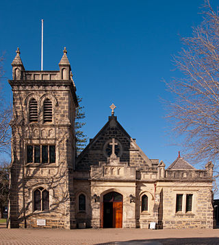
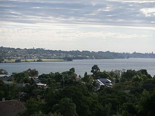
Claremont is a western suburb of Perth, Western Australia, on the north bank of the Swan River.

<span class="mw-page-title-main">Bull Creek, Western Australia</span> Suburb of Perth, Western Australia

Bull Creek is a suburb of Perth, Western Australia, located within the local government area of City of Melville. The suburb lies to the south of a creek of the same name, which flows into the Canning River.

<span class="mw-page-title-main">Booragoon, Western Australia</span> Suburb of Perth, Western Australia

Booragoon is a southern suburb of Perth, Western Australia, located within the City of Melville.

<span class="mw-page-title-main">Fremantle railway station</span> Railway station in Fremantle, Western Australia

Fremantle railway station is the terminus of Transperth's Fremantle line in Western Australia.

<span class="mw-page-title-main">Ardross, Western Australia</span> Suburb of Perth, Western Australia

Ardross is a suburb of Perth, Western Australia, located within the City of Melville. It was once an area of land acquired by the Scotsman, Sir Alexander Percival Matheson in 1896. In Matheson's subdivision of the adjoining suburb of Applecross, he created "Ardross Street" naming it after either the town of Ardrossan on the Scottish west coast or Ardross Castle, located about 40 kilometres north of Inverness. The suburb derives its name from this street.

<span class="mw-page-title-main">Burswood, Western Australia</span> Suburb of Perth, Western Australia

Burswood is an inner southeastern suburb of Perth, Western Australia, located immediately across the Swan River from Perth's central business district (CBD). Its local government area is the Town of Victoria Park. Burswood is the location of the State Tennis Centre, Perth Stadium, Belmont Park Racecourse, and the Crown Perth casino and hotel complex.

<span class="mw-page-title-main">Applecross, Western Australia</span> Suburb of Perth, Western Australia

Applecross is an affluent riverside suburb of Perth, Western Australia, bounded by Canning Highway and the Swan River. It is located within the City of Melville.

<span class="mw-page-title-main">Attadale, Western Australia</span> Suburb of Perth, Western Australia

Attadale is a riverside suburb of Perth, Western Australia, located within the City of Melville.

Bateman is a suburb of Perth, Western Australia, located within the City of Melville.

<span class="mw-page-title-main">Mount Pleasant, Western Australia</span> Suburb of Perth, Western Australia

Mount Pleasant is a suburb of Perth, Western Australia, located within Wajuk country, and the City of Melville, on the Canning River. It is bounded by Canning Highway to the north, the Canning River to the east, Cranford Avenue, Moolyeen Road and Canning Avenue to the south, and Rogerson Road, Coomoora Road, Henley Road and Ardross Street to the west.

<span class="mw-page-title-main">Winthrop, Western Australia</span> Suburb of Perth, Western Australia

Winthrop is a southern suburb of Perth, Western Australia, located within the City of Melville.

<span class="mw-page-title-main">Hilton, Western Australia</span> Suburb of Perth, Western Australia

Hilton is a suburb of Perth, Western Australia, located within the City of Fremantle.

<span class="mw-page-title-main">Beaconsfield, Western Australia</span> Suburb of Perth, Western Australia

Beaconsfield is a suburb of Perth, Western Australia, located within the City of Fremantle. It was named after a property of the same name in the area in the 1880s; the name was officially adopted from the post office on 1 August 1894. The name's origin is unknown, but it probably comes from the town in England or the Earl of Beaconsfield, Benjamin Disraeli, a former Conservative Prime Minister of the United Kingdom.

<span class="mw-page-title-main">Melville, Western Australia</span> Suburb of Perth, Western Australia

Melville is a suburb of Perth, Western Australia located within the likewise named City of Melville.

<span class="mw-page-title-main">Belmont, Western Australia</span> Suburb of Perth, Western Australia

Belmont is a suburb of Perth, the capital city of Western Australia, and is located 7 kilometres (4 mi) east of Perth's central business district (CBD) on the southern bank of the Swan River. Its local government area is the City of Belmont.

<span class="mw-page-title-main">East Fremantle, Western Australia</span> Suburb of Perth, Western Australia

East Fremantle is a suburb of Perth, Western Australia, located 13 kilometres (8.1 mi) south-west of the central business district. The suburb is mainly residential, and is coterminous with the Town of East Fremantle local government area.

<span class="mw-page-title-main">Perth (suburb)</span> Suburb of Perth, Western Australia

Perth is a suburb in the Perth metropolitan region, Western Australia that includes both the central business district of the city, and a suburban area spreading north to the northern side of Hyde Park. It does not include the separate suburbs of Northbridge or Highgate. Perth is split between the City of Perth and the City of Vincent local authorities, and was named after the city of the same name in Scotland.

<span class="mw-page-title-main">Fremantle (suburb)</span> Suburb of Perth, Western Australia

Fremantle is a Western Australian suburb located in Perth at the mouth of the Swan River, and is situated 18 kilometres (11 mi) from the Perth central business district. One of the original settlements of the Swan River Colony established in 1829 is within the area known today as this suburb.

References

  1. Australian Bureau of Statistics (28 June 2022). "Alfred Cove (suburb and locality)". Australian Census 2021 QuickStats. Retrieved 28 June 2022.  OOjs UI icon edit-ltr-progressive.svg
  2. "History of metropolitan suburb names – A". Western Australian Land Information Authority. Archived from the original on 16 March 2022. Retrieved 15 May 2007.
  3. "City of Melville | Find Venues, Parks and Reserves". City of Melville. Retrieved 3 June 2021.
  4. "2016 Census QuickStats: Alfred Cove". quickstats.censusdata.abs.gov.au. Retrieved 3 June 2021.
  5. "Alfred Cove". Parks and Wildlife Service.
  6. "Route 160". Bus Timetable 34 (PDF). Transperth. 8 December 2022 [effective from 20 December 2020].
  7. "Route 111". Bus Timetable 39 (PDF). Transperth. 8 December 2022 [effective from 29 January 2023].
  8. "Route 148". Bus Timetable 39 (PDF). Transperth. 8 December 2022 [effective from 29 January 2023].
  9. "Route 158". Bus Timetable 39 (PDF). Transperth. 8 December 2022 [effective from 29 January 2023].
  10. "Route 910". Bus Timetable 207 (PDF). Transperth. 12 December 2022 [effective from 29 January 2023].

Commons-logo.svg Media related to Alfred Cove, Western Australia at Wikimedia Commons