Dianella is a suburb of Perth, Western Australia. It is within the local government area of the City of Stirling.

Armadale is a suburb of Perth within the City of Armadale, located on the south-eastern edge of the Perth metropolitan region. The major junction of the South Western and Albany Highways, which connect Perth with the South West and Great Southern regions of Western Australia respectively, is located within the suburb. It is also the terminus of the Armadale railway line, one of five major railway lines to service Perth.

Bull Creek is a suburb of Perth, Western Australia, located within the local government area of City of Melville. The suburb lies to the south of a creek of the same name, which flows into the Canning River.

Leeming is a southern suburb of Perth, Western Australia. It is divided between the three local government areas of the City of Melville, the City of Cockburn (south) and the City of Canning (north-east). It is located approximately 17 kilometres (11 mi) south of the Perth central business district and 13 kilometres (8.1 mi) east of Fremantle.

Maddington railway station is on the Transperth network. It is located on the Armadale Line, 17.7 kilometres from Perth Station serving the suburb of Maddington.

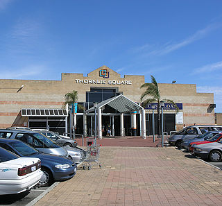
Thornlie is a large residential suburb of Perth, the capital city of Western Australia, located 15 kilometres (9.3 mi) south-east of the city's central business district. It is a part of the City of Gosnells local government area. The Canning River runs through the northern side of the suburb. Since the 1950s the suburb has developed in approximately five stages; north-east Thornlie (1950s–60s), south Thornlie (1970s–80s), Crestwood (1970s), Castle Glen (1980s) and Forest Lakes.

Carlisle is a suburb of Perth, Western Australia. Its local government area is the Town of Victoria Park.
Bateman is a suburb of Perth, Western Australia, located within the City of Melville.

Winthrop is a southern suburb of Perth, Western Australia, located within the City of Melville.

Canning Vale is a southern suburb of Perth, 22 km (13.7 mi) from the central business district. Its local government areas are the City of Canning and the City of Gosnells.

Willetton is a large southern suburb of Perth, Western Australia. Its local government area is the City of Canning.

Spearwood is a southern suburb of Perth, Western Australia, located within the City of Cockburn. This suburb derives its name from the Spearwood bush which is a common shrub in the area.
Success is a southern suburb of Perth, the capital city of Western Australia, located within the City of Cockburn.
South Fremantle is a suburb of Perth, Western Australia, located within the City of Fremantle.

Hilton is a suburb of Perth, Western Australia, located within the City of Fremantle.

Beaconsfield is a suburb of Perth, Western Australia, located within the City of Fremantle. It was named after a property of the same name in the area in the 1880s; the name was officially adopted from the post office on 1 August 1894. The name's origin is unknown, but it probably comes from the town in England or the Earl of Beaconsfield, Benjamin Disraeli, a former Conservative Prime Minister of the United Kingdom.

Southern River is a suburb of Perth, Western Australia, located within the City of Gosnells.

Seville Grove is a suburb of Perth, Western Australia in the City of Armadale.

Gosnells is a suburb located within the City of Gosnells. Gosnells is approximately 20 kilometres (12 mi) south-east of the Perth central business district. It contains the Gosnells town centre which includes the Council offices, library and the Gosnells Railway Station.

Fremantle is a Western Australian suburb located in Perth at the mouth of the Swan River, and is situated 18 kilometres (11 mi) from the Perth central business district. One of the original settlements of the Swan River Colony established in 1829 is within the area known today as this suburb.


