
Gwelup is a suburb of Perth, the capital city of Western Australia 12 km north of Perth's central business district (CBD) along the Mitchell Freeway. Its local government area is the City of Stirling.

Innaloo is a suburb of Perth, the capital city of Western Australia, 9 km (5.6 mi) from Perth's central business district in the local government area of the City of Stirling.

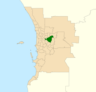
Mount Lawley is an inner northern suburb of Perth, Western Australia. The suburb is bounded by the Swan River to the east, Vincent, Harold and Pakenham Streets to the south, Central Avenue and Alexander Drive to the north, and Norfolk Street to the west.

The City of Belmont is a local government area in the inner eastern suburbs of the Western Australian capital city of Perth, located about 8 kilometres (5 mi) east of Perth's central business district on the south bank of the Swan River. The City covers an area of 39.8 square kilometres (15.4 sq mi), maintains 225 km of roads and had a population of almost 40,000 as at the 2016 Census. The City of Belmont is a member of the Eastern Metropolitan Regional Council

Forrestfield is a suburb of the City of Kalamunda in Western Australia. It lies 15 kilometres to the south-east of Perth at the base of the Darling Scarp and the southern border of Perth Airport.

Redcliffe is a suburb of Perth, Western Australia, located in the City of Belmont local government area.
Cloverdale is a suburb of Perth, the capital city of Western Australia, 10 kilometres (6 mi) east of Perth's CBD in the City of Belmont.

Edgewater is a suburb of Perth, Western Australia 23 kilometres (14 mi) north of Perth's central business district. Edgewater was approved as a suburb name in 1974, and its local government area is the City of Joondalup. It is named after its location on the western edge of Lake Joondalup, which is surrounded by Yellagonga Regional Park.

Burswood is an inner southeastern suburb of Perth, Western Australia, located immediately across the Swan River from Perth's central business district (CBD). Its local government area is the Town of Victoria Park. Burswood is the location of the State Tennis Centre, Perth Stadium, Belmont Park Racecourse, and the Crown Perth casino and hotel complex.

Carlisle is a suburb of Perth, Western Australia. Its local government area is the town of Victoria Park.

Duncraig is a northern suburb of Perth, the capital city of Western Australia, and is located 16 kilometres (10 mi) north of Perth's central business district (CBD) between Marmion Avenue and Mitchell Freeway. Its local government area is the City of Joondalup.

Canning Vale is a southern suburb of Perth, 16 km (9.9 mi) from the central business district. Its local government areas are the City of Canning and the City of Gosnells.

Lathlain is an inner south eastern suburb of Perth, Western Australia. Its local government area is the Town of Victoria Park.
Belmont is an electoral district of the Legislative Assembly in the Australian state of Western Australia. Belmont is named for the inner eastern Perth suburb of Belmont, which falls within its borders.

Stirling is a suburb of Perth, the capital city of Western Australia, about 10 km north of Perth's central business district (CBD) along the Mitchell Freeway. Its local government area is the City of Stirling, whose council offices and administration centre are located in the southwest of the mostly residential suburb.

Victoria Park is an inner south eastern suburb of Perth, Western Australia. Its local government area is the Town of Victoria Park.

Bayswater is a suburb 6 km (4 mi) north-east of the central business district (CBD) of Perth, the capital of Western Australia. It is just north of the Swan River, within the City of Bayswater local government area. It is predominantly a low-density residential suburb consisting of single-family detached homes. However, there are several clusters of commercial buildings, most notably in the suburb's town centre, around the intersection of Whatley Crescent and King William Street and a light industrial area in the suburb's east.
Abernethy Road is a 14.7-kilometre (9.1 mi) long minor arterial road linking Belmont with the Great Eastern Highway Bypass in Hazelmere, a suburb of Perth, Western Australia.

Treeby is a southern suburb of Perth, Western Australia, located within the City of Cockburn. It is located on the east side of the Kwinana Freeway, close to Cockburn Central.
Orrong Road is a major arterial road servicing the metropolitan area of Perth, Western Australia as well as the south-eastern continuation of the Graham Farmer Freeway. It is a dual carriageway for its entire length, with multiple sets of traffic lights.

