Lathlain, Western Australia

Last updated

Lathlain
Perth,  Western Australia
Lathlain Train Station, Western Australia.jpg
Lathlain railway station, before it was closed and razed
Metropolitan Perth.svg
Red pog.svg
Lathlain
Coordinates 31°57′58″S115°54′25″E / 31.966°S 115.907°E / -31.966; 115.907 Coordinates: 31°57′58″S115°54′25″E / 31.966°S 115.907°E / -31.966; 115.907
Population2,742 (2006 census) [1]
 • Density1,710/km2 (4,440/sq mi)
Established1890s
Postcode(s) 6100
Area1.6 km2 (0.6 sq mi)
Location6 km (4 mi) from Perth
LGA(s) Town of Victoria Park
State electorate(s) Victoria Park
Federal Division(s) Swan
Suburbs around Lathlain:
Burswood Rivervale
Victoria Park Lathlain Kewdale
East Victoria Park Carlisle

Lathlain is an inner south eastern suburb of Perth, Western Australia. Its local government area is the Town of Victoria Park.

Contents

History

Lathlain's development commenced in the 1890s when Peet and Co subdivided and sold lots in the "Victoria Park Station Estate" east of the railway station, with quarter-acre blocks on sale for £25–30. A brochure advertising the state claimed the lots were "So near Perth, near the Station and so near the Trams" (although the tram service did not eventuate). Peet and Co's advertising for the Victoria Park Station Estate was elaborate and multifaceted. Much of the promotion centred on the "Oldest Settler", a tree in the shape of a standing figure, located on one of the lots. Would-be purchasers were invited to "Look for the Oldest Settler from the train and at the pictures." They were also assured that the new section of the Victoria Park estate was the "finest subdivision" in Western Australia, destined to be "up-to-date in 40 years time", and distinguished by "Childrens Playgrounds for every group of homes". [2] Residential development was slow, and Geoff Gallop records in his historical notes that "bush land with some heavy timber and the occasional stray cow from Belmont greeted the post-war generation who built the suburb." [3]

Lathlain was a "garden suburb" estate designed in 1920 by Carl Klem and brother-in-law and senior partner Percy Hope. There was much controversy surrounding the development, which was initially planned to have 16 internal reserves that provided open space to all allotments. Maintenance of these public open spaces was seen as problematic by the City of Perth (then the local government of the area), and the plan was scaled back to only two such reserves (bordered by Roberts Road, Rutland Avenue, Bishopsgate Street and Goddard Street) one of which has been sold to adjoining residents (Roberts, Rutland, Bishopsgate, Forster). [2]

The suburb's name honours Sir William Lathlain, the Lord Mayor of Perth from 1918 until 1923. The name was in general use since the 1950s, after a park of this name was built there, but was not gazetted until 1981. [4]

In November 1953, it was proposed that the Perth Football Club, an Australian rules football team in the West Australian Football League, be based at a new oval to be built on vacant land at Lathlain. The Perth City Council supported the scheme, and construction commenced. As residents started to move into the area, a primary school was constructed in 1956. On 11 July 1959, the club moved into the premises at the ground, known as Lathlain Park, and went on to win premierships in 1966-1968 and 1976-1977. The ground was renamed to Eftel Oval in 2003.

Demographics changed and during the early 1990s Lathlain's only civil structure, its local primary school, was earmarked for closure by the education minister at the time, Norman Moore, due to low student enrolments. Students, parents and locals fought successfully to keep the school open, and it now has a healthy enrolment aided by the on-site pre-primary and better facilities.

Geography

Lathlain is bounded by Great Eastern Highway to the northwest, the Armadale railway to the southwest, Roberts Road to the southeast and Orrong Road and Graham Farmer Freeway to the northeast. The suburb is almost entirely residential, although a number of parks can be found most notably Lathlain Park, which houses the home ground of the Phoenix Demons, and J.A. Lee Reserve. Rayment Park is a small community park located centrally within the suburb, adjacent to Lathlain Primary School, local shops situated in Lathlain Place, Carlisle/Lathlain Playgroup, Carlisle/Victoria Park Toy Library [5] and scout hall. [6]

Lathlain is zoned predominately R20. City and hill views can be found in the western end of the suburb, which is situated on a hill that extends as far north as Rivervale and as far south as Kensington.

Facilities

Lathlain is a residential suburb [7] containing two reserves, two hotels and Lathlain Primary School. Commercial and other services are provided by Victoria Park and Belmont.

Transport

Lathlain is served by the Victoria Park train station on its southwestern edge, and by various bus services. All services are operated by Swan Transit.

The Lathlain railway station, built in 1959 and once located at the beginning of Goddard Street, was closed on 3 February 2003. Almost no trace of it exists today, although when the Lathlain railway station was decommissioned the "Lathlain" lighted signs were donated to the Perth Football Club to display in their clubroom due to their historical links with the station.

Politics

Lathlain's booth supports the Australian Labor Party at both federal and state elections, although less strongly than booths to the south and east in the 1996 election it voted for the Liberal Party.

Related Research Articles

Hawthorn, Victoria Suburb of Melbourne, Victoria, Australia

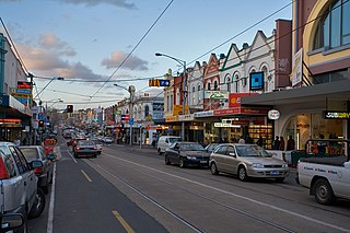
Hawthorn is an inner suburb of Melbourne, Australia, 6 kilometres (3.7 mi) east of Melbourne's central business district situated in the City of Boroondara. At the 2016 Census, Hawthorn recorded a population of 23,511.

Abbotsford, Victoria Suburb of Melbourne, Victoria, Australia

Abbotsford is an inner-city suburb of Melbourne, Australia, 2 kilometres (1.2 mi) north-east of Melbourne's Central Business District. Its local government area is the City of Yarra. At the 2016 census, Abbotsford had a population of 8,184.

Richmond, Victoria Suburb of Melbourne, Victoria, Australia

Richmond is an inner suburb of Melbourne, Victoria, Australia, 3 km east of Melbourne's Central Business District in the local government area of the City of Yarra municipality. The 2011 Census listed Richmond's population as 26,121.

Mount Waverley, Victoria Suburb of Melbourne, Victoria, Australia

Mount Waverley is a suburb in Melbourne, Victoria, Australia, south-east of Melbourne's central business district. It is 16 km from Melbourne at its closest point. Mount Waverley railway station, located in the main shopping precinct, is located 17.8 km from Flinders Street railway station. Its local government area is the City of Monash. At the 2016 Census, Mount Waverley had a population of 33,611.

Inglewood, Western Australia Suburb of Perth, Western Australia

Inglewood is an inner-city suburb of Perth, Western Australia in the local government area of the City of Stirling.

Redcliffe, Western Australia Suburb of Perth, Western Australia

Redcliffe is a suburb of Perth, Western Australia, located in the City of Belmont local government area.

Belmont, Victoria Suburb of Geelong, Victoria, Australia

Belmont is a southern suburb of Geelong, Victoria, Australia. The name means "beautiful hill". Belmont is geographically separated from the Geelong central business district by the Barwon River. The suburb is primarily residential, with some light industry along Barwon Heads Road. The suburb is part of the City of Greater Geelong local government area. At the 2011 census, Belmont had a population of 13,616.

The Armadale railway line is a suburban railway line in Western Australia that runs from Perth to Armadale, and continues as the South Western Railway to Bunbury. The line crosses the Swan River at East Perth via the Goongoongup Bridge, and formerly had crossed it via the Bunbury Bridge.

Dutton Park, Queensland Suburb of Brisbane, Queensland, Australia

Dutton Park is an inner southern suburb of the City of Brisbane, Queensland, Australia. In the 2016 census, Dutton Park had a population of 2,024 people.

Hughesdale, Victoria Suburb of Melbourne, Victoria, Australia

Hughesdale is a suburb in Melbourne, Victoria, Australia, 14 km south-east of Melbourne's central business district. Its local government area is the City of Monash. At the 2016 Census, Hughesdale had a population of 7,556.

Burswood railway station Railway station in Perth, Western Australia

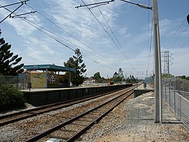
Burswood railway station is a railway station on the Transperth network. It is located on the Armadale line, 4.8 kilometres from Perth station serving the suburbs of Burswood, Lathlain and Rivervale.

Burswood, Western Australia Suburb of Perth, Western Australia

Burswood is an inner southeastern suburb of Perth, Western Australia, located immediately across the Swan River from Perth's central business district (CBD). Its local government area is the Town of Victoria Park. Burswood is the location of the State Tennis Centre, Perth Stadium, Belmont Park Racecourse, and the Crown Perth casino and hotel complex.

Carlisle, Western Australia Suburb of Perth, Western Australia

Carlisle is a suburb of Perth, Western Australia. Its local government area is the town of Victoria Park.

Kewdale, Western Australia Suburb of Perth, Western Australia

Kewdale is a suburb of Perth, Western Australia within the City of Belmont. Kew Street was one of the first roads in this district, hence the naming of the suburb.

Landsdale, Western Australia Suburb of Perth, Western Australia

Landsdale is a northern suburb of Perth, Western Australia located within the local government area of the City of Wanneroo. It is mixed use, with residential, commercial and light manufacturing areas.

Camp Hill, Queensland Suburb of Brisbane, Queensland, Australia

Camp Hill is an eastern suburb in the City of Brisbane, Queensland, Australia. In the 2016 census Camp Hill had a population of 11,202 people.

Belmont City College Public co-educational high school in Australia

Belmont City College is a comprehensive independent public co-educational high school, located in Belmont, 6 kilometres (4 mi) east of Perth, Western Australia. Opening in 1957, the school's catchment area covers most of the City of Belmont and the eastern part of the Town of Victoria Park. As of Semester 1, 2020 the College had an enrolment of 929 students between Year 7 and Year 12, 69 (13.5%) of whom are Indigenous Australians.

Victoria Park, Western Australia Suburb of Perth, Western Australia

Victoria Park is an inner south eastern suburb of Perth, Western Australia. Its local government area is the Town of Victoria Park.

Bayswater, Western Australia Suburb of Perth, Western Australia

Bayswater is a suburb 6 kilometres (3.7 mi) north-east of the central business district (CBD) of Perth, the capital of Western Australia. It is just north of the Swan River, within the City of Bayswater local government area. It is predominantly a low density residential suburb consisting of single-family detached homes. However, there are several clusters of commercial buildings, most notably in the suburb's town centre around the intersection of Whatley Crescent and King William Street, and a light industrial area in the suburb's east.

Soldiers Hill, Victoria Suburb of Ballarat, Victoria, Australia

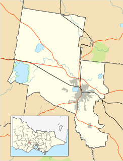
Soldiers Hill is a suburb of Ballarat, Victoria, Australia located directly north of the Central Business District. At the 2016 census, Soldiers Hill had a population of 2,803.

References

  1. Australian Bureau of Statistics (25 October 2007). "Lathlain (State Suburb)". 2006 Census QuickStats. Retrieved 5 October 2008.
  2. 1 2 Freestone, Robert; David Nichols (2001). "'Particularly happy' arrangement?: Idealism, pragmatism and the enclosed open spaces of Perth garden suburbs". Limina, A Journal of Historical and Cultural Studies. 7: 65–81. hdl:10536/DRO/DU:30008383.
  3. Dr Geoff Gallop. "From The Swan To The Canning - Historical Notes on Victoria Park and Surrounding Districts", December 1989. Originally published in Southern Gazette, 24 October 1989, p.7. Accessed at Battye Library, Perth.
  4. Town of Victoria Park. "Timeline 1970-2004" . Retrieved 10 November 2001.CS1 maint: discouraged parameter (link)
  5. http://www.cvptoylibrary.org.au
  6. 2006 StreetSmart directory, Department of Lands and Surveys, Perth.
  7. REIWA. "Suburb Profile Lathlain" . Retrieved 10 May 2016.CS1 maint: discouraged parameter (link)