Drumpellier Drive

Last updated

Drumpellier Drive

Drumpellier Drive route map.png
Map of Drumpellier Drive, highlighted in red, with surrounding suburbs and road network
General information
TypeRoad
Length9.9 km (6.2 mi) [1]
Opened1980s
Major junctions
South endAustralian state route 3.svg Reid Highway (State Route 3) / Daviot Road Caversham / Bennett Springs
 
North endThe Promenade Ellenbrook / Lexia
Location(s)
Major suburbs Bennett Springs, Dayton, Whiteman, Brabham , Ellenbrook

Drumpellier Drive is a north-south road linking Ellenbrook with Reid Highway in the north-eastern suburbs of Perth. The southern section was opened as Lord Street, and was the main link between Ellenbrook and the rest of Perth until the extension of Tonkin Highway north to Gnangara Road. The road corridor has had several proposals put forward for it, including a highway, a bus rapid transit road and a railway. In 2019, a new alignment for Lord Street south of Gnangara Road opened, and it was renamed to Drumpellier Drive, making the naming consistent with the section of road north of Gnangara Road.

Contents

Route description

Drumpellier Drive is a four lane dual carriageway south of Gnangara Road, and a two lane single carriageway north of Gnangara Road. It has a speed limit of 70 kilometres per hour (43 mph) south of Marshall Road, and a speed limit of 80 kilometres per hour (50 mph) north of Marshall Road. [1] [2]

Drumpellier Drive starts off at an intersection with Reid Highway, as a continuation of Daviot Road. From there, the road heads north, between the developing suburbs of Bennett Springs and Dayton. The road then passes to the east of Whiteman Park, and to the west of Caversham Airfield, Brabham and Henley Brook. Drumpellier Drive then passes Gnangara Road, where it heads past Ellenbrook, before terminating at a roundabout with The Promenade. Heading west on The Promenade leads to Tonkin Highway, and heading east on The Promenade leads to the Ellenbrook town centre. [1] [2]

Name

Drumpellier Drive is named after Drumpellier Country Park in Scotland, which was the birthplace of James Stirling. [3]

History

The first section of what is now Drumpellier Drive was an unsealed road along the perimeter of Caversham Airfield, which was constructed during World War II. The first upgrade occurred when the road was sealed and extended down to Marshall Road during the late 1980s. At the same time, another section of the road was constructed between Gnangara Road and Park Street as part of the development of Henley Brook. [4]

In the late 1990s, the two sections of the road were connected up, the road was extended south to Reid Highway and the northern end was converted to a roundabout and extended north as Pinaster Parade. This road would be called Lord Street. It was at this time that the satellite city of Ellenbrook was first being developed, and Lord Street served as one of the main connections between Ellenbrook and the rest of Perth. [4]

In 2005, a new road was constructed from just west of the Lord Street/Gnangara Road roundabout to The Promenade. This road was named Drumpellier Drive and ran along the edge of Ellenbrook before heading towards the Ellenbrook town centre. This section of road was not contiguous with Lord Street. [4]

Between 2009 and 2013, there were 172 crashes at the intersection of Lord Street and Reid Highway. At the time, the intersection had no traffic lights and Reid Highway was two lanes. In June 2014, an $8 million intersection upgrade opened. The upgrade featured traffic lights and widenings for both roads near the intersection. [5]

In 2016, Daviot Road was constructed, linking the southern terminus of Lord Street with Caversham. [6]

Perth Darwin National Highway

From the 1990s, there has been a road reserve designated for the proposed Perth Darwin National Highway which runs through and alongside Lord Street and Drumpellier Drive. The Swan Valley Bypass was proposed to be built in that road reserve, partially superseding Lord Street and Drumpellier Drive. In 2014, it was decided that the Swan Valley Bypass would be built along a different alignment, west of Whiteman Park. Construction started on the project, called NorthLink WA in June 2017. In March 2019, NorthLink WA opened as Tonkin Highway between Reid Highway and Gnangara Road, reducing traffic along Lord Street. [7] In August 2019, the section of Tonkin Highway between Gnangara Road and The Promenade opened, which caused the intersection of Drumpellier Drive and The Promenade to be modified to a roundabout intersection. [8]

Bus route and New Lord Street

In May 2016, the state Liberal government announced plans for a dedicated bus corridor to be built alongside Lord Street, and a realignment of Lord Street between Gnangara Road and Park Street, and Youle-Dean Road and Marshall Road, which would make Lord Street contiguous with Drumpelliar Drive. The realignment was called New Lord Street. The new bus road and Lord Street realignment was planned to travel along the corridor set aside for the Perth-Darwin National Highway. [9] The bus corridor was planned to be a two lane grade separated road between Marshall Road and the Ellenbrook town centre, with new bus stations constructed along the route. Approximately 2,000 bus passengers travel along Lord Street every weekday. [10] In November 2016, a $55 million contract was signed for the construction of the bus link. [11] [12]

In April 2017, the newly elected Labor government scrapped the plans for the dedicated bus road, instead going ahead with the plans for realigning Lord Street, but also upgrading it to a dual carriageway for its entire length. The contract was modified at no extra cost. Lord Street is used by 14,000 vehicles per day, and queues during peak hour can be 2.5 km (1.6 mi) long. [13] [14] [9] In October 2018, construction commenced on the upgrade. [15]

The southern section of New Lord Street between Marshall Road and Park Street opened on 4 April 2019. [16] The northern section of New Lord Street between Park Street and Gnangara Road opened on 12 April 2019. New Lord Street was renamed to Drumpellier Drive, making the name consistent with the northern section of the road. The old sections of Lord Street were renamed to Isoodon Street and Starflower Road, and they became local roads. [17] [18]

Future

The Morley–Ellenbrook railway line is planned to be built partially alongside Drumpellier Drive, with Whiteman Park station built next to Drumpellier Drive and a tunnel under the intersection of Drumpellier Drive and Gnangara Road. [19] [20] [21] The existing roundabout intersection with Youle-Dean Road will be replaced with a traffic light controlled intersection. [22]

The ultimate plan for the intersection of Reid Highway, Drumpellier Drive and Daviot Road is for a grade separated interchange to be built. There is land set aside for this in the Metropolitan Region Scheme. The expected start of construction is early 2024 and the expected completion is mid-2026. [23] [24]

Junction list

LGA [25] Location [2] kmmiDestinationsNotes
Swan CavershamBennett Springs border0.00.0Australian state route 3.svg Reid Highway (State Route 3) east and west / Daviot Road south  Caversham, Midland, Morley Drumpellier Drive terminus; Road continues south as Daviot Road; Traffic light controlled intersection
Bennett Springs0.70.43 Marshall Road   Dayton, Malaga Roundabout
WhitemanBrabham border3.11.9Whiteman Drive East – Whiteman Park / Youle-Dean Road  Brabham Roundabout being converted to traffic light-controlled interection. Access to future Whiteman Park railway station
5.53.4Park Street  Brabham, Henley Brook Roundabout
EllenbrookLexia–Whiteman tripoint7.64.7Australian state route 84.svg Gnangara Road (State Route 84)  Wanneroo, Ellenbrook Traffic light controlled intersection
Ellenbrook–Lexia border9.96.2The Promenade  Bullsbrook, Ellenbrook Drumpellier Drive terminus; Roundabout

See also

Related Research Articles

<span class="mw-page-title-main">Bayswater railway station, Perth</span> Railway station in Perth, Western Australia

Bayswater railway station is a suburban rail station in Bayswater, a suburb of Perth, Western Australia. It is on the Midland and Airport lines on the Transperth commuter rail network. Services on each line run every 12 minutes during peak and every 15 minutes between peak. The journey to Perth station is 6.7 kilometres (4.2 mi), and takes 12 minutes. The station is served by three regular bus routes.

<span class="mw-page-title-main">Meltham railway station</span> Railway station in Perth, Western Australia

Meltham railway station is a railway station in Bayswater, a suburb of Perth, Western Australia. It is on the Midland line and Airport line, between Maylands and Bayswater. It is 5.5 kilometres, or 10 minutes by train, from Perth railway station Services run every 6 minutes during peak and every 7.5 minutes between peak.

<span class="mw-page-title-main">Reid Highway</span> Highway in Perth, Western Australia

Reid Highway is a 23-kilometre (14 mi) east-west highway and partial freeway in the northern suburbs of Perth, Western Australia, linking North Beach with Middle Swan. As part of State Route 3, it forms half of Perth's outer ring road along with Roe Highway, which it joins onto at its eastern terminus.

<span class="mw-page-title-main">Ellenbrook, Western Australia</span> Suburb of Perth, Western Australia

Ellenbrook is a northeastern suburb of Perth, Western Australia, about 30 km (19 mi) from Perth's central business district (CBD), located within the City of Swan. Ellenbrook, and its neighbouring suburbs of The Vines and Aveley, are unusual for Perth in being a significant distance from neighbouring suburbs. Given this relative isolation and the distance from the CBD, Ellenbrook has been designed and developed as a self-sustainable community. Since the upgrade of Gnangara Road and the completion of the Tonkin Highway Northlink, access to Ellenbrook has improved. The Morley–Ellenbrook railway line is well underway as at June 2021 and this will enable better public transport. At the time of the 2016 census there were 22,681 people living in the gazetted suburb, by June 2018, it was estimated that the urban population for Ellenbrook and surrounds had grown to 41,382. It is envisioned that Ellenbrook will eventually become a satellite city, with a population of 80,000.

Tonkin Highway is an 81-kilometre-long (50 mi) north–south highway and partial freeway in Perth, Western Australia, linking Perth Airport and Kewdale with the city's north-eastern and south-eastern suburbs. As of April 2020, the northern terminus is at the interchange with Brand Highway and Great Northern Highway in Muchea, and the southern terminus is at Thomas Road in Oakford. It forms the entire length of State Route 4, and connects to several major roads. Besides Brand Highway and Great Northern Highway, it also connects to Reid Highway, Great Eastern Highway, Leach Highway, Roe Highway, and Albany Highway.

<span class="mw-page-title-main">Alexander Drive</span> Road in Perth, Western Australia

Alexander Drive is a major north–south arterial road in the northern suburbs of Perth, Western Australia, connecting Perth's central business district (CBD) with Edith Cowan University's Mount Lawley campus and the Malaga industrial area, as well as newer development suburbs to Perth's north. It is used by Transperth bus routes, including the 360, 361 and 362. Alexander Drive was named after Mr S.B. Alexander, a former Wanneroo Road Board member. Alexander Drive runs through the following local government areas City of Wanneroo, City of Swan, City of Bayswater and City of Stirling.

<span class="mw-page-title-main">Beechboro Road</span> Road in Perth, Western Australia

Beechboro Road is a north–south arterial road located in the northeastern suburbs of Perth, Western Australia, connecting Morley and Bayswater with areas further north. Until the construction of the nearby section of Tonkin Highway between 1984 and 1992, and later, during the NorthLink WA road project between 2016 and 2019, Beechboro Road was one of northeastern Perth's most important routes. The road is discontinuous at Tonkin Highway, with the section from Tonkin Highway to Walter Road officially known as Beechboro Road North, and the section running through Bayswater as Beechboro Road South.

<span class="mw-page-title-main">Ocean Reef Road</span> Road in Perth, Western Australia

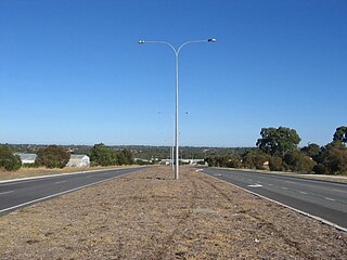
Ocean Reef Road is an arterial east-west road in Perth, Western Australia. It is located within the northern suburbs of Perth, from Ocean Reef in the west, to Landsdale in the east, with a portion travelling northwards along the coast to Iluka.

Brabham is a suburb located about 21 km (13 mi) north-east of Perth's central business district. The suburb is located in the City of Swan just south of Henley Brook, formerly being a part of that suburb before it was gazetted in May 2011. The suburb was named after Australian motor racing personality Sir Jack Brabham who competed in the 1962 Australian Grand Prix, held at the nearby Caversham Airfield. The suburb is part of the City of Swan's urban growth corridor and is bordered by Park Street to the north, Murray Street to the east, Harrow Street to the south and Drumpellier Drive and Isoondon Street to the west. It is located in the Whiteman Ward of the City of Swan.

<span class="mw-page-title-main">Gnangara Road</span> Road in Perth, Western Australia

Gnangara Road is an arterial east–west road in Perth, Western Australia. It is located within the northern suburbs of Perth, from Madeley in the west, to Henley Brook in the east. Gnangara Road provides a connection between Great Northern Highway and Wanneroo Road. The construction of the Ocean Reef Road extension in 2011 altered the road network in the Landsdale area in Landsdale. The plans show Gnangara Road as discontinuous between Mirrabooka Avenue and Alexander Drive, with the Mirrabooka Avenue and Ocean Reef Road extensions linking the two sections. Following construction, those linking road sections were named as Gnangara Road, allowing the road to remain continuous.

NorthLink WA was a road construction project in Perth, Western Australia, that saw both the northern section of Tonkin Highway upgraded, and the road extended northwards as the Swan Valley Bypass, to bypass Great Northern Highway. These two component projects were separately funded, with both the state and federal governments contributing to each project. Construction commenced in June 2016 and was completed on 23 April 2020.

<span class="mw-page-title-main">Metronet (Western Australia)</span> Government agency in Western Australia

Metronet is a multi-government agency in Western Australia. It is responsible for managing extensions to Perth's rail network. It was formed to deliver commitments made by the McGowan Government during the 2017 election campaign.

<span class="mw-page-title-main">Morley–Ellenbrook line</span> Planned railway in Perth, Western Australia

The Morley–Ellenbrook line is a planned suburban rail service between the Perth central business district and Ellenbrook in Western Australia. Construction began in 2021 as part of Metronet.

<span class="mw-page-title-main">Morley railway station, Perth</span> Proposed railway station in Perth, Western Australia

Morley railway station is a bus and railway station under construction as part of the Metronet Morley–Ellenbrook Line, serving the Perth suburbs of Bayswater, Embleton and Morley. It is to be built in the median strip of Tonkin Highway at Broun Avenue.

<span class="mw-page-title-main">Noranda railway station</span> Proposed railway station in Australia

Noranda railway station is a bus and railway station under construction as part of the Transperth network. It is planned to open in 2024 as a station on the Morley–Ellenbrook railway line, serving the Perth suburbs of Beechboro, Kiara and Noranda. It is being built in the median of Tonkin Highway, just north of Benara Road.

Malaga railway station is a bus and railway station under construction as part of the Transperth network. It is set to open in 2024 as a station on the Morley–Ellenbrook railway line, serving the Perth suburbs of Alexander Heights, Ballajura, Bennett Springs, Landsdale and Malaga.

<span class="mw-page-title-main">Henley Brook bus station</span> Bus station in Perth, Australia

Henley Brook bus station is a Transperth bus station located on the corner of Henley Street and Starflower Road, in Henley Brook, Perth, Western Australia. It has six stands served by six regular Transperth routes operated by Swan Transit.

Whiteman Park railway station is a bus and railway station on the Morley–Ellenbrook railway line in Perth, Western Australia as part of Metronet, serving Whiteman Park and the suburbs of Henley Brook, Dayton, West Swan, and Brabham. The station is currently under construction, with opening scheduled for 2024.

<span class="mw-page-title-main">Benara Road</span> Road in Perth, Western Australia

Benara Road is an east–west road in the north-eastern suburbs of Perth, Western Australia.

<span class="mw-page-title-main">Marshall Road</span> Road in Perth, Western Australia

Marshall Road is an east–west road in the northern suburbs of Perth, Western Australia. It is continuous with Beach Road.

References

  1. 1 2 3 "Drumpellier Drive". Google Maps. Archived from the original on 24 August 2021. Retrieved 8 August 2020.
  2. 1 2 3 "Road Information Mapping System". Main Roads Western Australia. Archived from the original on 18 March 2018. Retrieved 16 August 2021. Zoom into Drumpellier Drive. Click boxes next to "Speed Data" and "Speed Limit" for speed limit. Click box next to "Suburb" to view suburb boundaries.
  3. "Cr Kiely - Alternative Name Proposal For New Dual Section Of Road Between Reid Highway And Gnangara Road" (PDF). City of Swan. Archived (PDF) from the original on 24 July 2021. Retrieved 24 July 2021.
  4. 1 2 3 "Landgate Map Viewer Plus". Landgate. Archived from the original on 18 March 2020. Retrieved 14 August 2020.
  5. "Upgraded intersection boosts safety". Media Statements. Retrieved 15 August 2020.[ permanent dead link ]
  6. "Lord Street Caversham Road Extension Opens". Perth Now. Archived from the original on 25 October 2020. Retrieved 15 August 2020.
  7. "Joint media statement - WA's biggest free-flowing freeway-to-freeway interchange opens". Media Statements. Archived from the original on 12 August 2020. Retrieved 15 August 2020.
  8. "Joint media statement - NorthLink WA central section completed, slashing Ellenbrook travel times". Media Statements. Archived from the original on 27 September 2020. Retrieved 15 August 2020.
  9. 1 2 "New Lord Street Project". City of Swan . Archived from the original on 16 August 2021. Retrieved 15 August 2020.
  10. "Our State Budget 2016-17: Efficient delivery of quality services - WA's first dedicated bus link for Ellenbrook". Media Statements. Archived from the original on 17 October 2021. Retrieved 15 August 2020.
  11. "WA's first dedicated bus corridor for Ellenbrook". Media Statements. Archived from the original on 4 November 2019. Retrieved 15 August 2020.
  12. Cella, Lauren. "Contract for WA's first bus corridor awarded". Infrastructure Magazine. Archived from the original on 25 November 2020. Retrieved 15 August 2020.
  13. "New Lord Street a road to METRONET and local jobs". Media Statements. Archived from the original on 27 March 2020. Retrieved 15 August 2020.
  14. Caporn, Dylan. "Dual carriageway plan Lord Street to speed up Ellenbrook commute". Perth Now. Archived from the original on 5 March 2019. Retrieved 15 August 2020.
  15. "New Lord Street project works underway". Media Statements. Archived from the original on 4 November 2019. Retrieved 15 August 2020.
  16. Lim, Kristie. "First section of the new Lord Street opens". Perth Now. Archived from the original on 16 August 2021. Retrieved 15 August 2020.
  17. "Drumpellier Drive (New Lord Street)". Main Roads Western Australia . Archived from the original on 15 August 2020. Retrieved 15 August 2020.
  18. "New Lord Street Newsletter" (PDF). Main Roads Western Australia . Archived (PDF) from the original on 18 March 2021. Retrieved 15 August 2020.
  19. "Enabling legislation for METRONET Morley-Ellenbrook Line passes Parliament". Media Statements. Archived from the original on 10 August 2020. Retrieved 15 August 2020.
  20. "Morley-Ellenbrook Line Overview" (PDF). Metronet. Archived (PDF) from the original on 10 October 2020. Retrieved 15 August 2020.
  21. "Whiteman Park Station Factsheet" (PDF). Metronet. Archived (PDF) from the original on 1 July 2021. Retrieved 15 August 2020.
  22. "Whiteman Park". Metronet. Archived from the original on 10 June 2021. Retrieved 16 August 2021.
  23. "EastLink WA – Reid and Roe Highways Map 1" (PDF). Main Roads Western Australia. Archived (PDF) from the original on 19 March 2021. Retrieved 16 August 2021.
  24. "Reid Highway – Altone Road and Daviot Road / Drumpellier Drive - Grade Separated Intersections". The Department of Infrastructure, Transport, Regional Development and Communications. Archived from the original on 16 August 2021. Retrieved 16 August 2021.
  25. "Place map". City of Swan . Archived from the original on 13 July 2020. Retrieved 19 August 2020.