NorthLink WA

Last updated

NorthLink WA was a road construction project in Perth, Western Australia, that saw both the northern section of Tonkin Highway upgraded, and the road extended northwards as the Swan Valley Bypass, to bypass Great Northern Highway. These two component projects were separately funded, with both the state and federal governments contributing to each project. Construction commenced in June 2016 and was completed on 23 April 2020. [1]

Contents

Tonkin Highway upgrade

The federal government has allocated $140.6 million to grade-separate Tonkin Highway's intersections with Benara Road, Morley Drive and Collier Road. The funding is part of the five-year phase of the Nation Building Program from 2014–15 to 2018–19. The upgrades are intended to improve freight transportation along the highway. [2] The total cost is expected to be $281.2 million. [3] In the lead up to the 2013 Australian federal election, which resulted in a change a government, the Labor candidate for Perth, Alannah MacTiernan, accused the then-opposition's candidate of lying to the electorate over their commitment to the upgrade. [4] The official policy costings did not contain specific funding for the project. However, an opposition spokesperson claimed it was "in the current forward estimates", and not in the costing, as the upgrade was neither a "new and accelerated" project, nor a project that would definitely not be funded. [4]

Swan Valley Bypass

Swan Valley Bypass

Perth Darwin National Highway, Swan Valley bypass (NorthLinkWA).png
Map of Perth's north with the proposed bypass in dashed orange, and the existing Great Northern Highway in blue
General information
TypeHighway
Major junctions
South end
 
North end
Location(s)
Major suburbs Ellenbrook, Bullsbrook, Muchea
Highway system

The Perth Darwin National Highway (PDNH) Swan Valley Bypass is a highway built to bypass the Great Northern Highway within Perth. From the junction of Reid Highway and Tonkin Highway at Malaga, it heads north towards Ellenbrook, and continues on to Great Northern Highway and Brand Highway in Muchea. [5] The previously planned route of the PDNH, prior to 2012, followed Lord Street, east of Whiteman Park. [6] The state and federal governments allocated funding to the project, with contracts for the central section awarded to the Great Northern Connect Team on 12 January 2017, [7] and contracts for the northern section awarded to CPB Contractors on 30 January 2017. [8] Construction started on the central section on 12 June 2017, [9] and construction on the northern section planned to start late 2017. [10] Construction was completed on 23 April 2020. [11]

Route

Central section

This section starts at the Reid Highway/Tonkin Highway interchange, which will be upgraded to a cloverstack interchange. Following, to the north, is the Marshall Road flyover, then a two-level roundabout interchange with Hepburn Avenue and Beechboro Road North. Onwards from there is the Baal Street flyover, then at the planned interchange with the Whiteman/Yanchep Highway, the highway veers northeast, meeting up with a partial cloverleaf interchange with Gnangara Road. The highway then follows the edge of Ellenbrook, having a two-level roundabout interchange with The Promenade. [12]

Northern section

This section was originally planned to be a 2 lane single carriageway with at-grade intersections, but because costs went down, it was changed so it can be constructed as a 4 lane dual carriageway with grade separated interchanges. Continuing on from the roundabout interchange with The Promenade in Ellenbrook, it goes north, passing built up areas in Ellenbrook, then going through rural areas. Along the way are roundabout interchanges with Stock Road and Neaves Road, and a flyover over Muchea South Road and the Midland railway line, and the current Brand Highway, before ending at a roundabout interchange with Great Northern Highway and a new Brand Highway. [13]

See also

Australia road sign W5-29.svg   Australian roadsportal

Related Research Articles

<span class="mw-page-title-main">Brand Highway</span> Highway in Western Australia

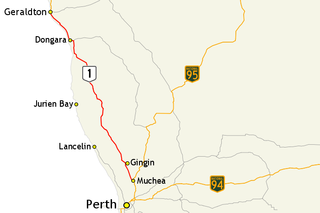
Brand Highway is a 370-kilometre (230 mi) main highway linking the northern outskirts of Perth to Geraldton in Western Australia. Together with North West Coastal Highway, it forms part of the Western Australian coastal link to the Northern Territory. The highway is a part of Australia's Highway 1, and is for the most part a single carriageway with one lane in each direction.

<span class="mw-page-title-main">Great Northern Highway</span> Highway in Western Australia

Great Northern Highway is an Australian highway that links Western Australia's capital city Perth with its northernmost port, Wyndham. With a length of almost 3,200 kilometres (2,000 mi), it is the longest highway in Australia, with the majority included as part of the Perth Darwin National Highway. The highway is constructed as a sealed, predominantly two-lane single carriageway, but with some single-lane bridges in the Kimberley. The Great Northern Highway travels through remote areas of the state, and is the only sealed road link between the Northern Territory and northern Western Australia. Economically, it provides vital access through the Wheatbelt and Mid West to the resource-rich regions of the Pilbara and Kimberley. In these areas, the key industries of mining, agriculture and pastoral stations, and tourism are all dependent on the highway.

<span class="mw-page-title-main">Great Eastern Highway</span> Highway in Western Australia

Great Eastern Highway is a 590-kilometre-long (370 mi) road that links the Western Australian capital of Perth with the city of Kalgoorlie. A key route for road vehicles accessing the eastern Wheatbelt and the Goldfields, it is the western portion of the main road link between Perth and the eastern states of Australia. The highway forms the majority of National Highway 94, although the alignment through the Perth suburbs of Guildford and Midland, and the eastern section between Coolgardie and Kalgoorlie are not included. Various segments form parts of other road routes, including National Route 1, Alternative National Route 94, and State Route 51.

<span class="mw-page-title-main">Roe Highway</span> Highway in Perth, Western Australia

Roe Highway is a 35-kilometre-long (22 mi) limited-access highway and partial freeway in Perth, Western Australia, linking Kewdale with the city's north-eastern and south-western suburbs. The northern terminus is at Reid Highway and Great Northern Highway in Middle Swan, and the southern terminus is with Murdoch Drive at the Kwinana Freeway interchange in Bibra Lake. Roe Highway, in addition to Reid Highway, form State Route 3, a partial ring road around the outer suburbs of the Perth metropolitan area. Roe Highway also forms part of National Highway 94 from Great Eastern Highway Bypass to Great Eastern Highway, and National Highway 95 from Great Eastern Highway to Great Northern Highway.

<span class="mw-page-title-main">Reid Highway</span> Highway in Perth, Western Australia

Reid Highway is a 23-kilometre (14 mi) east-west highway and partial freeway in the northern suburbs of Perth, Western Australia, linking North Beach with Middle Swan. As part of State Route 3, it forms half of Perth's outer ring road along with Roe Highway, which it joins onto at its eastern terminus.

<span class="mw-page-title-main">Ellenbrook, Western Australia</span> Suburb of Perth, Western Australia

Ellenbrook is a northeastern suburb of Perth, Western Australia, about 30 km (19 mi) from Perth's central business district (CBD), located within the City of Swan. Ellenbrook, and its neighbouring suburbs of The Vines and Aveley, are unusual for Perth in being a significant distance from neighbouring suburbs. Given this relative isolation and the distance from the CBD, Ellenbrook has been designed and developed as a self-sustainable community. Since the upgrade of Gnangara Road and the completion of the Tonkin Highway Northlink, access to Ellenbrook has improved. The Morley–Ellenbrook railway line is well underway as at June 2021 and this will enable better public transport. At the time of the 2016 census there were 22,681 people living in the gazetted suburb, by June 2018, it was estimated that the urban population for Ellenbrook and surrounds had grown to 41,382. It is envisioned that Ellenbrook will eventually become a satellite city, with a population of 80,000.

Tonkin Highway is an 81-kilometre-long (50 mi) north–south highway and partial freeway in Perth, Western Australia, linking Perth Airport and Kewdale with the city's north-eastern and south-eastern suburbs. As of April 2020, the northern terminus is at the interchange with Brand Highway and Great Northern Highway in Muchea, and the southern terminus is at Thomas Road in Oakford. It forms the entire length of State Route 4, and connects to several major roads. Besides Brand Highway and Great Northern Highway, it also connects to Reid Highway, Great Eastern Highway, Leach Highway, Roe Highway, and Albany Highway.

<span class="mw-page-title-main">Leach Highway</span> Highway in Perth, Western Australia

Leach Highway is a 23-kilometre (14 mi) east-west arterial highway in the southern suburbs of Perth, Western Australia, primarily linking Kewdale and Perth Airport with the city of Fremantle.

<span class="mw-page-title-main">Great Eastern Highway Bypass</span> Highway in Perth, Western Australia

Great Eastern Highway Bypass is a limited-access dual carriageway linking Great Eastern Highway and Roe Highway in Perth, Western Australia. Together with a section of Roe Highway, it bypasses the historical Guildford and Midland localities, through which the original, urban and slower Great Eastern Highway passes.

<span class="mw-page-title-main">Beechboro Road</span> Road in Perth, Western Australia

Beechboro Road is a north–south arterial road located in the northeastern suburbs of Perth, Western Australia, connecting Morley and Bayswater with areas further north. Until the construction of the nearby section of Tonkin Highway between 1984 and 1992, and later, during the NorthLink WA road project between 2016 and 2019, Beechboro Road was one of northeastern Perth's most important routes. The road is discontinuous at Tonkin Highway, with the section from Tonkin Highway to Walter Road officially known as Beechboro Road North, and the section running through Bayswater as Beechboro Road South.

<span class="mw-page-title-main">Hepburn Avenue</span> Road in Perth, Western Australia

Hepburn Avenue is an arterial east–west road in the northern suburbs of Perth, Western Australia. The road links Sorrento in the west with Malaga and Whiteman in the east. It also connects the residential developments that span its length with several local facilities, as well as major road routes into central Perth.

<span class="mw-page-title-main">Mounts Bay Road</span> Road in Perth, Western Australia

Mounts Bay Road is a major road in Perth, Western Australia, extending southwest from the central business district along the north bank of the Swan River, at the base of Kings Park.

<span class="mw-page-title-main">Morley Drive</span>

Morley Drive is a major east–west road in the inner northern suburbs of Perth, Western Australia, connecting the residential areas of Balcatta, Osborne Park, Tuart Hill, Nollamara, Yokine, Dianella, and Morley with major north-south arterial roads including Wanneroo Road, Alexander Drive, and Tonkin Highway.

<span class="mw-page-title-main">Gnangara Road</span> Road in Perth, Western Australia

Gnangara Road is an arterial east–west road in Perth, Western Australia. It is located within the northern suburbs of Perth, from Madeley in the west, to Henley Brook in the east. Gnangara Road provides a connection between Great Northern Highway and Wanneroo Road. The construction of the Ocean Reef Road extension in 2011 altered the road network in the Landsdale area in Landsdale. The plans show Gnangara Road as discontinuous between Mirrabooka Avenue and Alexander Drive, with the Mirrabooka Avenue and Ocean Reef Road extensions linking the two sections. Following construction, those linking road sections were named as Gnangara Road, allowing the road to remain continuous.

<span class="mw-page-title-main">Gateway WA</span> Road construction project in Perth, Western Australia

Gateway WA, formally called the Gateway WA Perth Airport and Freight Access Project, was a $1 billion project that upgraded the road network around Perth Airport.

The Perth Freight Link was a proposed $1.9 billion project in Perth, Western Australia to improve the road freight link between Kewdale and Fremantle Harbour. The project was announced by the state government in May 2014, but was cancelled following a change of government at the March 2017 state election.

<span class="mw-page-title-main">Ellen Brook</span> River in Western Australia

Ellen Brook is an ephemeral stream which runs from south of Gingin to the Swan River in Western Australia.

<span class="mw-page-title-main">Benara Road</span> Road in Perth, Western Australia

Benara Road is an east–west road in the north-eastern suburbs of Perth, Western Australia.

<span class="mw-page-title-main">Drumpellier Drive</span>

Drumpellier Drive is a north-south road linking Ellenbrook with Reid Highway in the north-eastern suburbs of Perth. The southern section was opened as Lord Street, and was the main link between Ellenbrook and the rest of Perth until the extension of Tonkin Highway north to Gnangara Road. The road corridor has had several proposals put forward for it, including a highway, a bus rapid transit road and a railway. In 2019, a new alignment for Lord Street south of Gnangara Road opened, and it was renamed to Drumpellier Drive, making the naming consistent with the section of road north of Gnangara Road.

<span class="mw-page-title-main">Marshall Road</span> Road in Perth, Western Australia

Marshall Road is an east–west road in the northern suburbs of Perth, Western Australia. It is continuous with Beach Road.

References

  1. "Joint media statement - NorthLink WA northern section - opening date". Archived from the original on 12 December 2019. Retrieved 12 December 2019.
  2. "Building and Planning for Western Australia's Future". Commonwealth of Australia. 14 May 2013. Archived from the original on 28 July 2013. Retrieved 25 July 2013.
  3. "Tonkin Highway Grade Separation Program" (PDF). Nation Building Program. Commonwealth of Australia. Archived from the original (PDF) on 28 July 2013. Retrieved 25 July 2013.
  4. 1 2 Hopkin, Michael (5 September 2013). "Alannah MacTiernan: Libs lied over Tonkin Highway funding". Western Advocate. Bathurst, New South Wales. Archived from the original on 29 September 2013. Retrieved 29 September 2013.
  5. "Perth Darwin National Highway Planning Study (Reid Highway to Maralla Road)" (PDF). Main Road Western Australia. June 2013. Archived (PDF) from the original on 28 July 2013. Retrieved 18 June 2013.
  6. Frank, Caroline (30 May 2012). "New Darwin route". The Advocate. Archived from the original on 28 July 2013. Retrieved 7 October 2012.
  7. "Stage 2 Contract awarded for NorthLink WA". Media Statements. Archived from the original on 26 April 2018. Retrieved 20 June 2017.
  8. "Stage 3 contract awarded for NorthLink WA". Media Statements. Archived from the original on 1 March 2017. Retrieved 20 June 2017.
  9. "Construction of the central section kicks off". Main Roads Western Australia. Retrieved 20 June 2017.
  10. "Timeline". Main Roads Western Australia. Retrieved 20 June 2017.
  11. "$1b NorthLink WA road project now open". Business News Australia. Retrieved 28 April 2020.
  12. "Northlink WA Ultimate Case" (PDF). Main Roads Western Australia. Retrieved 4 January 2017.
  13. "Northern Section Concept Plan" (PDF). Main Roads Western Australia. Retrieved 20 June 2017.

Further reading