Balga is a suburb of Perth, the capital city of Western Australia, 13 kilometres (8 mi) north of Perth city's central business district (CBD). Its local government area is the City of Stirling. Mark Irwin is the current mayor.
Karrinyup is a suburb of Perth, the capital city of Western Australia, and is located 12 km north of Perth's central business district. Its local government area is the City of Stirling.

Mirrabooka is a suburb of Perth, Western Australia. Its local government area is the City of Stirling. At the 2021 census it had a population of 8,000 people.

Nollamara is a suburb of Perth, Western Australia. Its local government area is the City of Stirling.

Westminster is a suburb approximately 12 kilometres north of Perth, Western Australia. Its local government area is the City of Stirling.

The Yanchep line is a suburban railway line and service in Perth, Western Australia, linking the city's central business district (CBD) with its northern suburbs. Operated by the Public Transport Authority as part of the Transperth system, the Yanchep line is 54.5 kilometres (33.9 mi) long and has sixteen stations. It commences in a tunnel under the Perth CBD as a through service with the Mandurah line. North from there, the line enters the median strip of the Mitchell Freeway, where nine of the line's stations are. The Yanchep line diverges from the freeway to serve the centre of Joondalup and permanently leaves the freeway north of Butler for the northernmost four stations to Yanchep.

Greenwood railway station is a park and ride suburban railway station in Perth, Western Australia, within the suburbs of Duncraig and Greenwood. The station is on the Yanchep line and is part of the Transperth network. Located within the median strip of the Mitchell Freeway at an interchange with Hepburn Avenue, Greenwood station consists of two side platforms connected to a car park east of the freeway by a footbridge.

Greenwood is a suburb of Perth, Western Australia, located in the City of Joondalup. The suburb is located 18 km from Perth's central business district. It is bordered by the Mitchell Freeway, Hepburn ave, Wanneroo road and Warwick road.

Sorrento is a northern coastal suburb of Perth, the capital city of Western Australia in the local government area of the City of Joondalup. At its northwestern corner is the Hillarys Boat Harbour, built in the late 1980s.

Warwick railway station is a railway station on the Transperth network. It is located on the Yanchep line, 13 kilometres (8.1 mi) from Perth Underground station serving the suburb of Warwick.

Whitfords railway station is a railway station located on the boundary of Padbury and Kingsley, suburbs of Perth, Western Australia. It is on the Yanchep line, which is part of the Transperth commuter rail network. It is located in the median of the Mitchell Freeway, and consists of an elevated bus interchange on top of an island platform at ground level. South of Whitfords, trains run every 5 minutes during peak. North of Whitfords, trains run every 10 minutes during peak. Between peak during the day, trains run every 15 minutes. The journey to Perth Underground railway station is 19.8 kilometres (12.3 mi), and takes 19 minutes.

Burswood is an inner southeastern suburb of Perth, Western Australia, located immediately across the Swan River from Perth's central business district (CBD). Its local government area is the Town of Victoria Park. Burswood is the location of the State Tennis Centre, Perth Stadium, Belmont Park Racecourse, and the Crown Perth casino and hotel complex.

Duncraig is a northern suburb of Perth, the capital city of Western Australia, and is located 16 kilometres (10 mi) north of Perth's central business district (CBD) between Marmion Avenue and Mitchell Freeway. Its local government area is the City of Joondalup.

Noranda is a suburb of Perth, Western Australia, located in the City of Bayswater.
Darch is a suburb of Perth, Western Australia, located within the City of Wanneroo approximately 17 kilometres (11 mi) north of the central business district. Previously part of Landsdale, much of the suburb was rural in character until the late 1990s. It was named after an early settler family in the area, with the name being approved in 1997. The area was subsequently opened to residential development, especially from 2001 onwards, as part of Cell 6 of the East Wanneroo Development Area.
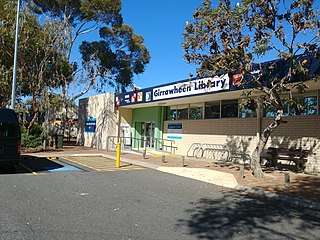
Girrawheen is a northern suburb of Perth, the capital city of Western Australia. Its local government area is the City of Wanneroo.
Landsdale is a northern suburb of Perth, Western Australia located within the local government area of the City of Wanneroo. It is mixed use, with residential, commercial and light manufacturing areas.
Kingsley is a suburb of Perth, Western Australia, located within the City of Joondalup. Kingsley is bounded to the north by Whitfords Avenue, to the south by Hepburn Avenue, to the west by the Mitchell Freeway and to the east by Wanneroo Road.

Marmion is a northern coastal suburb of Perth, the capital city of Western Australia. Its local government area is the City of Joondalup.

Malaga is a suburb of Perth, Western Australia, approximately 11 kilometres (6.8 mi) north of the CBD, in the City of Swan.

