
Joondalup is a regional metropolitan city within Perth, Western Australia, approximately 26 kilometres (16 mi) north of Perth's central business district. It acts as the primary urban centre of Perth's northern suburbs.

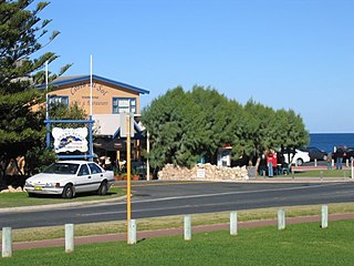
Ocean Reef is a suburb in northern Perth, Western Australia. It is located within the City of Joondalup. The name was coined by developers in the 1970s from the line of a reef visible several kilometres offshore. The name was formally adopted in 1974, replacing the prior name of Beaumaris, a name still retained by one of the shopping centres and one primary school.

Duncraig is a northern suburb of Perth, the capital city of Western Australia, and is located 16 kilometres (10 mi) north of Perth's central business district (CBD) between Marmion Avenue and Mitchell Freeway. Its local government area is the City of Joondalup.

Mullaloo is a northern coastal suburb of Perth, Western Australia, within the City of Joondalup.
Burns Beach is a suburb of Perth, Western Australia, located 34 kilometres (21 mi) north of Perth's central business district at the northern fringe of the City of Joondalup. Burns Beach has maintained much of its original character as a small coastal village even with its loss of isolation, and the beach is popular among hang gliding enthusiasts.

The City of Joondalup is a local government area with City status in Perth, Western Australia. It covers the metropolitan Perth city of Joondalup in its entirety, as well as the town centres of Hillarys and Warwick.

Joondalup is an electoral district of the Legislative Assembly in the Australian state of Western Australia. The district is located in the northern suburbs of Perth. Joondalup has tended to be a marginal seat.
The Electoral district of Mindarie was a Legislative Assembly electorate in the state of Western Australia. The district was named for the outer northern Perth suburb of Mindarie which falls within its borders.
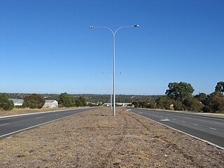
Joondalup Drive is a major distributor road in the northern suburbs of Perth, Western Australia. The road travels through the City of Joondalup's central business district and extends for a few kilometres east through neighbouring residential suburbs in the City of Wanneroo. The road was extended in 2005 to the northern suburb of Banksia Grove to provide easy access for residents to Joondalup's city centre, and to provide a complete connecting route to the Brand Highway from the Mitchell Freeway.

Leederville Oval is an Australian rules football ground located in Leederville, a suburb of Perth, Western Australia. The ground is used as a home ground by two clubs: the East Perth Football Club and the Subiaco Football Club, both competing in the West Australian Football League (WAFL). The ground was previously home to the West Perth Football Club from 1915 to 1993, before the club moved to Arena Joondalup, its current home ground. The ground is serviced by the Joondalup railway line, with the nearest stop being the Leederville station.

Arena Joondalup, known as HBF Arena under a commercial naming rights arrangement, is a multi-purpose sports complex in Joondalup, Western Australia, located on 35 ha of parkland approximately 25 km north of Perth. It was officially opened in 1994. An $11 million indoor aquatic centre, including a 50 m 10-lane competition pool, was completed in 2000.
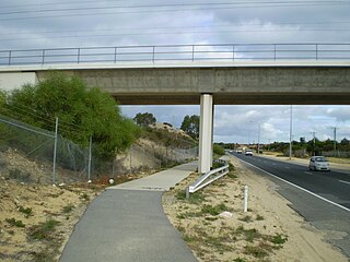
Burns Beach Road is an arterial east-west road in Perth, Western Australia, linking the suburbs of Burns Beach and Iluka to the Mitchell Freeway and Joondalup. It forms the entirety of State Route 87 and was the northern terminus of Mitchell Freeway and State Route 2 until 2017, when the freeway was extended to Hester Avenue.
Ocean Reef Road is an arterial east-west road in Perth, Western Australia. It is located within the northern suburbs of Perth, from Ocean Reef in the west, to Landsdale in the east, with a portion travelling northwards along the coast to Iluka.
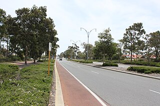
Shenton Avenue is an east-west distributor road in the northern suburbs of Perth, Western Australia, located within the City of Joondalup. The road primarily links Joondalup's coastal suburbs with the Joondalup central business district, which it passes through. It is also an entrance to the Mitchell Freeway.
Hodges Drive is a main west-east road in Joondalup, north of Perth, Western Australia. It begins in the suburb of Ocean Reef at a T-junction with Ocean Reef Road and runs through the residential areas in Ocean Reef, Connolly and Heathridge, before terminating at Joondalup Drive. The road continues from there as Grand Boulevard. Hodges Drive is a four lane dual-carriageway for most of its length, and changes to a two way single carriageway road west of Marmion Avenue. The northern part of the Mitchell Freeway terminated at Hodges Drive between 1999 and 2008, and the road provides freeway access for residents in the Joondalup City area.

Ocean Reef Senior High School is an independent public co-educational high day school, located in Ocean Reef, 27 kilometres (17 mi) north of Perth, Western Australia. Opened in 1983, the school's catchment area covered the northwestern part of the City of Joondalup and provides an education for approximately 1,300 students from Year 7 and Year 12.
Ocean Reef was an electoral district of the Legislative Assembly of Western Australia. It was located in Perth's northern suburbs, and was named after the suburb of Ocean Reef.

Joondalup is a suburb of the regional City of Joondalup in Perth, Western Australia, which includes the city's central business district as well as the council chambers for the local authority.
The Joondalup Giants Rugby League Club is an Australian rugby league football club based in Joondalup, Western Australia that competes in The Western Australian Rugby League. Founded in 1990, The Joondalup Giants provide the northern suburbs of Perth with a family friendly Rugby League club that has one of the strongest junior bases in Western Australia. The club fields junior teams from u6s through to u16s and senior teams, u18s, Women's league tag, women's tackle, Val Murphy Trophy, Reserve grade and Premiership grade.

Burns Beach is an electoral district of the Legislative Assembly of Western Australia. It is located in Perth's northern suburbs, and named after the suburb of Burns Beach.

