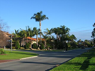
Carine is a suburb of Perth, the capital city of Western Australia, and is located 14 kilometres (9 mi) north of Perth's central business district (CBD) between Marmion Avenue and Mitchell Freeway. Its local government area is the City of Stirling.

Marangaroo is a suburb of Perth, Western Australia. It is located approximately 18 km north of Perth City, within the City of Wanneroo. Marangaroo's borders comprise Wanneroo Road, Hepburn Avenue, Mirrabooka Avenue and Marangaroo Drive.

Currambine is a northern suburb of Perth, the capital city of Western Australia, 29 km north of Perth's central business district. Its local government area is the City of Joondalup.

Whitfords railway station is a railway station located on the boundary of Padbury and Kingsley, suburbs of Perth, Western Australia. It is on the Yanchep line, which is part of the Transperth commuter rail network. It is located in the median of the Mitchell Freeway, and consists of an elevated bus interchange on top of an island platform at ground level. South of Whitfords, trains run every 5 minutes during peak. North of Whitfords, trains run every 10 minutes during peak. Between peak during the day, trains run every 15 minutes. The journey to Perth Underground railway station is 19.8 kilometres (12.3 mi), and takes 19 minutes.

Butler is an outer suburb of Perth, Western Australia, 41 kilometres north of Perth's central business district. It is part of the City of Wanneroo local government area. It forms the majority of the Brighton Estate, a large commercial and residential development by Satterley.

Clarkson is an outer northern suburb of Perth, Western Australia, located 34 kilometres north of Perth's central business district in the City of Wanneroo.

Eglinton is a locality in the Western Australian capital city of Perth, approximately 44 kilometres (27 mi) north of Perth's central business district on the Indian Ocean. For the most part, the suburb is covered in native banksia woodland, scrubland and heath typical of the Swan Coastal Plain. However, in recent years, there has been growth in residential estates, with a town centre to be built in the near future.

Neerabup is a rural locality in Perth, the capital of Western Australia, within the local government area of the City of Wanneroo.

Pearsall is a suburb of Perth, Western Australia in the City of Wanneroo. Until the late 1990s it was the southernmost part of the suburb of Wanneroo.
Tapping is a suburb of Perth, Western Australia, located within the City of Wanneroo. It came into being in the early 1990s as a subdivision of Wanneroo, originally as part of the Carramar estate.

Wangara is a light industrial suburb of Perth, Western Australia, located within the City of Wanneroo.

Merriwa is a coastal, northern suburb of Perth, Western Australia, 36 kilometres (22 mi) north of the central business district. It is part of the City of Wanneroo local government area. It is a predominantly residential suburb, containing two RAAF retirement villages.
Beldon is a small suburb of Perth, Western Australia, located within the City of Joondalup, to the north of Craigie.
Craigie is a northern suburb of Perth. Craigie was chosen as a suburb name in 1970 and honours an early councillor of the City of Wanneroo who did work in developing the City. Craigie is one of the four "Whitfords" suburbs that resulted from the State Government rezoning a large area of coastal land for development in 1969.
Heathridge is a suburb of Perth, Western Australia, located 33 kilometres (21 mi) south of Yanchep within the City of Joondalup.
Hillarys is a northern coastal suburb of Perth, the capital city of Western Australia, in the local government area of the City of Joondalup. It is part of the Whitfords precinct, and is located 21 km north-northwest of Perth's central business district via Mitchell Freeway and Hepburn Avenue.

Marmion is a northern coastal suburb of Perth, the capital city of Western Australia. Its local government area is the City of Joondalup.

Mullaloo is a northern coastal suburb of Perth, Western Australia, within the City of Joondalup.
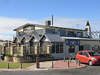
Burns Beach is a suburb of Perth, Western Australia, located 34 kilometres (21 mi) north of Perth's central business district at the northern fringe of the City of Joondalup. Burns Beach has maintained much of its original character as a small coastal village even with its loss of isolation, and the beach is popular among hang gliding enthusiasts.
Wanneroo is a northern suburb of Perth, Western Australia, located within the City of Wanneroo.


