In the 2011 census, Nepal's population was approximately 26 million people with a population growth rate of 1.35% and a median age of 21.6 years. In 2016, the female median age was approximately 25 years old and the male median age was approximately 22 years old. Only 4.4% of the population is estimated to be more than 65 years old, comprising 681,252 females and 597,628 males. 61% of the population is between 15 and 64 years old, and 34.6% is younger than 14 years. In 2011, the Birth rate is estimated to be 22.17 births per 1,000 people with an infant mortality rate of 46 deaths per 1,000 live births. Compared to the infant mortality rate in 2006 of 48 deaths per 1000 live births, the 2011 IMR is a slight decrease within that 5-year period. Infant mortality rate in Nepal is higher in rural regions at 44 deaths per 1000 live births, whereas in urban regions the IMR is lower at 40 deaths per 1000 live births. This difference is due to a lack of delivery assistance services in rural communities compared to their urban counterparts who have better access to hospitals and neonatal clinics. Life expectancy at birth is estimated to be 67.44 years for females and 64.94 years for males. The mortality rate is estimated to be 681 deaths per 100,000 people. Net migration rate is estimated to be 61 migrants per 100,000 people. According to the 2011 census, 65.9% of the total population is literate.

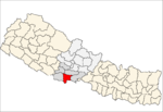
Banke District (Nepali: बाँके जिल्ला [bãke], a part of Lumbini Province, is one of the 77 districts of Nepal. The district, located in midwestern Nepal with Nepalganj as its district headquarters, covers an area of 2,337 km2 and had a population of 385,840 in 2001 and 491,313 in 2011. There are three main cities in the Banke District: Nepalganj, Kohalpur and Khajura Bajaar.

Bardiya District, one of the seventy-seven Districts of Nepal, is part of Lumbini Province of Nepal. The district, with Gulariya as its headquarters, covers an area of 2,025 km2 (782 sq mi) and according to the 2001 census the population was 382,649 in 2011 it has 426,576.
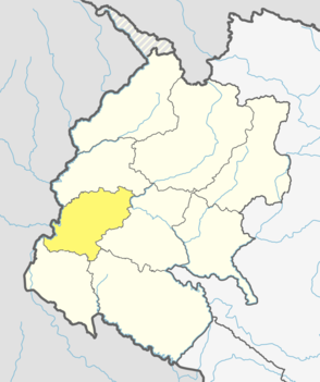
Dadeldhura district, a part of Sudurpashchim Province, is one of the seventy-seven districts of Nepal. The district, with Dadeldhura as its district headquarters, covers an area of 1,538 km2 (594 sq mi) and had a population of 126,162 in 2001 and 142,094 in 2011.

Jhapa is a district of Province No. 1 in eastern Nepal named after a Rajbanshi word "Jhapa" meaning "to cover" (verb). The latest official data, the 2011 Nepal Census, puts the total population of the district at 812,650. The total area of the district is 1606 square kilometres.

Ethnic groups in Nepal are a product of both the colonial and state-building eras of Nepal. The groups are delineated using language, ethnic identity or the caste system in Nepal. They are categorized by common culture and endogamy. Endogamy carves out ethnic groups in Nepal.

A Village Development Committee (VDC) in Nepal was the lower administrative part of its Ministry of Federal Affairs and Local Development. Each district had several VDCs, similar to municipalities but with greater public-government interaction and administration. There were 3,157 village development committees in Nepal. Each VDC was further divided into several wards depending on the population of the district, the average being nine wards.
Nepalese in the United Kingdom are British citizens or full-time residents of the United Kingdom whose ethnic origins lie fully or partially in Nepal. According to ONS estimates in 2019 there were 76,000 Nepalese-born people in the country.
The 1991 Nepal census was a widespread national census conducted by the Nepal Central Bureau of Statistics.
Bichhiya is a village in Bajura District in the Seti Zone of north-western Nepal. At the time of the 1991 Nepal census it had a population of 1,904 and had 352 houses in the village.

Satungal is a village and former Village Development Committee that is now part of Chandragiri Municipality in Kathmandu District in Province No. 3 of central Nepal. Satungal is also known as Satyapur. At the time of the 1991 Nepal census it had a population of 2730 and had 464 households in it. At the time of the 2001 Nepal census Satungal had a population of 5834 and had 1375 households in it. Satungal had 5173 literate people i.e. 88.66%.

Chulachuli is a rural municipality (gaunpalika) out of six rural municipality located in Ilam District of Province No. 1 of Nepal. There are a total of 10 municipalities in Ilam in which 4 are urban and 6 are rural.

Katari is a Municipality in Udayapur District in the Province No. 1 of south-eastern Nepal.It lies by the Tawa river having the bridge of length 123.5m. This was established by merging two existing village development committees i.e. Triveni and Katari on 18 May 2014. At the time of the 1991 Nepal census it had a population of 7230 people living in 1410 individual households.
Chainpur is a municipality in Sankhuwasabha District in the Kosi Zone of north-eastern Nepal. It was formed by merging five villages i.e. Chainpur, Siddhakali, Siddhapokhari, Baneshwar and Kharang. The municipality was implemented on 18 May 2014. At the time of the 1991 Nepal census it had a population of 4933 people in 948 households.
Duhabi is a municipality in Sunsari District in the Koshi Zone of south-eastern Nepal. At the time of the 2001 Nepal census it had a population of 17,574. Duhabi is situated in between Itahari and Biratnagar, on the bank of Budi River. It is the center of Sunsari–Morang industrial corridor.
Shivanagar is a town in Krishnanagar Municipality in Kapilvastu District in the Lumbini Zone of southern Nepal. The former VDC was merged to form the municipality established on 18 May 2014 Krishnanagar, Sirsihawa, Shivanagar VDCs. At the time of the 2011 Nepal census it had a population of 4,774 people living in 735 individual households.
Pathari Shanishchare (पथरी-शनिश्चरे) is a Municipality in Morang District in the Koshi Zone of south-eastern Nepal. It was formed by merging three existing village development committees i.e. Hasandaha, Pathari and Sanischare in May 2014.
Nepal conducted a widespread national census in 2011 by the Nepal Central Bureau of Statistics. Working with the 58 municipalities and the 3915 Village Development Committees at a district level, they recorded data from all the municipalities and villages of each district. The data included statistics on population size, households, sex and age distribution, place of birth, residence characteristics, literacy, marital status, religion, language spoken, caste/ethnic group, economically active population, education, number of children, employment status, and occupation.
The 2001 Nepal census was conducted by the Nepal Central Bureau of Statistics. According to the census, the population of Nepal in 2001 was 23,151,423. Working with Nepal's Village Development Committees at a district level, they recorded data from all the main towns and villages of each district of Nepal. The data included statistics on population size, households, sex and age distribution, place of birth, residence characteristics, literacy, marital status, religion, language spoken, caste/ethnic group, economically active population, education, number of children, employment status, and occupation.
Sundar Haraicha is a municipality in Morang District of Province No. 1 in Nepal that was established on 10 March 2017 by merging the former municipalities Sundar Dulari and Koshi Haraicha. At the time of the 2011 Nepal census, the localities formed had a joint population of 80,518 people living in 18,610 individual households.