San Antonio de Padua de la Concordia is a city in the north-east of the province of Entre Ríos in the Argentine Mesopotamia. It had about 172,000 inhabitants at the 2001 census [INDEC], and is the head town of the department of the same name.

The Pelotas River is a river in southern Brazil, and a tributary of the Uruguay River.
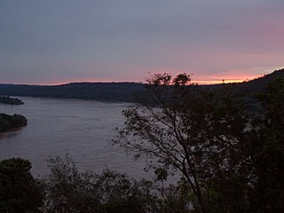
The Río Negro is the most important river in Uruguay. It originates in the southern highlands of Brazil, just east of Bagé, and flows west across the entire width of Uruguay to the Uruguay River. The course of the Río Negro across Uruguay effectively divides the south of the country from the north. The Río Negro's principals tributaries are Yí River and Tacuarembó River.
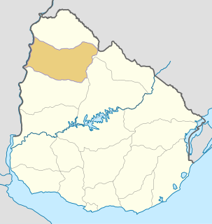
Salto Department is a department of the northwestern region of Uruguay. It has an area of 14,163 km2 (5,468 sq mi) and a population of 124,878. Its capital is the city of Salto. It borders Artigas Department to its north, Paysandú Department to its south, the departments of Rivera and Tacuarembó to its east and has the Río Uruguay flowing at its west, separating it from Argentina.
The Libertador General San Martín Bridge is a cantilever road bridge that crosses the Uruguay River and joins Argentina and Uruguay. It runs between Puerto Unzué, near Gualeguaychú, Entre Ríos Province, Argentina, and Fray Bentos, Río Negro Department, Uruguay, with a total length of 5,966 meters (3.7 mi).

The General Artigas Bridge is an international road bridge that crosses the Uruguay River and joins Argentina and Uruguay. It runs between Colón, Entre Ríos Province, Argentina, and Paysandú, Paysandú Department, Uruguay. It is a cantilever bridge with a total length of 2,350 metres (7,709 ft). The main span of the bridge measures 140 metres (460 ft) in length.

The Salto Grande Bridge is a road and railroad bridge that crosses the Uruguay River and joins Argentina and Uruguay. It is built on top of the Salto Grande Dam. The bridge runs between Concordia, Entre Ríos Province, Argentina, and Salto, Salto Department, Uruguay.
Kosmosdale is a neighborhood in southwestern Louisville, Kentucky located along Dixie Highway near Depot Lane and is named after the Kosmos Cement Company. The Kosmos Cement Company was purchased by the Flintkote Corporation in 1957 and operated as a Division of Flintkote for many years. It is now operated by Cemex, Inc. as a joint venture.
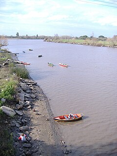
The Gualeguaychú River is a river in the province of Entre Ríos, Argentina. It starts in the center-east of the province, within the Colón Department, and flows south, passing by the city of Gualeguaychú and then emptying into the Uruguay River. Its drainage basin has an area of 6,693 square kilometres (2,584 sq mi).

The Quaraí or Cuareim River is a tributary of the Uruguay River.

The National University of Entre Ríos is an Argentine national university situated in the city of Concepción del Uruguay, Entre Ríos.
The Tacuarembó River is a river in Uruguay. The Tacuarembó and the Yí Rivers are the principal tributaries of the Río Negro.
The Ijuí River is a river of Rio Grande do Sul state in southern Brazil. It is a tributary of the Uruguay River.
Agraciada Beach is a historic beach area in Uruguay.
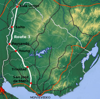
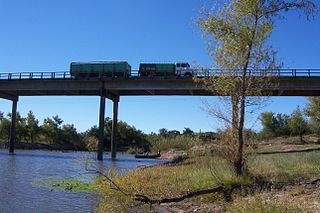
Route 3 is a national route of Uruguay. In 1975, it was assigned the name General José Artigas, the foremost national hero of Uruguay. It is one of the most important highways in the country along with Route 5, connecting the south coast near Rafael Perazza with Bella Unión in the extreme northwest. The road is approximately 592 kilometres (368 mi) in length.

Termas del Daymán is a resort and populated centre in the Salto Department of northwestern Uruguay.
Punta Gorda is a landform in Colonia Department, Uruguay.
Carroll Branch is a stream in the U.S. state of West Virginia.