
The Salmon River, also known as "The River of No Return", is a river located in the U.S. state of Idaho in the western United States. It flows for 425 miles (685 km) through central Idaho, draining a rugged, thinly populated watershed of 14,000 square miles (36,000 km2). The river drops more than 7,000 feet (2,100 m) from its headwaters, near Galena Summit above the Sawtooth Valley in the Sawtooth National Recreation Area, to its confluence with the Snake River. Measured at White Bird, its average discharge is 11,060 cubic feet per second. The Salmon River is the longest undammed river in the contiguous United States.

The Boise River is a 102-mile-long (164 km) tributary of the Snake River in the Northwestern United States. It drains a rugged portion of the Sawtooth Range in southwestern Idaho northeast of Boise, as well as part of the western Snake River Plain. The watershed encompasses approximately 4,100 square miles (11,000 km2) of highly diverse habitats, including alpine canyons, forest, rangeland, agricultural lands, and urban areas.

The Payette River is an 82.7-mile-long (133.1 km) river in southwestern Idaho and is a major tributary of the Snake River.

Boise National Forest is a National Forest covering 2,203,703 acres (8,918.07 km2) of the U.S. state of Idaho. Created on July 1, 1908, from part of Sawtooth National Forest, it is managed by the U.S. Forest Service as five units: the Cascade, Emmett, Idaho City, Lowman, and Mountain Home ranger districts.

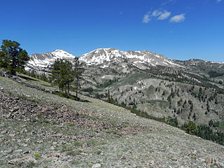
The Sawtooth Range is a mountain range of the Rocky Mountains in central Idaho, United States, reaching a maximum elevation of 10,751 feet (3,277 m) at the summit of Thompson Peak. It encompasses an area of 678 square miles (1,756 km2) spanning parts of Custer, Boise, Blaine, and Elmore counties, and is bordered to the east by the Sawtooth Valley. Much of the mountain range is within the Sawtooth Wilderness, part of the Sawtooth National Recreation Area and Sawtooth National Forest.

State Highway 21 (SH-21), also known as the Ponderosa Pine Scenic Byway, is a state highway in Idaho. It runs from Boise to Stanley, primarily as a two-lane road. With two-thirds of its length in Boise County, it passes by historic Idaho City and the village of Lowman to the western edge of the Sawtooth Mountains, then along their northern boundary to Stanley.

The North Fork Payette River is a river in the western United States in western Idaho. It flows about 113 miles (182 km) southwards from the Salmon River Mountains to near Banks, where it empties into the Payette River, a tributary of the Snake River. It drains a watershed of 912 square miles (2,360 km2), consisting of mountains and forests, and valleys filled with large lakes and wetlands.
Vernon Lake is an alpine lake in Boise County, Idaho, United States, located high in the Sawtooth Mountains in the Sawtooth National Recreation Area. The lake is approximately 17 miles (27 km) southwest of Stanley and 14.5 miles (23.3 km) southeast of Grandjean. Located in the remote central Sawtooth Wilderness, Vernon Lake can be reached by trails from many directions, including the Sawtooth Valley (east), Grandjean (northwest), Redfish Lake (north), and Atlanta (south).
Confusion Lake is a small alpine lake in Elmore County, Idaho, United States, located in the Sawtooth Mountains in the Sawtooth National Recreation Area. The lake is accessed from Sawtooth National Forest trail 479 along Timpa Creek or 462 along the Middle Fork of the Boise River.
The Trail Creek Lakes are a series of five small alpine glacial lakes in Boise County, Idaho, United States, located in the Sawtooth Mountains in the Sawtooth National Recreation Area. The lakes are on Trail Creek, which is a tributary of the South Fork Payette River. The lakes can be accessed from Sawtooth National Forest trail 453.
The Trailer Lakes are a series of three small alpine glacial lakes in Boise County, Idaho, United States, located in the Sawtooth Mountains in the Sawtooth National Recreation Area. The Trailer Lakes are in the Trail Creek watershed, which is a tributary of the South Fork Payette River. The lakes are most easily accessed from Sawtooth National Forest trail 453.
The Feather Lakes are a chain of four small alpine glacial lakes in Boise County, Idaho, United States, located in the Sawtooth Mountains in the Sawtooth National Recreation Area. The lakes are located on Goat Creek which is a tributary of the South Fork Payette River. There are no trails leading to the lakes or the Goat Creek drainage.
Smoky Dome, at 10,095 feet (3,077 m) above sea level is the highest peak in the Soldier Mountains of Idaho. Smoky Dome is located northwest of Fairfield in Camas County and Sawtooth National Forest.
Boardman Creek is a stream in the Sawtooth National Forest in Camas County, Idaho in the United States. It is a tributary of the South Fork Boise River, which in turn is a tributary to the Snake River and Columbia River.

Iron Mountain, at 9,694 feet (2,955 m) high is one of the peaks of the Soldier Mountains of Idaho. Iron Mountain is located at the west end of the range northwest of Fairfield in Camas County and Sawtooth National Forest.
Boardman Peak, at 9,457 feet (2,882 m) high is one of the peaks of the Soldier Mountains of Idaho. Boardman Peak is located at the center of the range southeast of Iron Mountain, northwest of Smoky Dome, and northwest of Fairfield in Camas County and Sawtooth National Forest. No trails go to the summit, but several pass near the peak, and the ascent is only class 2.
Skillern Peak, at 8,878 feet (2,706 m) above sea level is a peak in the Smoky Mountains of Idaho. The peak is located in Sawtooth National Forest in Camas County. It is located in the watershed of Big Smoky Creek, a tributary of the South Fork of the Boise River. It is about 4.5 mi (7.2 km) northwest of Big Peak and 3.9 mi (6.3 km) southeast of Paradise Peak. No roads or trails go to the summit, although a trail is on the side of the mountain.
Paradise Peak, at 9,798 feet (2,986 m) above sea level is a peak in the Smoky Mountains of Idaho. The peak is located in Sawtooth National Forest in Camas County. It is located in the watersheds of Paradise and Emma creeks and the South Fork of the Boise River. It is about 4 mi (6.4 km) northwest of Skillern Peak, 0.35 mi (0.56 km) northwest of Paradise Lake, and 1.2 mi (1.9 km) west of Snowslide Lake. No roads or trails go to the summit.
Two Point Mountain is the highest point in the Boise Mountains with a summit elevation of 10,124 feet (3,086 m) located in the Fairfield Ranger District of Sawtooth National Forest, Idaho. It is located 12.67 miles (20.39 km) from Perfect Peak in the Sawtooth Range, its line parent, giving it a prominence of 1,524 feet (465 m). Two Point Mountain is named for having two peaks: its main summit and a second summit about 0.4 miles (0.64 km) to the northwest that rises to an elevation of 10,060 feet (3,070 m). The mountain is within the watershed of the South Fork Boise River where the south side is drained by Bear Creek and the north side by the Ross Fork. No maintained trails lead to either summit.

