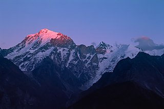
Himachal Pradesh is a state in the northern part of India. Situated in the Western Himalayas, it is one of the thirteen mountain states and is characterized by an extreme landscape featuring several peaks and extensive river systems. Himachal Pradesh is the northernmost state of India and shares borders with the union territories of Jammu and Kashmir and Ladakh to the north, and the states of Punjab to the west, Haryana to the southwest, Uttarakhand to the southeast and a very narrow border with Uttar Pradesh to the south. The state also shares an international border to the east with the Tibet Autonomous Region in China. Himachal Pradesh is also known as Dev Bhoomi, meaning 'Land of Gods' and Veer Bhoomi which means 'Land of the Brave'.

India is the most populous country in the world with one-sixth of the world's population. According to official estimates in 2022, India's population stood at over 1.42 billion.

Mumbai is the capital city of the Indian state of Maharashtra. Mumbai is the de facto financial centre and the most populous city of India with an estimated city proper population of 12.5 million (1.25 crore). Mumbai is the centre of the Mumbai Metropolitan Region, the sixth most populous metropolitan area in the world with a population of over 23 million living under the Brihanmumbai Municipal Corporation. Mumbai lies on the Konkan coast on the west coast of India and has a deep natural harbour. In 2008, Mumbai was named an alpha world city.

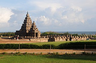
Tamil Nadu is the southernmost state of India. The tenth largest Indian state by area and the sixth largest by population, Tamil Nadu is the home of the Tamil people, whose Tamil language—one of the longest surviving classical languages in the world—is widely spoken in the state and serves as its official language. The capital and largest city is Chennai.

Kolkata is the capital of the Indian state of West Bengal. It is on the eastern bank of the Hooghly River 80 km (50 mi) west of the border with Bangladesh. It is the primary business, commercial, and financial hub of Eastern India and the main port of communication for North-East India. According to the 2011 Indian census, Kolkata is the seventh-most populous city in India, with a population of 45 lakh (4.5 million) residents within the city. It is a part of Kolkata Metropolitan Area which has a population of over 1.41 crore (14.1 million) residents making it the third-most populous metropolitan area in India. In 2021, the Kolkata metropolitan area crossed 1.5 crore (15 million) registered voters. The Port of Kolkata is India's oldest operating port and its sole major riverine port. Kolkata is regarded as the cultural capital of India. Kolkata is the second largest Bengali-speaking city after Dhaka. It has the highest number of nobel laureates among all cities in India.

Jammu and Kashmir was a region formerly administered by India as a state from 1952 to 2019, constituting the southern and southeastern portion of the larger Kashmir region, which has been the subject of a dispute between India, Pakistan and China since the mid-20th century. The underlying region of this state were parts of the former princely state of Jammu and Kashmir, whose western districts, now known as Azad Kashmir, and northern territories, now known as Gilgit-Baltistan, are administered by Pakistan. The Aksai Chin region in the east, bordering Tibet, has been under Chinese control since 1962.

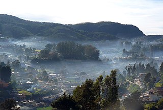
Ooty, officially known as Udhagamandalam, is a town and a municipality in the Nilgiris district of the South Indian state of Tamil Nadu. It is located 86 km (53 mi) north west of Coimbatore, 100 km north west of Tirupur, 128 km (80 mi) south of Mysore and is the headquarters of the Nilgiris district. It is a popular hill station located in the Nilgiri Hills. It is popularly called the "Queen of Hill Stations". It was the summer capital of the Madras Presidency.

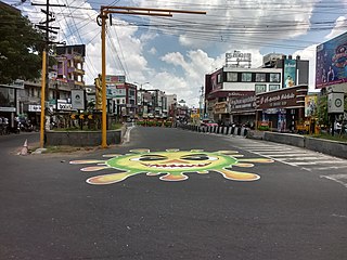
Coimbatore, also spelt as Koyamputhur, sometimes shortened as Kovai, is one of the major metropolitan cities in the Indian state of Tamil Nadu. It is located on the banks of the Noyyal River and surrounded by the Western Ghats. Coimbatore is the second largest city in Tamil Nadu after Chennai in terms of population and the 16th largest urban agglomeration in India as per the census 2011. It is administered by the Coimbatore Municipal Corporation and is the administrative capital of Coimbatore District. In 1981, Coimbatore formed as the third municipal corporation in Tamil Nadu after Chennai and Madurai. Podanur Junction is the oldest railway station in Coimbatore City. The city is one of the largest exporters of jewellery, wet grinders, poultry and auto components; the "Coimbatore Wet Grinder" and the "Kovai Cora Cotton" are recognised as Geographical Indications by the Government of India. Being a hub of textile industry in South India, the city is sometimes referred to as the "Manchester of South India". It was ranked the 7th best city in India in the Ease of Living index 2020.

Uttar Pradesh is a state in northern India. With over 240 million inhabitants, it is the most populated state in India as well as the most populous country subdivision in the world. It was established in 1950 after India had become a republic. It was a successor to the United Provinces (UP) during the period of the Dominion of India (1947–1950), which in turn was a successor to the United Provinces (UP) established in 1935, and eventually of the United Provinces of Agra and Oudh established in 1902 during the British Raj. The state is divided into 18 divisions and 75 districts, with the state capital being Lucknow, and Prayagraj serving as the judicial capital. On 9 November 2000, a new state, Uttaranchal, was created from Uttar Pradesh's western Himalayan hill region. The two major rivers of the state, the Ganges and its tributary Yamuna, meet at the Triveni Sangam in Prayagraj, a Hindu pilgrimage site. Other notable rivers are Gomti and Saryu. The forest cover in the state is 6.1 per cent of the state's geographical area. The cultivable area is 82 per cent of total geographical area and net area sown is 68.5 per cent of cultivable area.

The Scheduled Castes (SCs) and Scheduled Tribes (STs) are officially designated groups of people and among the most disadvantaged socio-economic groups in India. The terms are recognized in the Constitution of India and the groups are designated in one or other of the categories. For much of the period of British rule in the Indian subcontinent, they were known as the Depressed Classes.
Kothamangalam, IPA: [koːd̪ɐmɐŋgɐlɐm], is a municipality in Ernakulam district of Kerala, India. The town is in the foothills of the Western Ghats, and is a part of the Idukki Lok Sabha constituency.
RannaBelagali is a Pattan Panchayat Town in the southern state of Karnataka, India. It is located in the Mudhol taluka of Bagalkot district in Karnataka
Malali is a village in Bagalkot district, Karnataka, India.

The 2011 Census of India or the 15th Indian Census was conducted in two phases, house listing and population enumeration. The House listing phase began on 1 April 2010 and involved the collection of information about all buildings. Information for National Population Register (NPR) was also collected in the first phase, which will be used to issue a 12-digit unique identification number to all registered Indian residents by Unique Identification Authority of India. The second population enumeration phase was conducted between 9 and 28 February 2011. Census has been conducted in India since 1872 and 2011 marks the first time biometric information was collected. According to the provisional reports released on 31 March 2011, the Indian population increased to 1.21 billion with a decadal growth of 17.70%. Adult literacy rate increased to 74.04% with a decadal growth of 9.21%. The motto of the census was 'Our Census, Our future'.

Tiruppur or Tirupur is a city in the Indian state of Tamil Nadu. Tiruppur is the administrative headquarters of Tiruppur district and the Seventh largest city as well as an urban agglomeration in Tamil Nadu. Located on the banks of Noyyal River, it has been ruled at different times, by the Early Pandyas, Medieval Cholas, Later Cholas, Mysore Kingdom and the British. It is about 450 kilometres (280 mi) southwest of the state capital Chennai about 50 kilometres (31 mi) east of Coimbatore 50 kilometres (31 mi) south of Erode and 50 kilometres (31 mi) north of Dharapuram.

Jammu and Kashmir is a region administered by India as a union territory and consists of the southern portion of the larger Kashmir region, which has been the subject of a dispute between India and Pakistan since 1947, and between India and China since 1959. The Line of Control separates Jammu and Kashmir from the Pakistani-administered territories of Azad Kashmir and Gilgit-Baltistan in the west and north. It lies to the north of the Indian states of Himachal Pradesh and Punjab and to the west of Ladakh which is administered by India as a union territory.


