Chornobyl is a city in the restricted Chernobyl Exclusion Zone situated in the Ivankiv Raion of northern Kiev Oblast, near Ukraine's border with Belarus. Chornobyl is about 90 kilometres (56 mi) northeast of Kiev, and approximately 140 kilometres (87 mi) southwest of the Belarusian city of Gomel and 16 km [10 mi] from Ukraine’s border with Belarus. The city was the administrative center of Chornobyl Raion (district) from 1923 until it was disestablished in 1988. Before its evacuation, the city had about 14,000 residents.

Electricity generation is the process of generating electric power from sources of primary energy. For electric utilities in the electric power industry, it is the first stage in the delivery of electricity to end users, the other stages being transmission, distribution, energy storage and recovery, using the pumped-storage method.

Niue is an island country in the South Pacific Ocean, 2,400 kilometres (1,500 mi) northeast of New Zealand, east of Tonga, south of Samoa, and west of the Cook Islands. Niue's land area is about 261 square kilometres (101 sq mi) and its population, predominantly Polynesian, was about 1,600 in 2016. The island is commonly referred to as "The Rock", which comes from the traditional name "Rock of Polynesia". Niue is one of the world's largest coral islands. The terrain of the island has two noticeable levels. The higher level is made up of a limestone cliff running along the coast, with a plateau in the centre of the island reaching approximately 60 metres high above sea level. The lower level is a coastal terrace approximately 0.5 km wide and about 25–27 metres high, which slopes down and meets the sea in small cliffs. A coral reef surrounds the island, with the only major break in the reef being in the central western coast, close to the capital, Alofi. A notable feature are the many limestone caves near the coast.

A society is a group of individuals involved in persistent social interaction, or a large social group sharing the same geographical or social territory, typically subject to the same political authority and dominant cultural expectations. Societies are characterized by patterns of relationships between individuals who share a distinctive culture and institutions; a given society may be described as the sum total of such relationships among its constituent of members. In the social sciences, a larger society often exhibits stratification or dominance patterns in subgroups.

A village is a clustered human settlement or community, larger than a hamlet but smaller than a town, with a population ranging from a few hundred to a few thousand. Though villages are often located in rural areas, the term urban village is also applied to certain urban neighborhoods. Villages are normally permanent, with fixed dwellings; however, transient villages can occur. Further, the dwellings of a village are fairly close to one another, not scattered broadly over the landscape, as a dispersed settlement.

The administrative divisions of New York are the various units of government that provide local government services in the state of New York.

For administrative purposes, Egypt is divided into twenty-seven governorates. Egyptian governorates are the top tier of the country's jurisdiction hierarchy. A governorate is administered by a governor, who is appointed by the President of Egypt and serves at the president's discretion. Most governorates have a population density of more than one thousand per km², while the three largest have a population density of less than two per km².

Perth-Andover is a village in Victoria County, New Brunswick, Canada.

Tomari is a village located in Shiribeshi Subprefecture, Hokkaido, Japan. As of September 2016, the village had a population of 1,750, and a density of 21 persons per km². The total area is 82.35 square kilometres (31.80 sq mi).

Limingen (Norwegian) or Lyjmede (Southern Sami) is a lake in the municipalities of Røyrvik and Lierne in Trøndelag county, Norway. It is the eighth-largest lake in the country. The lake lies 418 metres (1,371 ft) above sea level and has an area of 93 square kilometres (36 sq mi). At the deepest point, it is 192 metres (630 ft) deep and averages about 87 metres (285 ft) deep. The lake has a volume of 8.34 cubic kilometres (2.00 cu mi) and is located just north of the large lake Tunnsjøen. The border with Sweden lies about 725 metres (0.5 mi) east of the lake.

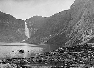
Ringedalsvatnet is a lake in the municipality of Odda in Hordaland county, Norway. The 7-square-kilometre (2.7 sq mi) lake sits just east of the village of Skjeggedal and about 3.5 kilometres (2.2 mi) east from the village of Tyssedal, which sits on the shore of the Sørfjorden. The lake is the main reservoir for a hydroelectric power station in Tyssedal which provides electricity for the power intensive industries in the nearby town of Odda. The 521-metre (1,709 ft) wide and 33-metre (108 ft) high Ringedals Dam was constructed from 1910–1918.
In the United States, the meaning of "village" varies by geographic area and legal jurisdiction. In many areas, "village" is a term, sometimes informal, for a type of administrative division at the local government level. Since the Tenth Amendment to the United States Constitution prohibits the federal government from legislating on local government, the states are free to have political subdivisions called "villages" or not to and to define the word in many ways. Typically, a village is a type of municipality, although it can also be a special district or an unincorporated area. It may or may not be recognized for governmental purposes.

Jósvafő is a village in Borsod-Abaúj-Zemplén county, Hungary, situated at the confluence of the Jósva, Kecső, and Tohonya streams. The area, now designated Aggteleki National Park, abounds with natural springs and caves. The "old village" of the settlement was declared a landmark site in 1999. The Tengerszem Lake was constructed in the 1930s to power mills and generate power, from a system in the Baradla Cave.

Paluel is a commune in the Seine-Maritime department in the Normandy region in northern France.

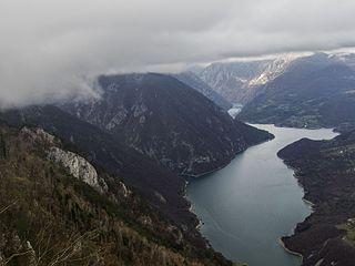
The Drina is a 346 km (215 mi) long international river, which forms a large portion of the border between Bosnia and Herzegovina and Serbia. It is the longest tributary of the Sava River and the longest karst river in the Dinaric Alps which belongs to the Danube river watershed. Its name is derived from the Latin name of the river which in turn is derived from Greek.

Shakti is the primordial cosmic energy and represents the dynamic forces that are thought to move through the entire universe in Hinduism and Shaktism.
Mahishwadgi is a village in Belgaum district of Karnataka, India. Mahishwadgi is situated on the banks of Krishna River, 25 km from Athani, Belgavi. 90% of the population follow Jainism.
Renewable energy in Pakistan is a relatively underdeveloped sector; however, in recent years, there has been some interest by environmentalist groups and from the authorities to explore renewable energy resources for energy production in light of the energy crises and power shortages affecting the country. Most of Pakistan's renewable energy comes from hydroelectricity.
Jhimpir railway station is located at Jhimpir village, Thatta district of Sindh province, Pakistan. There is also Pakistan's first wind power plant Jhimpir Wind Power Plant. Jhimpir is 114 km (71 mi) away from Karachi.

Following the Syrian Arab Army's successful Kuweires offensive, during the Syrian Civil War, which ended with the securing of the Kuweires Military Airbase on 16 November 2015, the Syrian Army launched a new offensive in the eastern countryside of the Aleppo Governorate, with the aim of expanding the buffer zone around the airbase and disrupting ISIL supply lines.


