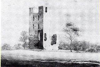
Deuteren

Last updated
Deuteren
Map NL 's-Hertogenbosch-'s-Hertogenbosch-West-Deuteren.png
Country Netherlands
Province Noord-Brabant
Municipality 's-Hertogenbosch
Area
  Total 0.28 km2 (0.11 sq mi)
Population 1,600

Deuteren is a hamlet in the Dutch province of North Brabant. It is located in the municipality of 's-Hertogenbosch, about 2 km west of the city centre.

Netherlands Constituent country of the Kingdom of the Netherlands in Europe

The Netherlands is a country located mainly in Northwestern Europe. The European portion of the Netherlands consists of twelve separate provinces that border Germany to the east, Belgium to the south, and the North Sea to the northwest, with maritime borders in the North Sea with Belgium, Germany and the United Kingdom. Together with three island territories in the Caribbean Sea—Bonaire, Sint Eustatius and Saba— it forms a constituent country of the Kingdom of the Netherlands. The official language is Dutch, but a secondary official language in the province of Friesland is West Frisian.

North Brabant Province of the Netherlands

North Brabant, also unofficially called Brabant, is a province in the south of the Netherlands. It borders the provinces of South Holland and Gelderland to the north, Limburg to the east, Zeeland to the west, and Belgium to the south. The northern border follows the Meuse westward to its mouth in the Hollands Diep strait, part of the Rhine–Meuse–Scheldt delta.

s-Hertogenbosch City and municipality in North Brabant, Netherlands

's-Hertogenbosch, colloquially known as Den Bosch, is a city and municipality in the Southern Netherlands with a population of 152,968. It is the capital of the province of North Brabant.

According to the 19th-century historian A.J. van der Aa, [1] this hamlet was the location of the first Reformed preaching in the area in 1566, by Cornelis van Diest. In the siege of 's-Hertogenbosch in 1629, Deuteren was the location of the headquarters of colonel Pinsen. The hamlet suffered a lot of damage in the year 1757 by high water and ice shelves.

Formerly, the hamlet was divided into two parts: Groot-Deuteren (the current hamlet) and Klein-Deuteren, about 1 km to the northeast. The latter part had shrunk to only one house in the middle of the 19th century; [1] nowadays, a suburb of 's-Hertogenbosch covers the area of Klein-Deuteren.

Deuteren was a part of the municipality of Cromvoirt until that municipality merged with Vught; at that time, Deuteren became a part of 's-Hertogenbosch.

Cromvoirt Place in North Brabant, Netherlands

Cromvoirt is a village in the Dutch province of North Brabant. It is located in the municipality of Vught.

Vught Town and municipality in North Brabant, Netherlands

Vught is a municipality and a town in the southern Netherlands, and lies just south of the industrial and administrative centre of 's-Hertogenbosch. Many commuters live in the municipality, and the town of Vught was once named "Best place to live" by the Dutch magazine Elsevier.

Related Research Articles

Schalkwijk, Utrecht Village in Utrecht, Netherlands

Schalkwijk [ˈsxɑɫkʋɛik] is a small village in the Dutch province of Utrecht. It consists of a small village centre on the railway line between Utrecht and 's-Hertogenbosch and a 5 km long ribbon of farms along the small channel Schalkwijksche Wetering.

Bommenede former town and former municipality in Zeeland

Bommenede or Bommenee is a former island, village, and municipality in the Netherlands, located about 5 km east of the city of Brouwershaven.

Bath is a small village and a former municipality in the Dutch province of Zeeland, lying on the north shore of the Western Scheldt. It is now located in the municipality of Reimerswaal, about 10 km southwest of Bergen op Zoom. Bath has a population of about 90.

Strevelshoek Hamlet in South Holland, Netherlands

Strevelshoek is a hamlet in the Dutch province of South Holland. It is located about 1 km northwest of the village of Rijsoord, on the south bank of the Waaltje. The hamlet is not mentioned on recent topographical maps.

Vliet, Utrecht human settlement in the Netherlands

Vliet is a hamlet in the Dutch province of Utrecht. It is located about 1 km southwest of the city of Oudewater, on the south bank of the Hollandsche IJssel.

Anholt is a hamlet in northeast Netherlands. It is located in the municipality De Wolden, Drenthe, about 2 km west of Pesse.

Appel, Netherlands Place in Gelderland, Netherlands

Appel is a hamlet in the Dutch province of Gelderland. It is located in the municipality Nijkerk, about 6 km southeast of the city, on the border with the municipality of Barneveld.

Appen is a hamlet in the Dutch province of Gelderland. It is located in the municipality of Voorst, about 0.5 km southwest of Gietelo, to which it belongs.

Baal is a hamlet in the Dutch province of Gelderland. It is located in the municipality of Lingewaard, about 1 km northeast of Bemmel, and located 1 kilometer north of Haalderen and is therefore part of Haalderen.

Bahr is a hamlet in the Dutch province of Gelderland. It is located in the municipality Zevenaar, about 3 km southeast of Rheden.

Baalhoek is a hamlet in the Dutch province of Zeeland. It is located in the municipality of Hulst, about 5 km east of Kloosterzande on the dyke of the Westerschelde.

Toom is a hamlet in the Dutch province of North Brabant. It is located in the municipality of Cranendonck, about 1 km west of Budel, and a few hundred metres from the Belgian border.

Bosch is a hamlet in the Dutch province of North Brabant. It is located in the municipality of Cranendonck, about 1.5 km east of Budel.

Heikant is a hamlet in the Dutch province of North Brabant. It is located in the municipality of Cranendonck, about 1.5 km southeast of Budel.

Heikant is a hamlet in the Dutch province of North Brabant. It is located in the municipality of Alphen-Chaam, about 2 km northeast of Chaam.

Heikant is a former hamlet in the Dutch province of North Brabant. It was located in the municipality of Gilze en Rijen, about 1 km west of the centre of Rijen.

Heikant is a former hamlet in the Dutch province of North Brabant. It was located about 2 km northwest of Helvoirt.

Heikant is a former hamlet in the municipality of Berg en Dal, in the Dutch province of Gelderland. It was located about 3 km northeast of Groesbeek, on the German border.

Heikant is a hamlet in the municipality of Reusel-De Mierden, in the Dutch province of North Brabant. It is located about 1 km north of Hulsel.

References

  1. 1 2 Abraham Jacob van der Aa , "Aardrijkskundig woordenboek der Nederlanden", vol. 3 (C/D), 1841, p. 268 .

Coordinates: 51°41′12″N5°16′0″E / 51.68667°N 5.26667°E / 51.68667; 5.26667

Geographic coordinate system Coordinate system

A geographic coordinate system is a coordinate system that enables every location on Earth to be specified by a set of numbers, letters or symbols. The coordinates are often chosen such that one of the numbers represents a vertical position and two or three of the numbers represent a horizontal position; alternatively, a geographic position may be expressed in a combined three-dimensional Cartesian vector. A common choice of coordinates is latitude, longitude and elevation. To specify a location on a plane requires a map projection.