Zschopau, is a town in the Erzgebirgskreis district of Saxony, Germany.
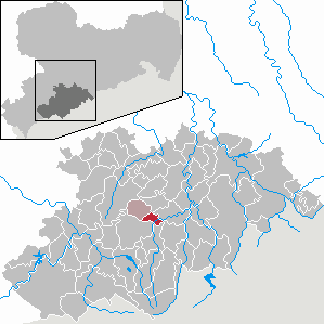
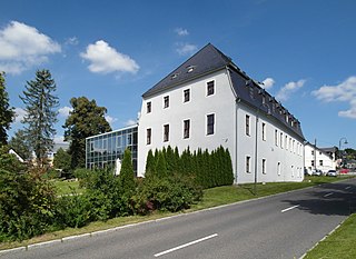
Tannenberg is a municipality in the district of Erzgebirgskreis in Saxony in Germany.

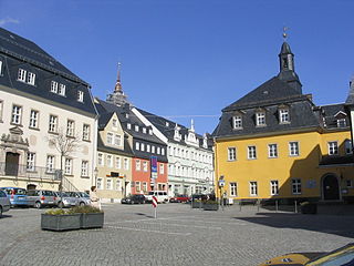
Oelsnitz is a town in the district Erzgebirgskreis, in Saxony, Germany. It is situated 14 km east of Zwickau, and 20 km southwest of Chemnitz. Between 1844 and 1971 hardcoal was mined in Oelsnitz and the surrounding towns. The major mine "Karl-Liebknecht" became a mining museum in 1986.
Lugau is a town in the district Erzgebirgskreis, in the Free State of Saxony, Germany. It is situated 17 km east of Zwickau, and 17 km southwest of Chemnitz. The town has partnerships with Sallaumines (France) and Penzberg (Bavaria).

Scheibenberg is a town in the district of Erzgebirgskreis in Saxony in Germany. It is situated in the Ore Mountains, 8 km southwest of Annaberg-Buchholz, and 9 km east of Schwarzenberg.

Schlettau is a town in the district of Erzgebirgskreis, in Saxony in Germany. It is situated in the Ore Mountains, 5 km southwest of Annaberg-Buchholz, and 12 km east of Schwarzenberg.

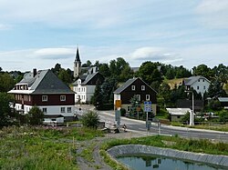
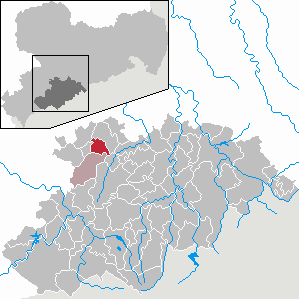
Königswalde is a municipality in the district of Erzgebirgskreis, in Saxony, Germany.

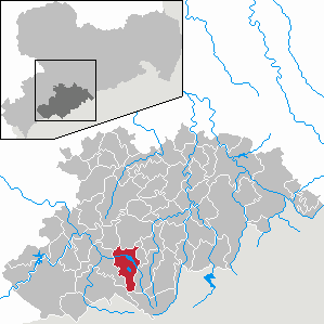
Crottendorf is a municipality located in the district of Erzgebirgskreis, in Saxony, Germany.

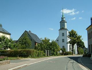
Gelenau is a municipality in the district of Erzgebirgskreis, in Saxony, Germany.

Amtsberg is a municipality in the district Erzgebirgskreis, in Saxony, Germany.
Großrückerswalde is a municipality in the district Erzgebirgskreis, in Saxony, Germany.

Heidersdorf is a municipality in the district Erzgebirgskreis, in Saxony, Germany.

Neukirchen is a municipality in the district Erzgebirgskreis, in Saxony, Germany.
Niederdorf is a municipality in the district Erzgebirgskreis, in Saxony, Germany.
Raschau-Markersbach is a municipality in the district of Erzgebirgskreis in Saxony, Germany. It was formed on 1 January 2008, by the merger of the former municipalities Markersbach and Raschau.
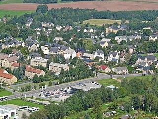
Krumhermersdorf is a village in the large county borough of Zschopau in the district Erzgebirgskreis in eastern Germany. It was first mentioned in the records in 1369.
Frohnau is a village in the Saxon town of Annaberg-Buchholz in the district of Erzgebirgskreis in southeast Germany. The discovery of silver on the Schreckenberg led in 1496 to the foundation of the neighbouring mining town of Annaberg. The village of Frohnau is best known for its museum of technology, the Frohnauer Hammer, and the visitor mine of Markus Röhling Stolln. The mining area around Frohnau has been selected as a candidate for a UNESCO World Heritage Site: the Ore Mountain Mining Region.

Satzung is a village in the Saxon municipality of Marienberg, which is in the district of Erzgebirgskreis in the German Ore Mountains.
Niederlauterstein is a village in Saxony which has been incorporated into the town of Marienberg in the district Erzgebirgskreis since 1996.
Hundshübel is a village in Erzgebirgskreis district of Saxony, forming a subdivision of the municipality of Stützengrün in the Ore Mountains. It is located north of Eibenstock Dam on federal highway B 169.