Padre Island National Seashore (PINS) is a national seashore administered by the National Park Service, located on Padre Island off the coast of South Texas, USA. In contrast to South Padre Island, known for its beaches and vacationing college students, PINS is located on the north end of Padre Island and consists of a long beach where nature is preserved.
The Mud Islands reserve is located within Port Phillip, about 90 km (56 mi) south-west of Melbourne, Australia, lying 10 km (6.2 mi) inside Port Phillip Heads, 7 km (4.3 mi) north of Portsea and 9 km (5.6 mi) east of Queenscliff. The land area of about 50 hectares is made up of three low-lying islands surrounding a shallow tidal 35-hectare (86-acre) lagoon connected to the sea by three narrow channels. The shapes and configuration of the islands change over the years due to movement of sand by tidal currents.

Gaillard Island is an artificially created island located in Mobile Bay near Mobile, Alabama. It was built by the United States Army Corps of Engineers, using sand and mud dredged from the Mobile Bay ship channel and elsewhere. The island is an important site for colonial nesting seabirds and shore birds in coastal Alabama and has been the only nesting site for brown pelicans in Alabama - first discovered in 1983.
The Skerries, coming from the Old Norse word sker, are a group of sparsely vegetated rocky islets (skerries), with a total area of about 17 hectares lying 3 kilometres (1.9 mi) offshore from Carmel Head at the northwest corner of Anglesey, Wales. The islands are important as a breeding site for seabirds, and they attract divers, who come to visit the numerous shipwrecks. The Skerries Lighthouse sits atop the highest point in the islands.

Padre Island is the largest of the Texas barrier islands and the world's longest barrier island. The island is located along Texas's southern coast of the Gulf of Mexico and is noted for its white sandy beaches. Meaning father in Spanish, it was named after Father José Nicolás Ballí (c.1770-1829), who owned the island and served as a missionary priest and collector of finances for all the churches in the Rio Grande Valley. He also founded the first mission in present-day Cameron County.

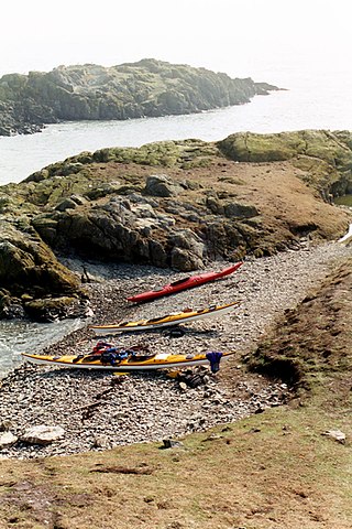
Annet is the second-largest of the fifty or so uninhabited Isles of Scilly, one kilometre west of St Agnes with a length of one kilometre and approximately 22 hectares in area. The low-lying island is almost divided in two by a narrow neck of land at West Porth which can, at times, be covered by waves. At the northern end of the island are the two granite carns of Annet Head and Carn Irish and three smaller carns known as the Haycocks. The rocky outcrops on the southern side of the island, such as South Carn, are smaller. Annet is a bird sanctuary and the main seabird breeding site in Scilly.

The Atlantic Flyway is a major north-south flyway for migratory birds in North America. The route generally starts in Greenland, then follows the Atlantic coast of Canada, then south down the Atlantic Coast of the United States to the tropical areas of South America and the Caribbean. Every year, migratory birds travel up and down this route following food sources, heading to breeding grounds, or traveling to overwintering sites.

The Antarctic tern is a seabird in the family Laridae. It ranges throughout the southern oceans and is found on small islands around Antarctica as well as on the shores of the mainland. Its diet consists primarily of small fish and crustaceans. It is very similar in appearance to the closely related Arctic tern, but it is stockier, and it is in its breeding plumage in the southern summer, when the Arctic tern has shed old feathers to get its non-breeding plumage. The Antarctic tern does not migrate like the Arctic tern does, but it can still be found on a very large range. This tern species is actually more closely related to the South American tern.
The Oregon Coast National Wildlife Refuge Complex consists of six National Wildlife Refuges along the Oregon Coast. It provides wilderness protection to thousands of small islands, rocks, reefs, headlands, marshes, and bays totaling 371 acres spanning 320 miles (515 km) of Oregon's coastline. The areas are all managed by the United States Fish and Wildlife Service.
The Twin Islands are similarly shaped Arctic islands in the Qikiqtaaluk Region of Nunavut, Canada. They are located in central James Bay, 56 km (35 mi) north east of Akimiski Island, and 58 km (36 mi) west of Quebec. The group includes North Twin and South Twin islands.
Minsener Oog, also Minser Oog or Minsener Oldeoog, is an uninhabited East Frisian island that belongs to the parish of Wangerooge in the north German district of Friesland in the state of Lower Saxony. It has been artificially enlarged through the construction of groynes.

Housing more than 200 resident and wintering bird species, Chennai has long been a haven for bird watchers. It is one of the few urban areas in India with diverse range of birds including greater flamingo, black baza, osprey, Indian eagle-owl, Coppersmith barbet, Spot billed pelican and pied avocet can be seen. The following are some known birding hotspots in and around Chennai.
Menunketesuck Island, also known as Menunketesuck Point, is an island in Long Island Sound located in the town of Westbrook in Middlesex County, Connecticut, US.

Solitary Islands Marine Park (SIMP) is a marine park in New South Wales State waters, Australia. It adjoins the Solitary Islands Marine Reserve and was declared under the Marine Parks Act 1997 (NSW) in January 1998. Prior to this it was declared a marine reserve in 1991. The Park was one of the first declared in NSW and stretches along the northern NSW coast, from Muttonbird Island, Coffs Harbour, to Plover Island near Sandon River, 75 kilometres to the north. It includes coastal estuaries and lakes and extends from the mean high water mark, to three nautical miles out to sea, covering an area of around 72,000 hectares. There are five main islands in the Park, North Solitary Island, North West Solitary Island, South West Solitary Island, South Solitary Island and Split Solitary Island, as well as other significant outcrops such as Muttonbird Island and submerged reefs.
Qatar is a peninsula on the northeastern coast of the Arabian Peninsula, bordering Saudi Arabia to the south and surrounded elsewhere by the Persian Gulf. A strait separates Qatar from the island kingdom of Bahrain.

Pulo Island, commonly known as Isla Pulo, is a long, narrow island surrounded by mudflats in the Manila Bay coast of Navotas, about 13 kilometers (8.1 mi) north of Manila in the Philippines. It is a sitio in Barangay Tanza, connected to the mainland of Navotas by a 500-meter-long (1,600 ft) bamboo bridge. The island is known for its mangroves for which it was declared a "marine tree park" and as one of four ecotourism sites in Metro Manila established under the National Ecotourism Strategy in 1999. In 2014, it was home to a resettlement site of about 137 indigent families that mostly occupied the island's southern tip.

Nalbana Bird Sanctuary or Nalbana Island is the core area of the Ramsar designated wetlands of Chilika Lake. It was declared a bird sanctuary under the Wildlife Protection Act in 1972. In the heart of the park, one can see thousands of birds descending during the migratory season. The island disappears during monsoon season due to inundation only to emerge again in post-monsoon.
The Gros-Mécatina Migratory Bird Sanctuary is a protected area in Quebec, Canada. It consists of four islands and a reef in the Gulf of Saint Lawrence that are used as nesting sites by seabirds.