
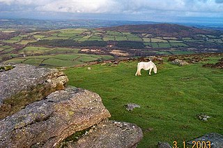
Dartmoor is an upland area in southern Devon, England. The moorland and surrounding land has been protected by National Park status since 1951. Dartmoor National Park covers 954 km2 (368 sq mi).

Dartmoor Preservation Association (DPA) is one of the oldest environmental or amenity bodies in the UK. It was founded in 1883. It concerns itself with Dartmoor, a National Park in Devon, south-west England. It began with two main areas of concern. Firstly, commoners' rights were being eroded through army use, including the firing of live artillery shells, and piecemeal enclosure of land around the margins. Secondly, there was increasing public interest in Dartmoor's scenery, archaeology, history and wildlife
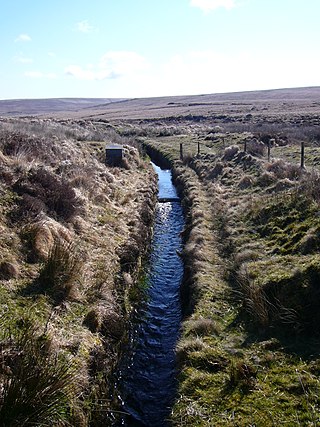
A leat is the name, common in the south and west of England and in Wales, for an artificial watercourse or aqueduct dug into the ground, especially one supplying water to a watermill or its mill pond. Other common uses for leats include delivery of water for hydraulic mining and mineral concentration, for irrigation, to serve a dye works or other industrial plant, and provision of drinking water to a farm or household or as a catchment cut-off to improve the yield of a reservoir.

Crazywell Pool or Crazy Well Pool is a large pond situated about 3 km (1.9 mi) south of Princetown just off the path between Burrator and Whiteworks on the western side of Dartmoor, Devon, England at grid reference SX582705. It is about 100 metres (110 yd) long and has a surface area of about 3,500 square metres.
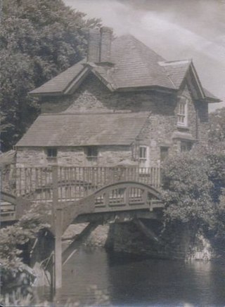
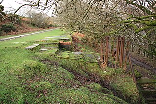
Drake's Leat, also known as Plymouth Leat, was a watercourse constructed in the late 16th century to tap the River Meavy on Dartmoor, England, from which it ran 17.5 miles (28.2 km) in order to supply Plymouth with water. It began at a point now under water at Burrator Reservoir, from which its path now emerges some 10m lower than the typical reservoir water level. It was one of the first municipal water supplies in the country.

Burrator Reservoir is a reservoir on the south side of Dartmoor in the English county of Devon. It is one of a number of reservoirs and dams that were built over the course of the 19th and 20th centuries in the area now covered by Dartmoor National Park to supply drinking water to the city of Plymouth and other rapidly growing towns in the surrounding lowlands.
The River Meavy is a river in the southwest part of Dartmoor in Devon in south-west England. It runs entirely in the national park and connects Burrator Reservoir to the River Plym.

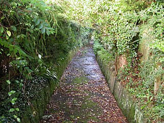
The Cann Quarry canal was a canal in Devon, England which ran for just under 2 miles (3.2 km) from Cann Quarry to the River Plym at Marsh Mills. It opened in 1829, and a short tramway connected it to the Plymouth and Dartmoor Railway at Crabtree Junction. It had been replaced by a tramway within ten years, but continued to be used as a mill leat to supply Marsh Mills corn mill, and most of it is still visible.

Wistman's Wood is one of three remote high-altitude oakwoods on Dartmoor, Devon, England.
Burrator is a grouped parish council in the English county of Devon. It is entirely within the boundaries of the Dartmoor National Park and was formed in 1973 as a result of the Local Government Act 1972 from the older councils of Meavy, Sheepstor and Walkhampton.
The Plymouth and Dartmoor Railway (P&DR) was a 4 ft 6 in gauge railway built to improve the economy of moorland areas around Princetown in Devon, England. Independent carriers operated horse-drawn wagons and paid the company a toll. It opened in 1823, and a number of short branches were built in the next few years.

Walkhampton is a village and civil parish on the western side of Dartmoor in the county of Devon, England. The village lies on the Black Brook, a tributary of the River Walkham, about 7 kilometres (4.3 mi) south-east of Tavistock, near the villages of Horrabridge, Yelverton and Dousland. Burrator Reservoir, constructed in 1898, is to the south-east.

The Princetown Railway was a 10¼ mile single track branch railway line in Devon, England, that ran from Yelverton on the Plymouth to Tavistock line, to Princetown via four intermediate stations, Dousland, Burrator and Sheepstor Halt, Ingra Tor Halt and King Tor Halt. The line closed in 1956 and today forms part of a popular cycling and walking route.

Ingra Tor Halt railway station was located on the 10.5 mile long single track Princetown Railway in Devon, England, running from Yelverton to Princetown with four intermediate stations. It was opened with only a basic wood platform and shelter in connection with the short-lived re-opening of the adjacent quarry. Its later traffic was entirely walkers and it was retained in an attempt to counter competition from local bus services and encourage tourist traffic.
Dousland railway station, originally opened at Dousland Barn in 1883 was located on the 10.5 mile long single track branch railway line in Devon, England, running from Yelverton to Princetown with eventually four intermediate stops, three being halts and one at Dousland as a fully fledged station.
Princetown railway station, opened in 1883 was the terminus of the 10.5 mile long single track branch line in Devon, England, running from Yelverton with eventually four intermediate stops, three being halts and one at Dousland as a fully fledged station.
King Tor Halt railway station was located on the 10.5 mile long single track branch railway line in Devon, England, running from Yelverton to Princetown with four intermediate stations. It was opened with only a basic wood platform and shelter in connection with the adjacent granite quarry and the associated worker's houses. Its later traffic was entirely walkers and like Ingra Tor Halt it was retained in an attempt to counter competition from local bus services and encourage tourist traffic.
Burrator and Sheepstor Halt railway station was located on the 10.5 mile long single track branch railway line in Devon, England, running from Yelverton to Princetown with eventually four intermediate stations. The station was opened as Burrator Platform and became Burrator Halt when it was opened to the public, the name being changed again in 1929 to Burrator and Sheepstor Halt.
Holne Ridge, on Dartmoor, includes some of southern Dartmoor's highest land. The ridge to the south west overlooks mires and bogs like Aune Head Mires. To the north east it overlooks the Dart Gorge with its many tors; Sharp Tor, for example. It also includes many notable features including:


