
The Principality of Ruhuna, also referred to as the Kingdom of Ruhuna, is a region of present-day Southern and Eastern Sri Lanka. It was the center of a flourishing civilisation and the cultural and economic centres of ancient Sri Lanka. Magama, Tissamaharama and Mahanagakula were established here.

Gampaha is an urban city in Gampaha District, Western Province, Sri Lanka. It is situated to the north-east of the capital Colombo. It is the sixth largest urban area in Western Province, after Colombo, Negombo, Kalutara, Panadura and Avissawella. Gampaha is also the second largest municipal centre in Gampaha district, after Negombo. Gampaha has a land area of 25.8 ha and is home to the offices of 75 government institutions.
Sri Lanka has its own indigenous scheme of traditional medicine which is called hela wedakama. This system has been practised for thousands of years. On the other hand, the Sri Lankan hela wedakama tradition is a mixture of Sinhala traditional medicine, mainland āyurveda and Siddha systems of India, Unani medicine of Greece through the Arabs, and most importantly, the Desheeya Chikitsa, which is the indigenous medicine of Sri Lanka. College teaching of these systems began in 1929 at what is now the Institute of Indigenous Medicine of the University of Colombo. The Siddha Medicine Unit moved to the University of Jaffna in 1984.

Konda in medieval times signified a group of Karava nobles in Sri Lanka. Old timers referred to them as Konda Karáva another clan of the Karava similar to the Suriya clans Kurukulasuriya, Warnakulasuriya, Mihindukulasuriya, Bharathakulasuriya, Manukulasuriya, Arasakulasuriya and Kón Karávas. Konda came to mean hair in Sri Lanka only after the 15th century Kotte period. Prior to that hair was referred to in the Sinhala language as kes, varalasa, dhammilla or muhulasa.

Gampola is a town located in Kandy District, in Sri Lanka's Central Province. The town is governed by an Urban Council. Gampola was made the capital of the island by King Buwanekabahu IV, who ruled for four years in the mid-fourteenth century. The last king of Gampola was King Buwanekabahu V, who ruled the island for 29 years. A separate city was built in Kotte during this time by a noble known as Alagakkonara. The longest sleeping Buddha statue in South Asia is located in the Saliyalapura Temple, Gampola.
Mabodala is a village in Gampaha District of Sri Lanka. It is situated approximately 12 km (7.5 mi) from the Gampaha, 15 km (9.3 mi) from the Negombo and also in close proximity to suburban areas of Divulapitiya, Minuwangoda and Veyangoda. Mabodala is approximately 20 km2 (7.7 sq mi) in extent and is divided into four village officer divisions whose combined population was 4,832 at the 2012 census.
Bhuvanekabahu VI of Kotte, also known as Sapumal Kumaraya and Chempaka Perumal, was an adopted son of Parakramabahu VI. His principal achievement was the conquest of Jaffna Kingdom, a historical kingdom of what today is northern Sri Lanka, in 1447 or 1450. Bhuvanaikabahu was apparently summoned south after the demise of his adopted father. He then ruled for 17 years. According to Rajavaliya, he killed the grandson of Parakrama Bahu VI, namely Vira Parakrama Bahu or Jaya Bahu.

The current legislative capital of Sri Lanka is Sri Jayawardhapura Kotte and the executive and judicial capital is Colombo. Over the course of the island's history, the national capital has been in several locations other thanSri Jayawardenepura Kotte.
Udugampola is a small town in the Gampaha District of Sri Lanka and was a sub kingdom during reign of the King Sakala Kala Wallabha of Kotte Era. The main point in the area is around the intersection of Gampaha-Minuwangoda and Kotugoda-Naiwala roads.
Minuwangoda is a town in Gampaha district, governed by an Urban Council, situated near Negombo, Western Province of Sri Lanka. It is located 15 kilometres (9.3 mi) east of Negombo and 35 kilometres (22 mi) north east of Colombo. It is an important junction town, connecting the Negombo to Kandy road with the A1/A6 main road from Colombo to Kurunegala. The main bus route 5 from Colombo to Kurunegala passes through the town. The town is also situated near the Bandaranaike International Airport, on the way to Negombo.

The Kingdom of Kotte, named after its capital, Kotte, was a Sinhalese kingdom that flourished in Sri Lanka during the 15th century.
Minuwangoda Divisional Secretariat is a Divisional Secretariat of Gampaha District, of Western Province, Sri Lanka.
Vijayabahu VI was the son of Vira Parakrama Bahu VIII, who was an adopted child of Parakrama Bahu VI who founded the Kingdom of Kotte. He was born in c. 1445 and grew up with his brothers Sri Rajasinghe, Dharma Parakramabahu IX, and Raigam Bandara. He also had a sister who was married to Manamperi Arachchi.

Sinhalese–Portuguese conflicts refers to the series of armed engagements that took place from 1518 AD to 1658 AD in Sri Lanka between the native Sinhalese and Tamil kingdoms and the Portuguese Empire. It spanned from the Transitional to the Kandyan periods of Sri Lankan history. A combination of political and military moves gained the Portuguese control over most of the island, but their invasion of the final independent kingdom was a disaster, leading to a stalemate in the wider war and a truce from 1621. In 1638 the war restarted when the Dutch East India Company intervened in the conflict, initially as an ally of the Sinhalese against the Portuguese, but later as an enemy of both sides. The war concluded in 1658, with the Dutch in control of about half the island, the Kingdom of Kandy the other half, and the Portuguese expelled.

Asgiriya Raja Maha Vihara is an ancient Cave temple situated in Gampaha District, Sri Lanka. The temple is located on top of a hillock on the Gampaha - Minuwangoda road and approximately 2 km (1.2 mi) away from Gampaha town. The temple has been formally recognised by the Government as an archaeological site in Sri Lanka. The designation was declared on 22 November 2002 under the government Gazette number 1264.
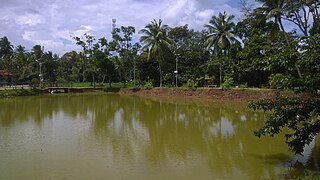
Pathaha Pokuna is an ancient bathing tank or pool situated in Udugampola, Sri Lanka. It is located approximately 0.45 km (0.28 mi) from Udugampola Roundabout and close to the historic temple Uththararama Purana Vihara. The pond has been formally recognised by the Government as an archaeological protected monument in Sri Lanka. The designation was declared on 8 July 2005 under the government Gazette number 1401.

Uththararama Purana Vihara is a historic Buddhist temple situated at Udugampola in the Western province, Sri Lanka. The temple is located on Udugampola – Weediyawatta junction road approximately 0.5 km (0.31 mi) away from the Udugampola Roundabout. The temple has been formally recognised by the Government as an archaeological site in Sri Lanka. The designation was declared on 7 July 2005 under the government Gazette number 1401.
Sakalakala Wallabha, was the viceroy or provincial king of the sub kingdom of Udugampola in the Kotte Kingdom during the sixteenth century. He was the son of King Veera Parakramabahu VIII of Kotte and his chief queen's sister. His brother, Thaniya-Vallabha, was the viceroy of Katupiti Madampe. He had four step brothers, Dharma Parakramabahu, Vijayaratne, Rajasingha and Raigam Bandara. The Rajaveliya recounts how together with his brother, he defeated a Muslim invader, who terrorised the area named 'Kadirayana' and restored peace.
Asgiriwalpola is a small village in Minuwangoda Divisional Secretariat of Gampaha District, Western Province, Sri Lanka.

The Minuwangoda Polling Division is a Polling Division in the Gampaha Electoral District, in the Western Province, Sri Lanka.

