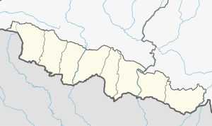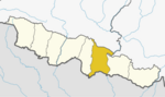
Dhanusha District,, a part of Madhesh Province, is one of the seventy-seven districts of Nepal. It is situated in the Outer Terai. The district, with Janakpurdham as its district headquarter, covers an area of 1,180.7 km2 (455.9 sq mi) and has a population (2021) of 838,084.

A village development committee in Nepal was the lower administrative part of its Ministry of Federal Affairs and Local Development. Each district had several VDCs, similar to municipalities but with greater public-government interaction and administration. There were 3,157 village development committees in Nepal. Each village development committee was further divided into several wards depending on the population of the district, the average being nine wards.
Balha Saghara is a village development committee in Dhanusa District in the Janakpur Zone of south-eastern Nepal. At the time of the 2011 Nepal census it had a population of 4,030 and had 698 houses.
Bhutahi Paterwa is a village development committee in Dhanusa District in the Janakpur Zone of south-eastern Nepal.Currently, it is situated in Mithila Bihari Municipality ward no. 01 of Madhesh Pradesh. At the time of the 2021 Nepal census it had a population of 4,736 persons living in more than 1000 individual households in 9.3 km2.Most people living in this village follow Hinduism.The main inhabitants are Mandal, Daha, Dhanuk, Yadav, Shah, Das, Thakur, Sharma, Sada (Mushahar) and many more.It has various religious and cultural places such as Maharani Mai Temple (Sthan), Ram Janaki Temple (Kutti), Bhuinya Baba Mandir, Mrigakund etc.There is a Ganesh Temple in the southern part of the village.There is a big and attractive temple of Maharani Mai on the bank of Chhath Pokhari.One of the exciting place in the village is Purni Pokhari.It includes Naga Baba Mandir, Hanuman Mandir, Mahadev(Shiv) Mandir, Dihabar Mandir etc.
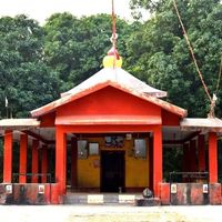
Dhanushadham is a municipality in Dhanusha District in Province No. 2 of south-eastern Nepal. The municipality was established on 18 May 2014 by merging the existing Govindapur, Umprempur, Yagyabhumi, Dhanushadham village development committees (VDCs). It is a religious place of Hindu worship in Nepal. It is believed that a part of Shiva Dhanusha that was broken by Rama during Sita's swayamvara, is housed. Now there is temple around the remaining of bow and visited by Hindu devotees from all over the world. That's why it is named Dhanushadham.
Ichhapur is a town in Chhireswornath Municipality in Dhanusa District in the Janakpur Zone of south-eastern Nepal. The formerly Village Development Committee was converted into municipality merging along with existing VDCs Ramdaiya, Sakhuwa Mahendranagar, Hariharpur and Digambarpurin 18 May 2014. At the time of the 1991 Nepal census it had a population of 7,115 persons living in 1352 individual households.

Duhabi is a Village Development Committee in Dhanusa District in the Janakpur Zone of south-eastern Nepal. At the time of the 1991 Nepal census it had a population of 5,762 persons residing in 990 individual households.
Giddha is a village development committee in Dhanusa District in the Janakpur Zone of south-eastern Nepal Municipality called Videha. At the time of the 1991 Nepal census it had a population of 4,147 persons living in 714 individual households.
Yagyabhumi is a town in Dhanusadham Municipality in Dhanusa District in the Janakpur Zone of south-eastern Nepal. The former village was merged on 18 May 2014 along with Govindapur, Umprempur, Yagyabhumi, and Dhanusadham village development committees (VDCs) to form the new municipality. At the time of the 1991 Nepal census it had a population of 10808 persons living in 2168 individual households.
Govindapur is a town in Dhanusadham Municipality in Dhanusa District in the Janakpur Zone of south-eastern Nepal. The former village was merged on 18 May 2014 along with Govindapur, Umprempur, Yagyabhumi, and Dhanusadham village development committees (VDCs) to form the new municipality. At the time of the 1991 Nepal census it had a population of 6,504 persons living in 1283 individual households.
Inarwa is a Village in Janaknandini rural council of Dhanusha District in Province No. 2 of south-eastern Nepal. Inarwa belongs to ward no. 1 of the Janaknandini rural council. At the time of the 1991 Nepal census it had a population of 3,094.
Kachuri is a village development committee in Dhanusa District in the Janakpur Zone of south-eastern NepalHere is big temple of Mithila bihari. At the time of the 1991 Nepal census it had a population of 4,560 persons living in 818 individual households.
Lagmamdha Guthi, often shortened to 'Lagma', is a Village Development Committee (VDC) in Dhanusa District in the Janakpur Zone of south-eastern Nepal. At the time of the 1991 Nepal census, it had a population of 3,726 people living in 663 individual households.
Ramdaiya Bhawadi is a village in the Chhireswarnath Municipality of the Dhanusa District in the Janakpur Zone and central development Region of south-eastern Nepal. The former Village Development Committee was converted into a municipality, merging along with existing VDCs Ramdaiya, Sakhuwa Mahendranagar, Hariharpur and Digambarpur on 18 May 2014. At the time of the 1991 Nepal census it had a population of 4,790 persons living in 977 individual households.
Umprempur is a town in Dhanusadham Municipality in Dhanusa District in the Janakpur Zone of south-eastern Nepal. The former village was merged on 18 May 2014 along with Govindapur, Umprempur, Yagyabhumi, Dhanusadham village development committees (VDCs) to form the new municipality. At the time of the 1991 Nepal census it had a population of 9,345 persons living in 1774 individual households.

Bardibas is a municipal area (municipality) and a town located in Mahottari District of Madhesh Province of Nepal. It is located at latitude: 26°54'6.84" to 27°08'46.90" and longitude: 85°47'42.67" to 85°56'42.97". The municipality is surrounded by Dhalkebar of Mithila municipality, Dhanusha District in the East and Ishworpur municipality of Sarlahi District in the West, Kamalamai municipality of Sindhuli District, Bagmati Province falls in the North and Bhangaha, Aurahi and Gaushala municipalities are located in the South.
Shivanagar is a town in Krishnanagar Municipality in Kapilvastu District in the Lumbini Zone of southern Nepal. The former VDC was merged to form the municipality established on 18 May 2014 Krishnanagar, Sirsihawa, Shivanagar VDCs. At the time of the 2011 Nepal census it had a population of 4,774 people living in 735 individual households.
Chhireshwarnath is a municipality in the Dhanusa District of Madhesh Province of Nepal. The municipality was established on 18 May 2014, as a result of the merger between Village Development Committees Ramdaiya, Kumhraul, Sakhuwa Mahendranagar, Hariharpur, Gopalpur, Baninya, and Digambarpur.
Mithila is a municipality in Danusha District in Madhesh Province of south-eastern Nepal. After the government announcement the municipality was established on 2 December 2014 by merging the existing Begadawar, Nakatajhijh and Dhalkebar village development committees (VDCs). At the time of the 2011 Nepal census after merging the three VDCs population it had a total population of 31,575 persons. After the government decision the number of municipalities has reached 191 in Nepal.
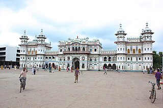
Mithila Bihari is a municipality in Danusha District in Madhesh Province of Nepal. It was formed in 2016 occupying current 10 Sections (Wards) from previous 10 VDCs. It occupies an area of 37.60 km2 with a total population of 37,276. Dhanusha district, located in the central part of the Janakpur region, which is one of the development regions of Nepal, is bordered by southern India. There are 18 local levels located in the central part of the Dhanusha district, which were part of the Madhyamanchal Development Region. Among them, six Village Development Committees (VDCs) - Bhutahi Paterwa, Mithileshwar Nikas, Andupatti, Tarapatti Sirsiya, and Mithileshwar Mauwahi - have been merged to form the Mithila Bihari Municipality under the Madhesh Province of Nepal as of Falgun 27, 2073 B.S. Despite being situated in the easily accessible terrain of the Terai region in terms of geographical features, Mithila state has a densely populated settlement from the perspective of human development indicators and progress. In the historic pilgrimage of Mithila state, which includes two main Dolis (Processions) or travel camps, such as the Mela, established with the name of Lord Bihari from Mithila Bihari, the city of Janakpur, which is recognized as the holy place of the Hindu religion, meaning the father-in-law's place of Lord Ram, has given additional identity to the Mithila Bihari. From a religious point of view, Mithila Bihari has been named after Lord Ram, who is historically recognized, which has resulted in the naming of this local place as Mithila Bihari. Published in the Rajpatra on Jestha 11, 2074 B.S., upgrading the Mithila Bihari Rural Municipality to the Municipality level was not possible, but an interim order of the Supreme Court issued on Bhadra 27, 2074 B. S. resulted in the transformation of Mithila Bihari Rural Municipality into a Municipality.