The administrative divisions of Nepal are subnational administrative units of Nepal. The first level of country subdivision of Nepal are the provinces. Each province is further subdivided into districts, each district into municipalities and rural municipalities, and each of those municipalities into wards. Before 2015, instead of provinces, Nepal was divided into developmental regions and administrative zones.

Dhanauji is a rural municipality in Dhanusha District in Province No. 2 of south-eastern Nepal established in 2073. As of 2011 Nepal census, it has a population of 22,395. It was formed by joining Jhojhi Kataiya, Lakhauri, Bahuarba and former Dhanuji Village development committees. The total area of Nagarain municipality is 22 km2.
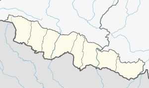
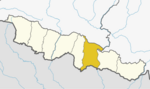
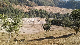
Nagarain is a municipality in Dhanusha District in Province No. 2 of south-eastern Nepal. As of 2011 Nepal census, it has a population of 36,336 living in 6,478 individual households. It was formed by joining Fulgama, Devdiha, old Nagrain, Lagmagadha Guthi and Ghodghans village development committees. The total area of Nagarain municipality is 38.71 km2.

Gauradaha is a municipality in Jhapa District in the Province No. 1 of eastern Nepal. After the government announcement the municipality was established on 19 September 2015 by merging the existing Maharanijhoda, Baigundhura, Juropani, Kohabara and Gauradaha village development committees (VDCs). The center of the municipality is established in the mid of Gauradaha, Dhobiniya chowk. At the time of the 2011 Nepal census after merging the four VDCs population it had a total population of 47,393 persons. After the government decision the number of municipalities has reached 217 in Nepal.

Kanepokhari Rural Municipality is a Gaunpalika located in the center of Morang District, Province No. 1, Nepal.

Laligurans is a municipality located in Terhathum District in the Province No. 1 of eastern Nepal. After the government announcement, the municipality was established on 19 September 2015 by merging the existing Basantapur, Phulek, Dangpa, Sungnam and Solma village development committees (VDCs). The center of the municipality is established in Basantpur. At the time of the 2011 Nepal census after merging the five VDCs population it had a total population of 16,934 persons. After the government decision the number of municipalities has reached 217 in Nepal.

Bhanu is a municipality of Tanahun District in Gandaki Zone of western Nepal. The municipality was established on 19 September 2015 by merging the existing Bhanu village development committee or VDC, Barbhanjyang VDCs, Rupakot (VDC), Tanahunsur Village Development Committee, Purkot VDC, Mirlung VDC, Satiswara VDC, Risti VDC, Basantapur VDC and Chok Chisapani VDC. The center of the municipality is established in former VDC Office of Bhanu. After merging the population of all of the VDCs, it had a total population of 46,179 according to 2011 Nepal census. After the government decision the number of municipalities has reached 217 in Nepal. Nepali poet Bhanubhakta Acharya was born in Bhanu Municipality. It was named after him.

Barahathwa is a municipality of the Sarlahi District in the Janakpur Zone of central Nepal. The municipality was established on 19 September 2015 by merging the existing Barahathwa, Murtiya, Hajariya and Laukat village development committees (VDCs). The center of the municipality is established in the former VDC Office of Barahathwa Bazaar. After merging the four VDCs' populations, it had a total population of 50,424 according to 2011 Nepal census. After the government decision, the number of Nepali municipalities reached 217.

Madhyabindu is a municipality of Nawalpur District in Lumbini Zone of Southern Nepal. The municipality was established on 19 September 2015 by merging the existing Tamasariya, Naya Belahani and Kolhuwa Village development committees (Nepal)|Village development committee]]s (VDCs). The center of the municipality is established in the former Tamasariya VDC of Chormara Bazaar. After merging the three VDCs population it had a total population of 28,224 according to 2011 Nepal census. After the government decision the number of Sub Metropolitan cities and municipalities has reached 12 and 217 respectively in Nepal.

Bagmati Province is one of the seven provinces of Nepal established by the constitution of Nepal. The province is Nepal's second-most populous province and fifth largest province by area. Bagmati is bordered by Tibet Autonomous Region of China to the north, Gandaki Province to the west, Province No. 1 to the east, Indian state of Bihar and Madhesh Province to the south. With Hetauda as its provincial headquarter, the province is also the home to the country's capital Kathmandu, is mostly hilly and mountainous, and hosts mountain peaks including Gaurishankar, Langtang, Jugal, and Ganesh.

A Gaunpalika is an administrative division in Nepal. The Ministry of Federal Affairs and Local Development dissolved the existing village development committees and announced the establishment of this new local body. It is a sub-unit of a district. There are currently 460 rural municipalities.
Budhiganga is a Gaupalika out of eight rural municipality located at Morang district of Province No. 1 of Nepal. There are a total of 17 local body in Morang District in which 1 is metro city, 7 are urban municipality and 7 are rural municipality.

Hanumannagar Kankalinimai is a municipality of Saptari District in Sagarmatha Zone of eastern Nepal. The municipality was established on 19 September 2015 by merging the existing Hanuman Nagar, Joginiya-1, Joginiya-2, Gobargada and Inarwa village development committees (VDCs). Later, Bhardaha, Portaha, Madhawapur, Rampur Malhniya, Malhniya village development committees (VDCs) were added to the existing Hanumannagar Yoginimai Municipality.
Nechasalyan is a rural municipality (gaunpalika) out of seven rural municipality located in Solukhumbu District of Province No. 1 of Nepal. There are total 8 municipalities in Solukhumbu in which 1 is urban and 7 are rural.

The Janamat Party is a Nepalese political party. Formerly known as Alliance for Independent Madhesh, it was formed by former secessionist leader C. K. Raut. It was formed after signing an 11-point agreement with the government of Nepal and resulted in ending his separatist movement with KP Oli. The party stands as the seventh largest party in local levels of Madhesh province since the 2022 local election.

The People's Socialist Party, Nepal, also known as Janata Samajbadi Party is the fifth largest political party in Nepal. In today's date, the People's Socialist Party, Nepal is junior ally in Nepali Congress led Deuba government. Since the 2022 local election, the party stands as the third largest party of Madhesh Province after Nepali Congress and CPN (UML) respectively.

Municipal election for Bharatpur took place on 13 May 2022, with all 147 positions up for election across 29 wards. The electorate elected a mayor, a deputy mayor, 29 ward chairs and 116 ward members. An indirect election will also be held to elect five female members and an additional three female members from the Dalit and minority community to the municipal executive.
Municipal election for Kalaiya took place on 13 May 2022, with all 137 positions up for election across 27 wards. The electorate elected a mayor, a deputy mayor, 27 ward chairs and 108 ward members. An indirect election will also be held to elect five female members and an additional three female members from the Dalit and minority community to the municipal executive.
Municipal election for Jitpursimara took place on 13 May 2022, with all 122 positions up for election across 24 wards. The electorate elected a mayor, a deputy mayor, 24 ward chairs and 96 ward members. An indirect election will also be held to elect five female members and an additional three female members from the Dalit and minority community to the municipal executive.