The city of Dhamdha is situated in the district of Durg in the state of Chhattisgarh, India.
Chhattisgarh is one of the 29 states of India, located in the centre-east of the country. It is the tenth-largest state in India, with an area of 135,191 km2 (52,198 sq mi). With a 2011 population of 25.5 million, Chhattisgarh is the 16th-most populated state in the country. A resource-rich state, it is a source of electricity and steel for the country, accounting for 15% of the total steel produced. Chhattisgarh is one of the fastest-developing states in India.
India, also known as the Republic of India, is a country in South Asia. It is the seventh largest country by area and with more than 1.3 billion people, it is the second most populous country as well as the most populous democracy in the world. Bounded by the Indian Ocean on the south, the Arabian Sea on the southwest, and the Bay of Bengal on the southeast, it shares land borders with Pakistan to the west; China, Nepal, and Bhutan to the northeast; and Bangladesh and Myanmar to the east. In the Indian Ocean, India is in the vicinity of Sri Lanka and the Maldives, while its Andaman and Nicobar Islands share a maritime border with Thailand and Indonesia.
The town with a small population has been declared as the municipal corporation of Durg district. Situated along the Durg-Bemetara road, the town is easily accessible by roads from the city of Durg. Dhamdha which was the ancient citadel of Gondwana dynasty, today is known as historical, religious and cultural venue. The city's ancient name was "Dharmdham" but over time it kept on changing from Dharmdham to Dharmda, then Dhamda and finally Dhamdha.
To cities, counties, towns, townships, charter townships, villages, and boroughs. The term can also be used to describe municipally owned corporations.
Durg district is a district situated in Chhattisgarh, India. The district headquarters is Durg. The district covers an area of 2,238 km². As of 2011 it is the second most populous district of Chhattisgarh, after Raipur.
Small Farmers: 314 Marginal: 446 Medium: 181 High: 82
Total: 1023
Agricultural workers: 652
Demographics
As of 2001[update] India census,[2] Dhamdha had a population of 8574. Males constitute 50% (4,298) of the population and females make up 50% (4,276).
A census is the procedure of systematically acquiring and recording information about the members of a given population. The term is used mostly in connection with national population and housing censuses; other common censuses include agriculture, business, and traffic censuses. The United Nations defines the essential features of population and housing censuses as "individual enumeration, universality within a defined territory, simultaneity and defined periodicity", and recommends that population censuses be taken at least every 10 years. United Nations recommendations also cover census topics to be collected, official definitions, classifications and other useful information to co-ordinate international practice.
Average population of Dhamdha has received education. The town has an average literacy rate of 62% (5,282), higher than the national average of 59.5%: male literacy is 72% (3103) and, female literacy is 51% (2179). In Dhamdha, 15% of the population is under 6 years of age.
The population of children between the age group of 0 to 6 years reveals that the number of girl child in the town is more than the number of boys in the town of Dhamdha. The total of 1,300 children of the specified age group is divided into 645 males and 655 females.
Other details
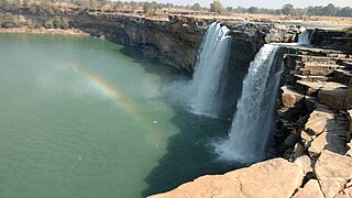
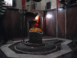
The most popular tourists attractions of the Dhamdha town is the old palatial building structure known as the Prachin Kila and the Mandir or the temple.
This page is based on this Wikipedia article Text is available under the CC BY-SA 4.0 license; additional terms may apply. Images, videos and audio are available under their respective licenses.
Related Research Articles
Bithoor or Bithur is a town in Kanpur District, 23.4 kilometres (14.5 mi) by road north of the centre of Kanpur city, in Uttar Pradesh, India. Bithoor is situated on the right bank of the Ganga, and is the centre of Hindu pilgrimage. According to Hindu mythology, Bithoor is the birthplace of Ram's sons Luv and Kush. Bithoor is also the centre for Revolt of 1857 as Nana Sahib, a popular freedom fighter who was based there. The city is enlisted as a municipality of Kanpur metropolitan area.
Gyanpur is a town and a nagar panchayat in Sant Ravidas Nagar district in the Indian state of Uttar Pradesh and the administrative headquarters of Sant Ravidas Nagar district. Current chairman is Hiralaal Maurya. Gyanpur is the only educational hub of Sant Ravidas Nagar District, A Govt PG College, two Govt Intermediate college and many other private institutions are situated here. Gyanpur is a district headquarter of bhadohi.
Gyanpur Road Railway station is situated in Gopiganj, Uttar Pradesh. Station code of Gyanpur Road is (GYN). Some trains that are passing through Gyanpur Road railway station are Manduadih-New Delhi Superfast Express,Lichchvi Express and more.
Ashta is a city and a municipality in Sehore district in the state of Madhya Pradesh, India.
Chas is a Municipal Corporation City in Bokaro district in the state of Jharkhand, India. Chas is the sub-urban area of Bokaro Steel City. Chas Nagar nigam area consists of 35 wards.Chas is notable for a large wholesale market.
Dongargarh is a city and municipality in Rajnandgaon District in the state of Chhattisgarh, India and the site of the Bambleshwari Temple.
A prominent pilgrim destination in Rajnandgaon District, the city lies about 35 kilometres (22 mi) west from Rajnandgaon, 67 kilometres (42 mi) west from Durg and 132 kilometres (82 mi) east from Bhandara which are situated on National Highway 6. Featuring majestic mountains and ponds, Dongargarh is derived from the words: Dongarh meaning 'mountains' and garh meaning 'fort'.
Hiranagar is a town and a notified area committee in Kathua district in the Indian state of Jammu and Kashmir. It is a tehsil headquarters. It is named after Raja Hira Singh, son of Raja Dhyan Singh and nephew of Raja Gulab Singh.
Kakrala is a city and municipal board in Badaun district in India state of Uttar Pradesh. It is located to the East of the district Headquarter. It is 12 km from Badaun. the term Kakrala originates from the apbhramsha Kakrabad. The most population of this town are consisting Muslims, as the Vibrant culture of India suggests, the town is also diverse in terms of religion, festivals etc. India has a unique culture of Unity in diversity, the same phenomenon has occurred in this town also. In the vista of towns of this state one distinguishes Kakrala as quite significant. In fact, Kakrala is the name of a city which has a well British era municipal board.It is situated approximately at 27.9 deg N 79.2 deg E. It has an average height of 160 meters or 524 feet.
The discovery of Indian town or city becomes complete with the knowledge of its current demographic scenario. In order to meet the objectives, numerous demographers have organized surveys and research works and thus brought out significant information about Kakrala city. Regarding this, the Census report is praiseworthy. Data like population, literacy rate etc. can be deduced from this report. According to this report, Kakrala city has got a total population measurement of 40,380. Females are less in number than their male counterparts. This becomes obvious from the literacy rates of both males and females. In other words, male populace constitutes 53 %, while the total population of females comprises 57 %. Information about the children who are residing in Kakrala too can be deduced. Thus kids who are below six years of age constitute 20 % of the total population of Kakrala.
Literacy rate adds to the information of this Kakrala city. The most of the population of the city belongs to the Muslim Rajputs.
Kakrala has done a important great war with british government from 1914 to 1919.
Khetia is a town and a nagar panchayat in the Barwani district in the Indian central western state of Madhya Pradesh.
Kumhari is a city located in the Indian state of Chhattisgarh. It is a part of the Durg district of the state. It is situated at the twenty-one degrees and sixteen minutes north latitude. Its longitudinal position is eighty-one degrees and thirty-one minutes east. It is situated at an average elevation of 284 meters above the sea level.
Murgud is a city and a municipal council in Kolhapur district in the Indian state of Maharashtra.This City has a rich culture in various sports such as wrestling and volleyball.
Theog is a town and a municipal committee as well as a tehsil in Shimla district in the Indian state of Himachal Pradesh. First settlements were in 1902.
Maraimalai Nagar is a town of Kanchipuram District, near Chennai, Tamil Nadu, India. It is a municipality town in Kanchipuram district. It lies in the southern part of the Chennai metropolitan area around 50 km from downtown Chennai Egmore and about 15 km from Vandalur. Maraimalar Nagar is a part of the Chengalpattu taulk in Kanchipuram district. It is a satellite town developed by the CMDA in 1980. Many heavy industries are located in Maraimalai Nagar. The Ford India and BMW car factories are located within a mile from Maraimalai Nagar and the Indian software giant Infosys also has an office within eight kilometers of Maraimalai Nagar. SRM University has its main campus in the neighbouring Potheri. As of 2011, Maraimalai Nagar had a population of 81,872.
Ramnagar is a City in Barabanki district in the state of Uttar Pradesh, India. It is a town, tehsil and a nagar panchayat in Barabanki District in the Indian state of Uttar Pradesh.
Patan is a town and a nagar panchayat in Durg district in the Indian state of Chhattisgarh.
Jamul is a town and a nagar panchayat in Durg district in the Indian state of Chhattisgarh.
Amta I is a city and community development block that forms an administrative division in Uluberia subdivision of Howrah district in the Indian state of West Bengal.
Memari II is a community development block that forms an administrative division in Bardhaman Sadar South subdivision of Purba Bardhaman district in the Indian state of West Bengal.
"Parpodi," also known as "Raja Parpodi," is a town and a Nagar Panchayat in the Bemetara district of Chhattisgarh, India.
The town is situated in the district of Bemetara in the state of Chhattisgarh, India. It has a small population and has been declared a "Nagar Panchayat" of the Bemetara district.