Dharamsagar

Last updated
Dharamsagar
village
CountryFlag of India.svg  India
State Odisha
District Nuapada
Talukas Dharamsagar
Population (2011)
  Total 669
Languages
Time zone IST (UTC+5:30)
Website odisha.gov.in

Dharamsagar is a village in Nuapada district in the state of Odisha in India. [1]

Nuapada district District in Odisha, India

Nuapada is a district of Odisha.

Odisha State in Eastern India

Odisha is one of the 29 states of India. Located in eastern India, it is surrounded by the states of West Bengal to the north-east, Jharkhand to the north, Chhattisgarh to the west and north-west, and Andhra Pradesh to the south. Odisha has 485 kilometres (301 mi) of coastline along the Bay of Bengal on its east, from Balasore to Ganjam. It is the 9th largest state by area, and the 11th largest by population. It is also the 3rd most populous state of India in terms of tribal population. Odia is the official and most widely spoken language, spoken by 36.6 million according to the 2016 Census.

Contents

Geography

Dharamsagar is located on the BhawanipatnaRaipur Highway (353 / SH-16) north of Khariar.

Bhawanipatna City in Odisha, India

Bhawanipatna is a city and district headquarter of the Kalahandi district in the Indian state of Odisha. Bhawanipatna is a city of numerous temples dedicated to different deities of Hindu pantheon. It is named after the presiding deity, Bhawani-Shankar. Bhawanipatna municipality is the administrative head of the city, which is divided into twenty wards with different sub-areas called para. Originally, these paras were inhabited by people of different communities, but over the last few decades, these Paras have become homogeneous. Bhawanipatna has more than forty-two paras. It is one of the biggest urban areas of western part of Odisha.

Raipur Metropolis in Chhattisgarh, India

Raipur is the capital city of the Indian state of Chhattisgarh. It is also the largest city of the state. It was formerly a part of Madhya Pradesh before the state of Chhattisgarh was formed on 1 November 2000. It has a widely diverse population from all over the country. On the industrial propects, it has seen an exponenetial growth over the years. With a strong presence of international brands and prominent global automobile companies, Raipur has emerged as a major business hub in the central India. It is ranked 7th in Ease of Living Index 2018 by Union Ministry of Housing and Urban Affairs (MoHUA)

Khariar is a City and a Notified Area Committee in Nuapada district of the Indian state of Odisha.

Population

According to the 2011 Census of India, there were 181 households in Dharamsagar, with a total population of 669. [2]

The 15th Indian Census was conducted in two phases, house listing and population enumeration. House listing phase began on 1 April 2010 and involved collection of information about all buildings. Information for National Population Register was also collected in the first phase, which will be used to issue a 12-digit unique identification number to all registered Indian residents by Unique Identification Authority of India (UIDAI). The second population enumeration phase was conducted between 9 and 28 February 2011. Census has been conducted in India since 1872 and 2011 marks the first time biometric information was collected. According to the provisional reports released on 31 March 2011, the Indian population increased to 1.21 billion with a decadal growth of 17.70%. Adult literacy rate increased to 74.04% with a decadal growth of 9.21%. The motto of the census was 'Our Census, Our future'.

Related Research Articles

Kalahandi district District in Odisha, India

Kalahandi is a district of Odisha in India. The region had a glorious past and great civilisation in ancient time. Archaeological evidence of stone age and Iron Age human settlement has been recovered from the region. Asurgarh offered an advanced, well civilised, cultured and urban human settlement about 2000 years ago in the region. In South Asia it is believed that the lands of Kalahandi district and Koraput district were the ancient places where people started cultivation of paddy. In ancient time it was known as Mahakantara and Karunda Mandal, which means treasure of precious stones like karandam (Corundum/Manik), Garnet, Beruz, Neelam, and Alexandra etc. Manikeswari is the clan deity of Kalahandi may also signify its historical name.

Khordha City in Odisha, India

Khordha is a city and a municipality area in Khordha district in the Indian state of Odisha. Bhubaneswar, capital of Odisha, belongs to Khordha district and is only 25 km from Khordha town. Odisha State Highway 1 and National Highway 16 runs via this town.

Binika city in Odisha, India

Binika is a town and a Notified Area Council in Subarnapur district in the state of Odisha, India.

Khandapada city in Odisha, India

Khandapada is a town and a notified area committee in Nayagarh district in the Indian state of Odisha. It's a beautiful town on the vally of nine mountains.

Khariar Road Town in Odisha, India

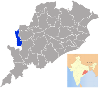
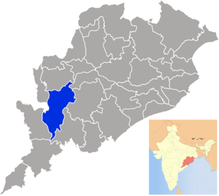
Khariar Road is a town and a notified area committee in Nuapada district in the Indian state of Odisha. Khariar Road is connected to Mahasamund - Raipur through National Highway 353 as well as the Indian Railway.

Nimapada Town in Odisha, India

Nimapada is a town and a notified area council (NAC) in Puri district on the way to Konark and 40 km from the state capital Bhubaneswar in the Indian state of Odisha.

Pipili city in Odisha, India

Pipili is a town and a NAC under jurisdiction of Puri district in the Indian state of Odisha. It is famous for designing beautiful Applique handicrafts. It is a town of artisans famous for their colourful fabrics.

Mahasamund district District of Chhattisgarh in India

Mahasamund District is an administrative district in Chhattisgarh state in eastern India. The city of Mahasamund is the district headquarters. Mahasamund District is bounded by Raipur District - Gariyaband District - Baloda Bazar District -Raigarh District of Chhattisgarh state and Bargarh District and Nuapada District of Odisa state.

The Bhunjia are a scheduled tribe found in the state of Odisha in India. Their homeland is the Sunabeda plateau, which is roughly between 21° 25′ north and 21° 30′ north latitude and 82° 35′ east longitude. It was a part of Khariar Zamindari, which formed the eastern and the southeastern region of Raipur district of Chhattisgarh division in Central Province till 1 April 1936, when it was transferred to Odisha on its creation. It is now in Komna block of Nuapada district in Orissa.

Jonk River is a tributary of Mahanadi River that flows for approximately 210 kilometers through the Nuapada District and Bargarh District in the state of Odisha; and the Mahasamund District and Raipur District in the state of Chhattisgarh in India. The river starts from the Sundabeda plateau and enters Maraguda valley where it is joined by a stream called Gaidhas-nala near Patora village. The river forms Beniadhas fall (80 feet) and Kharaldhas fall (150 feet) before entering the valley. It joins Mahanadi at Sheorinarayan.

Board of Secondary Education, Odisha organization

The Board of Secondary Education, Odisha is a board of education for public and private schools under the state government of Odisha, India.

Parashkhol is a village near Nuapada in Nuapada district of Orissa state of India.

Komna, Nuapada town in Odisha, India

Komna is a town and block in Nuapada district of Odisha, India. Komna is the biggest block or taluk in Nuapada district. Komna is 39 km distance from its District Main City Nuapada, and 330 km distant from its State Main City, Bhubaneswar. This town is situated in western side of Odisha and near the border of Chhattisgarh state.

Khariar is a Vidhan Sabha constituency of Nuapada district, Odisha.

Nuapada is a Vidhan Sabha constituency of Nuapada district, Odisha.

Brahmanpada, Nuapada Village in Odisha, India

Brahmanpada is a major & medium size village in Sinapali Tehsil, Nuapada district,Odisha, India. This village is situated on Southern part of Nuapada district. Distances from the district Headquarter Nuapada to this village 100 KM.Distance Between Brahmanpada to Chhattisgarh Border is just 5 km.

References

  1. "List of Sub-Districts". Census of India. Retrieved 2007-05-29.
  2. "District Census Handbook, Nuapada" (PDF). Directorate of Census Operations, Odisha. 16 June 2014. p. 82. Retrieved 17 October 2016.


Coordinates: 20°24′N82°41′E / 20.400°N 82.683°E / 20.400; 82.683

Geographic coordinate system Coordinate system

A geographic coordinate system is a coordinate system that enables every location on Earth to be specified by a set of numbers, letters or symbols. The coordinates are often chosen such that one of the numbers represents a vertical position and two or three of the numbers represent a horizontal position; alternatively, a geographic position may be expressed in a combined three-dimensional Cartesian vector. A common choice of coordinates is latitude, longitude and elevation. To specify a location on a plane requires a map projection.