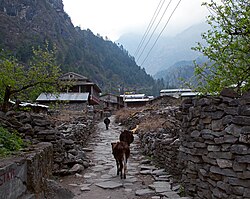
Baglung District, a part of Gandaki Province, is one of the seventy-seven districts of Nepal. The district, with Baglung as its district headquarters, covers an area of 1,784 km2 (689 sq mi) and has a population (2011) of 268,613.
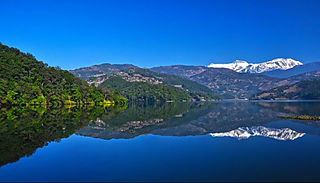
Kaski District, a part of Gandaki Province, is one of the seventy-seven districts of Nepal. The name is disambiguated from Kaskikot, the ancient Kaski Kingdom.

Lomanthang is a rural municipality in Mustang district in Gandaki Province of western Nepal. It is located at the northern end of the district, bordering the Tibet Autonomous Region of China to the north and Dalome rural municipality of Mustang in the south.

Jomsom, also known as Dzongsam, is the centre of Gharapjhong rural municipality in Mustang district and a former independent village development committee situated at an altitude of about 2,700 metres (8,900 ft) in Gandaki Province of western Nepal. The soaring peaks of Dhaulagiri and Nilgiri form a backdrop to the town straddling the Kali Gandaki River, which flows right through the centre of Jomsom. Along the banks of the Kali Gandaki, black fossilised stones called shaligram, considered as an iconic symbol and reminder of the god Vishnu in the Hindu culture, can be found. Such stones are believed to be found only in the Kali Gandaki, and are considered holy by Hindus.
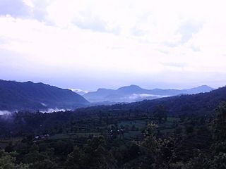
Mirkot is a village development committee in Gorkha District in the Gandaki Zone of northern-central Nepal. It is also known as Bhirkot, Gorkha. It lies on the western side of the headquarters of Gorkha. According to the National Population and Housing Census 2011, it had a population of 5261, and had 1388 households in the village. Its neighbourhood VDCs are Gaikhur, Dhuwakot, Khoplang, Chyangli, Palumtar, Chhoprak and Deurali. Such as Kotgadi, Lakang, Mahadev Temple are the most important places of Mirkot. The central part of Mirkot VDC is called Bagdanda, Where the main office of the VDC and Mirkot Higher Secondary School are located.
Chumchet is a village development committee in Gorkha District in the Gandaki Zone of northern-central Nepal. At the time of the 1991 Nepal census it had a population of 979 and had 221 houses in the village.
Samagaun is a village development committee in Gorkha District in the Gandaki Zone of northern-central Nepal. The village is located at an altitude between 3530 m and 3800m, making it the highest-located large settlement in the Manaslu Mountain Area. At the time of the 1991 Nepal census, it had a population of 665 and had 179 houses in the village. 100% of this population are followers of Buddhism.
Deurali is a Village Development Committee in Kaski District of the Gandaki province of north-central Nepal. At the time of the 1991 Nepal census, it had a population of 2,882. The base camp of Mount Machapuchare is situated at a 6-hour uphill trek from the village.

Dhampus is a village and Village Development Committee in Kaski District in the Gandaki Zone of northern-central Nepal. The village is located 19 km away from the Pokhara Baglung Highways and falls within the trekking route of Mardi Himal Trek. At the 1991 Nepal census, it had a population of 2,753 persons in 547 individual households. The village is gradually turning into a tourist destination. It has the Australian Base Camp with views of the peaks Annapurna, Dhaulagiri and Machhapuchhre.

Dhital, formerly a village development committee in Kaski District, Gandaki Zone, is now located in Machhapuchhre rural municipality, ward number 6 in Kaski district, Gandaki Province, Nepal.The name Dhital Dhi+Tal Dhi means nepali word धि and Tal means lake it is believed that there was a lake in 18th century. At the 1991 Nepal census, it had a population of 4,121 persons in 862 individual households. Dhital is near Annapurna Himalaya and on its trekking route.

Ghandruk is a Village Development Committee in the Kaski District of the Gandaki Province of Nepal. Situated 32 km north-west to Pokhara, the village is readily accessible by public buses and private taxis from the provincial headquarter. At the time of the 1991 Nepal census, it had a population of 4,748 residents in 1,013 individual households.
Dharapani, Bheri is a village development committee in Surkhet District in Karnali Province of mid-western Nepal. At the time of the 1991 Nepal census it had a population of 2542 people living in 445 individual households.

Chhusang is a village development committee in Mustang District in the Dhawalagiri Zone of northern Nepal. It is located on the Upper Mustang trekking route, between Tangbe and Chele, about an hour's walk north of Tangbe. It lies at the junction of the Narshing river and the Kali Gandaki.
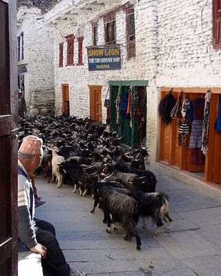
Marpha is a village in Mustang District in the Dhawalagiri Zone of northern Nepal. At the time of the 1991 Nepal census it had a population of 1630 people living in 434 individual households.

Thapathana is one of the Ward of Phalewas Municipality of Gandaki Province established by the current constitution of Nepal which was promulgated on 20 September 2015. It was renamed as ward no. 2 of Phalewas Municipality. At the time of the 1991 Nepal census, it had a population of 3263 people living in 639 individual households. This ward of Nepal is well known for some high elevated hills and natural sceneries. This place consists of locals speaking the Nepali language as their primary language and Hinduism is followed by the majority of the locals.
Archalbot is a village development committee in Lamjung District in the Gandaki Zone of northern-central Nepal. At the time of the 1991 Nepal census it had a population of 1650 people living in 333 individual households.

Bhraka, Nepal is a village development committee in Manang District in the Gandaki Zone of northern Nepal. At the time of the 2011 Nepal census it had a population of 306 people living in 83 individual households.
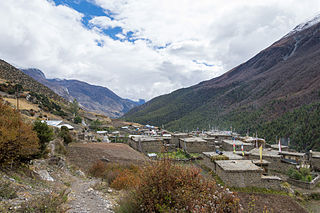
Khangsar is a village development committee in Manang District in the Gandaki Zone of northern Nepal. At the time of the 2011 Nepal census it had a population of 257 people in 58 individual households. In terms of religion, 92% of locals are followers of Buddhism and 5% are followers of Hinduism. 42% of Locals are engaged in agriculture, 26% in tourism industry, and 19% are gone for foreign employment.

Pisang is a village development committee in Manang District in the Gandaki Zone of northern Nepal. At the time of the 2011 Nepal census it had a population of 307 people living in 105 individual households. The village is located in the Marshyangdi River valley, directly south of Pisang Peak, north of Annapurna II, and west of Paungda Danda. Pisang village is the last human settlement before the Pisang Trekking Peak 6,091 m, thus increasing tourism activities in the last few years. Currently, 8 local houses have been converted to guest houses to accommodate climbers to Pisang Trek.

Mirkot is a village development committee in Gorkha District in the Gandaki Zone of northern-central Nepal. It lies on the western side of the headquarters of Gorkha. According to the National Population and Housing Census 2011, it had a population of 5261, and had 1388 households in the village. Its neighbourhood VDCs are Gaikhur, Dhuwakot, Khoplang, Chyangli, Palumtar, Chhoprak and Deurali. Such as Kotgadi, Lakang, Mahadev Temple are the most important places of Mirkot. The central part of Mirkot VDC is called Bagdanda, Where the main office of the VDC and Mirkot Higher Secondary School are located.
