
Gandaki zone was one of the fourteen zones of Nepal, located in the Western Development Region. It was named as Sapta Gandaki after the seven tributaries that makes up the Gandaki River. Pokhara served as its regional and zonal headquarter. It was also the birthplace of Bhanubhakta Acharya, first poet of Nepal.

Kaski District, a part of Gandaki Province, is one of the seventy-seven districts of Nepal. The name is disambiguated from Kaskikot, the ancient Kaski Kingdom.

Manang District (Nepali: मनाङ जिल्ला, in Gandaki Province, is one of the seventy-seven districts of Nepal. The district, with Chame as its district headquarters, covers an area of 2,246 km2 and in 2011 had a population of 6,538.

Mustang District is one of the eleven districts of Gandaki Province and one of seventy-seven districts of Nepal which was a Kingdom of Lo-Manthang that joined the Federation of Nepal in 2008 after abolition of the Shah dynasty. The district covers an area of 3,573 km2 (1,380 sq mi) and in 2011 had a population of 13,452. The headquarters is located at Jomsom. Mustang is the fifth largest district of Nepal in terms of area.
Milarepa's Cave or Namkading Cave is a cave where the Tibetan Buddhist philosopher, and Vajrayana Mahasiddha, Milarepa spent many years of his life in the eleventh century. It is located 11 kilometres (7 mi) north of the town of Nyalam at Gangka village. It is on the slope below the China–Nepal Friendship Highway and above the Matsang river in Nyalam County, Tibet.

Chame is the headquarters of Manang District in the Gandaki Zone of northern Nepal. At the time of the 2011 Nepal census it had a population of 1129 people living in 279 individual households. Manang District is the lowest populated district in Nepal.

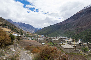
Manang is a town in the Manang District of Nepal. It is located at 28°40'0N 84°1'0E with an elevation of 3,519 metres (11,545 ft). According to the preliminary results of the 2011 Nepal census, the district has a population of 6,527 people living in 1,495 individual households. Its population density is 3 persons/km2.
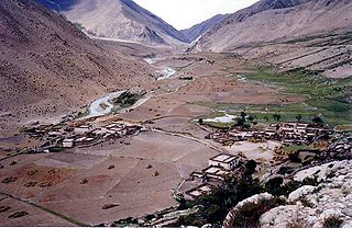
Dhikurpokhari is a suburb and former Village Development Committee in Kaski District in the Gandaki Province of northern-central Nepal. At the 1991 Nepal census, it had a population of 7,392 persons in 1,427 individual households.

Bhraka, Nepal is a village development committee in Manang District in the Gandaki Zone of northern Nepal. At the time of the 2011 Nepal census it had a population of 306 people living in 83 individual households.

Dharapani is a village development committee in Manang District in the Gandaki Zone of northern Nepal. At the time of the 2001 Nepal census it had a population of 1012 people living in 232 individual households.
Phu, Nepal is a village development committee in Manang District in the Gandaki Zone of northern Nepal. At the time of the 2011 Nepal census it had a population of 176 people living in 36 individual households.

Ghyaru is a village development committee in Manang District in the Gandaki Zone of northern Nepal. At the time of the 2011 Nepal census it had a population of 71 people living in 33 individual households.
Khangsar is a village development committee in Manang District in the Gandaki Zone of northern Nepal. At the time of the 2011 Nepal census it had a population of 257 people in 58 individual households.

Nar is a village development committee in Manang District in the Gandaki Zone of northern Nepal. In the 2011 Nepal census it had a population of 362 people, living in 86 individual households.

Pisang is a village development committee in Manang District in the Gandaki Zone of northern Nepal. At the time of the 2011 Nepal census it had a population of 307 people living in 105 individual households. The village is located in the Marshyangdi River valley, directly south of Pisang Peak, north of Annapurna II, and west of Paungda Danda.
Tachi Bagarchhap is a village development committee in Manang District in the Gandaki Zone of northern Nepal. At the time of the 2011 Nepal census it had a population of 544.
Tanki Manang is a village development committee in Manang District in the Gandaki Zone of northern Nepal. At the time of the 2011 Nepal census it had a population of 377 people living in 110 individual households.
Thoche is a village development committee in Manang District in the Gandaki Zone of northern Nepal. At the time of the 2011 Nepal census it had a population of 382 people living in 102 individual households.

Milarepa Cave or Milerepa Cave is a cave associated with Milarepa in Nepal on the Annapurna Circuit at approximately 13,450 feet (4,100 m) just outside Manang. It is credited to have been the residence of the famous Tibetan Buddhism siddha Milarepa during his stay in 11th century in what is now modern-day northern Nepal. This site also includes a holy spring and a gompa. The cave is located beyond the gompa, with locals praying from the edge of a glacial moraine in direct line of sight of the cave as its approach is on a steep scree slope.


