
Darchula District is one of the nine districts of Sudurpashchim Province. The area, with Khalanga as its capital, covers an area of 2,322 km2 (897 sq mi) and has a population (2011) of 133,274. Darchula lies in the west-north corner of the country.
Bhagavathi is a small town in Arghakhanchi District in the Lumbini Zone of southern Nepal. At the time of the 1991 Nepal census, the town had a population of 4418 living in 842 houses. At the time of the 2001 Nepal census, the population was 4543, of which 59% was literate.
Bhotechaur is a village in Sindhupalchok District in the Bagmati Zone of central Nepal. At the time of the 1991 Nepal census it had a population of 4995 and had 870 houses in the village.
Barakot is a ward in Dasharathchanda municipality, in Baitadi District in Sudurpashchim Province of western Nepal. Earlier it was a village development committee (VDC). At the time of the 1991 Nepal census it had a population of 2,389 and had 462 houses in the village.
Dilasaini is a former village development committee that is now a Rural Municipality in Baitadi District in Sudurpashchim Province of western Nepal. At the time of the 1991 Nepal census it had a population of 4,828 and had 849 houses in the village. There is one plus two, two high schools and many primary schools in the VDC. This VDC is bordered by Mathairaj, Gokuleshwor, Rudreswor and Rim VDC and Darchula district in the northwest. This VDC is named after a local deity. The temple of this devi is located in Dhamigaun which is one of the wards of the VDC. This temple is famous in far-western Nepal for the sacrifice of huge number of bull buffaloes on occasion of Dashain.

Matatirtha is a village and former Village Development Committee that is now part of Chandragiri Municipality in Kathmandu District in Province No. 3 of central Nepal. At the time of the 1991 Nepal census it had a population of 2,799 living in 506 households. Its population has now grown to 5,982 spread over 1,314 households. Santosh Khadka was elected as Ward Chairman of Matatirtha through a local election.
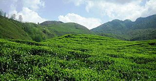
Dhurkot Nayagaun is a town and municipality in Gulmi District in the Lumbini Zone of central Nepal. At the time of the 1991 Nepal census it had a population of 4692. This VDC is one of the most beautiful VDC of Gulmi and famous for Oranges. Literacy rate of this VDC is above 90%. Politically above 75% people support Nepali Congress in this village. This VDC is touched by Arghakhanchi district.
Rupakot is a Village Development Committee (VDC) in Gulmi District in the Lumbini Zone of central Nepal. Its headquarters is in Myal pokhara. It is located in about the center of Gulmi District. It is surrounded by hills. Its main religion is Hinduism. There are many temples like Chhatra Thaan, Shiddababa temple, Shiva Temple, Ram Temple, Debi deurali temple etc. The main sources of revenue for the village are agriculture and foreign employment. At the time of the 2001 Nepal census, it had a population of 3521 persons residing in 704 individual households. 76.48% of students attend school. The most populated parts of this VDC is Damuka, Sota & Ekle Pipal.
Ghyang Sukathokar is a village development committee (VDC) in Dolakha District in the Janakpur Zone of north-eastern Nepal. At the time of the 1991 Nepal census it had a population of 4,600.
Jamuniya is a village development committee in Sarlahi District in the Janakpur Zone of south-eastern Nepal. At the time of the 1991 Nepal census it had a population of 5,399 people living in 914 individual households.
Byans is a rural area of the Byans Rural Municipality in the Darchula District and Sudurpashchim Province of Nepal. At the time of the 1991 Nepal census, the population was 723; by the 2011 Nepal census, it had dropped to 556.
Dhap is a market center in Mahakali Municipality in Darchula District in the Mahakali Zone of western Nepal. The formerly Village Development Committee was merged to form new municipality since 18 May 2014. At the time of the 2021 Nepal census it had a population of 1443 people living in 325 individual households. The major ethnic group living in Dhap are Brahmins and Chhetris with the majority of Bista (Brahmin), Joshi, Bhatta, Pant, Raikhola caste. Temple of God Malikarjun and Temple of God Latinath are two main religious sites. The main educational institute is Malikarjun Secondary School, where one can study up to Undergraduate level from Elementary Level.
Huti is a village development committee (VDC) in Darchula District in the Mahakali Zone of western Nepal. At the time of the 1991 Nepal census it had a population of 2317 people living in 417 individual households. It is named after the village of Huti. The Brama Devta temple is located there at Huti-2 and is visited by many pilgrims.
Khar is a village development committee (VDC) of Darchula District in the Mahakali Zone of Far-Western Development Region, Nepal. Geographically khar is located 29.79 N and 80.64 E, its nearest border to the district headquarters is Dallekh which is 10- 12 kilometer north east to the Darchula. The Khar VDC is surrounded by Sipti and Dhuligada VDC to the East and South, Katai to the West, and Eyarkot to the North. According to national census 2011 khar VDC has total population 4,272 residing 698 households.
Latinath is a village development committee in Darchula District in the Mahakali Zone of western Nepal. At the time of the 1991 Nepal census it had a population of 3392 people living in 587 individual households. In this development region one of the famous temple of this district is located which is called "latainath" or "latinath".
Malikarjun is a former village development committee that is now a Rural Municipality in Darchula District in Sudurpashchim Province of far western Nepal. Mallikarjun is named after the famous temple of lord Shiva Shree Shailyn shikar Malikarjun. At the time of the 1991 Nepal census it had a population of 1814 people living in 331 individual households.
Sipti is a village development committee in Darchula District in the Mahakali Zone of western Nepal. At the time of the 2011 Nepal census it had a population of 4,339 people living in 749 individual households.
Tapoban is a village in Darchula District in the Mahakali Zone of western Nepal. At the time of the 1991 Nepal census it had a population of 1841 people living in 305 individual households.
Samaiji is a village development committee in Dadeldhura District in the Mahakali Zone of western Nepal. It is named after the name of god Samaiji. It is divided into 9 wards. Ward no: 1 Pali Ward no: 2 Bakayal Ward no: 3 Bajkot Ward no: 4 Khateda Ward no: 5 Mudrad Ward no: 6 Silangi Ward no: 7 Baida Ward no: 8 Mahargaun Ward no: 9 koteli The headquarters is located at a small town named Puilek. It is around 14 km from the district headquarters. The major destination of this V.D.C. includes the natural beauties and some temples. Some famous temples are Kola Samaiji, Pali Samaiji, Shikhar Samaiji etc. There are 2 higher secondary schools in the V.D.C. And a graveled road has made it possible to touch the district headquarters. The facilities like water, sanitation, telephone and electricity are accessible to the locals but they are still lacking proper education, hospital and even transportation at the need. One has to walk 14 km to reach the nearest hospital, bank and for all other basic things. At the time of the 1991 Nepal census it had a population of 2184 people living in 382 individual households.

Mirkot is a village development committee in Gorkha District in the Gandaki Zone of northern-central Nepal. It lies on the western side of the headquarters of Gorkha. According to the National Population and Housing Census 2011, it had a population of 5261, and had 1388 households in the village. Its neighbourhood VDCs are Gaikhur, Dhuwakot, Khoplang, Chyangli, Palumtar, Chhoprak and Deurali. Such as Kotgadi, Lakang, Mahadev Temple are the most important places of Mirkot. The central part of Mirkot VDC is called Bagdanda, Where the main office of the VDC and Mirkot Higher Secondary School are located.

