Dhing

Last updated

Dhing
Village
Dhing Village
India Assam location map.svg
Red pog.svg
Dhing
Location in Assam, India
India location map.svg
Red pog.svg
Dhing
Dhing (India)
Coordinates: 26°28′N92°28′E / 26.47°N 92.47°E / 26.47; 92.47
CountryFlag of India.svg  India
State Assam
District Nagaon
Elevation
64 m (210 ft)
Population
 (2011)
  Total19,235
Languages
  Official Assamese.
Time zone UTC+5:30 (IST)
PIN
782123

Dhing is a village in the northwest of the Nagaon district in the state of Assam, India. [1]

Contents

Geography

Dhing is located at 26°28′N92°28′E / 26.47°N 92.47°E / 26.47; 92.47 . [2] It has an average elevation of 64 meters (210 feet). [3]

Dhing is approximately 25 kilometers from the city of Nagaon. [4]

Demographics

In the 2011 India census, [5] Dhing had a population of 19,235. Males constituted 51.7% of the population and females 48.3%. Dhing had an average literacy rate of 87.35%, higher than the state average of 72.19%. Male literacy is 90.77% and female literacy is 83.69%.

Politics

The Communist leader M. Shamsul Huda was elected several times to the Assam Legislative Assembly as the member for the Dhing legislative assembly constituency. [6] Dhing is part of the Kaliabor (Lok Sabha constituency). [7]

Dhing constituency is currently represented by an All India United Democratic Front politician, Aminul Islam, who has won the last two Assam Legislative Assembly elections in 2011 and 2016. [6] [8]

Education

Dhing serves as an educational hub for surrounding villages and services multiple secondary schools. [9] It also provides post-secondary education with Dhing College, which is affiliated with Gauhati University. [10]

Notable people

See also

Related Research Articles

<span class="mw-page-title-main">Tezpur</span> Municipality in Assam, India

Tezpur is a town in Sonitpur district, Assam state, India. Tezpur is located on the banks of the river Brahmaputra, 175 kilometres (109 mi) northeast of Guwahati, and is the largest of the north bank cities.

<span class="mw-page-title-main">Golaghat district</span> District of Assam in India

Golaghat district (Pron:ˌgəʊləˈgɑ:t) is an administrative district in the state of Assam in India. It attained district status in 1987. The district headquarters are located at Golaghat. The district occupies an area of3,502 km2 (1,352 sq mi) and lies 100 metres (330 ft) above sea level.

<span class="mw-page-title-main">Morigaon district</span> District of Assam in India

Morigaon district is an administrative district in the state of Assam in India. The district headquarters is located at Morigaon. The ancient place of occult Mayong is located in this district as well as Pobitora Wildlife Sanctuary.

<span class="mw-page-title-main">Barpeta</span> Town in Assam, India

Barpeta is a town in Barpeta district of the state of Assam in India and is district headquarters. The city is located 90 kilometres (56 mi) north west of Guwahati and is one of the major cities in Western Assam. It is also called Satra Nagari of Assam due to the presence of various Vaishnavite Satras in the vicinity.

<span class="mw-page-title-main">Nagaon</span> Town in Assam, India

Nagaon is a town and a municipal board in Nagaon district in the Indian state of Assam. It is situated 122.6 kilometres (76 mi) east of Guwahati.

<span class="mw-page-title-main">Morigaon</span> Town in Assam, India

Morigaon is a town of town area committee and the district headquarters of Morigaon district in the Indian state of Assam and including the headquarters of the Tiwa Autonomous Council (TAC), Tiwashong, Assam which was constituted by the Government of Assam on 14 April 1995, The Apex council will consist of 144 villages of Nagaon, Morigaon and Kamrup with 28 blocks. Pincode of Morigaon town is 782105.

<span class="mw-page-title-main">Karimganj</span> Town in Assam, India

Karimganj is a town in the Karimganj District of the Indian state of Assam. It is the administrative headquarters of the district.

Bihpuria is a small town in Lakhimpur district in the state of Assam, India. Bihpuria is located at 27.03°N 93.90°E.

Hojai is a town and a municipal board in Hojai district in the Indian state of Assam. It is located on the banks of the two tributaries of Brahmaputra, namely Kapili and Jamuna.

<span class="mw-page-title-main">Mangaldoi</span> Town in Assam, India

Mangaldoi; also spelt Mangaldai, Assamese pronunciation:[mɔŋɔldoɪ], is a town in the state of Assam, India. It's named after Mangaldahi, who was the daughter of the Raja of Darrang. She was married to Susenghphaa (r.1603-1641),, a ruler of the Ahom kingdom. Mangaldoi serves as the administrative headquarters of Darrang district. Positioned around 70 km to the east of Guwahati, the capital city of Assam.

<span class="mw-page-title-main">Batadroba Assembly constituency</span> Constituency of the Assam legislative assembly in India

Batadroba Assembly constituency is one of the 126 assembly constituencies of Assam a north east state of India.It is no longer exist after Delimitation.Batadroba was also part of Kaliabor Lok Sabha constituency.

<span class="mw-page-title-main">Barhampur Assembly constituency</span> Constituency of the Assam legislative assembly in India

Barhampur Assembly constituency is one of the 126 assembly constituencies of Assam a north east state of India. Barhampur is also part of Kaziranga Lok Sabha constituency.

<span class="mw-page-title-main">Hojai Assembly constituency</span> Assembly constituency of Assam

Hojai Assembly constituency is one of the 126 state legislative assembly constituencies in Assam state in North Eastern India. It is also one of the 9 state legislative assembly constituencies included in the Nagaon Lok Sabha constituency.

<span class="mw-page-title-main">Chapaguri Assembly constituency</span> Constituency of the Assam legislative assembly in India

Chapaguri Assembly constituency is one of the 126 assembly constituencies of Assam Legislative Assembly. Chapaguri forms part of the Kokrajhar Lok Sabha constituency. It is a reserved seat for the Scheduled tribes (ST).

<span class="mw-page-title-main">Dhekiajuli Assembly constituency</span> Constituency of the Assam legislative assembly in India

Dhekiajuli Assembly constituency is one of the 126 assembly constituencies of Assam Legislative Assembly. Dhekiajuli forms part of the Tezpur Lok Sabha constituency.

<span class="mw-page-title-main">Dhing Assembly constituency</span> Constituency of the Assam legislative assembly in India

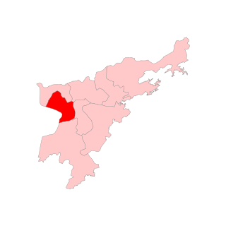
Dhing Assembly constituency is one of the 126 assembly constituencies of Assam Legislative Assembly. Dhing forms part of the Kaliabor Lok Sabha constituency in the Indian state of Assam.

<span class="mw-page-title-main">Rupohihat Assembly constituency</span> Constituency of the Assam legislative assembly in India

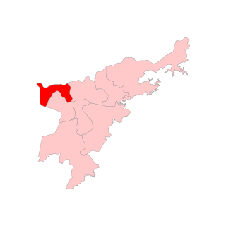
Rupohihat Assembly constituency is one of the 126 assembly constituencies of Assam Legislative Assembly. Rupohihat forms part of the Kaliabor Lok Sabha constituency.

Mobarak Ali Pathan is an All India United Democratic Front politician from Assam. He was elected in Assam Legislative Assembly election in 2006 from Dhing constituency.

Muwamari is a medium size village located in Dhing of Nagaon district, Assam, India with total 156 families residing. The Muwamari village has population of 826 of which 428 are males while 398 are females as per Population Census 2011.

Rajdweep is an Indian screenwriter, playwright, lyricist and journalist hails from Dhing, Nagaon, Assam. He has been awarded by Bollywood superstar Aamir Khan for his script 'Ishqlogy' at Cinestaan India's Storyteller's Script Contest in 2018. He is the first lyricist from Assam who writes Assamese songs in Bollywood film. He wrote the songs 'Jiri Jiri' for the film A Death In The Gunj and the bihu song for the film Jagga Jasoos. Again, he becomes the first screenwriter from Assam who signed a Bollywood film. He signed the film on 21 October 2019.

References

  1. "District Profile | Nagaon District | Government Of Assam, India". nagaon.gov.in. Archived from the original on 23 September 2021. Retrieved 6 September 2020.
  2. Falling Rain Genomics, Inc - Dhing
  3. "Average Weather in Dhing, India, Year Round - Weather Spark". weatherspark.com. Retrieved 6 October 2020.
  4. "Distance from Nagaon, Assam to Dhing, Assam". www.indiadistance.com. Retrieved 6 October 2020.
  5. "Dhing (Nagaon, Assam, India) - Population Statistics, Charts, Map, Location, Weather and Web Information". www.citypopulation.de. Retrieved 6 October 2020.
  6. 1 2 "Dhing Election Results 2016, Candidate list, Winner, Runner-up and Current MLAs". Elections in India. Retrieved 5 October 2020.
  7. "List of Parliamentary & Assembly Constituencies" (PDF). Assam. Election Commission of India. Archived from the original (PDF) on 4 May 2006. Retrieved 6 October 2008.
  8. "Assam Legislative Assembly - Member". assamassembly.gov.in. Retrieved 5 October 2020.
  9. "Schools in Dhing Urban Cluster | List of Schools in Dhing Urban Cluster, Nagaon District (Assam)". schools.org.in. Retrieved 5 October 2020.
  10. "Home || Dhing College || KSGI || KSGI-Kinetic Solutions Group of India". dhingcollege.in. Retrieved 5 October 2020.
  11. PTI (13 July 2018). "Hima Das becomes first Indian woman to win gold in World Jr Athletics Championships". @businessline. Retrieved 5 October 2020.
  12. "Ratnakanta Barkakati | Ratnakanta Borkakati". Menonim Menonimus. 14 September 2020. Retrieved 5 October 2020.
  13. Seta, Keyur. "Playwright Rajdweep on how the universe conspired to help him win a Cinestaan script contest prize". www.cinestaan.com. Archived from the original on 6 December 2019. Retrieved 5 October 2020.