
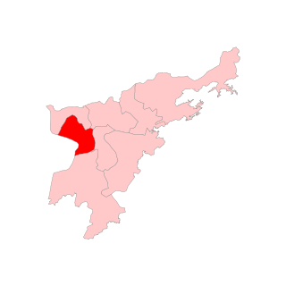
Nagaon district is an administrative district in the Indian state of Assam. At the time of the 2011 census it was the most populous district in Assam, before Hojai district was split from it in 2016.

Dhamtari is a municipal corporation and headquarters of the Dhamtari district in the state of Chhattisgarh, India, which is part of the Mahasamund Lok Sabha constituency formed on 6 July 1998. The district is home to 3.13 percent of Chhattisgarh's total population.

Barpeta is a major city in Barpeta district of the state of Assam in India and is district headquarters. The city is located 90 kilometres (56 mi) north west of Guwahati and is one of the major cities in Western Assam. It is also called Satra Nagari of Assam due to the presence of various Vaishnavite Satras in the vicinity.

Nagaon is a city and a municipal board in Nagaon district in the Indian state of Assam. It is situated 122.6 kilometres (76 mi) east of Guwahati. With a population of 1,16,355 as per 2011 census it is an AMRUT City and 4th biggest city of Assam.

Lumding is a town with a municipal board in Hojai District in of Assam state in India. It is notable as the location of Lumding Junction railway station, a major hub for India's Northeast Frontier Railway network.

Jorhat is an administrative district of the Indian state of Assam situated in the central part of the Brahmaputra Valley. The district is bounded by Majuli on north, Nagaland state on the south, Sivasagar on the east and Golaghat on the west. On the north of the district, the river Brahmaputra forms the largest riverine island of the world. The administrative seat is at Jorhat city.

Bokakhat is a town in Assam and a Municipality Board in Golaghat district in the state of Assam, India. It is about 23 km away from the world heritage site Kaziranga National Park. Bokakhat town is situated almost in the middle of Assam. It is the headquarters of Bokakhat subdivision. The town is base to many nearby tourist places and is well connected to other cities and towns by road. The Kaipho Langso waterfall, an important picnic spot surrounded with magnificent views, lies in Karbi Anglong 13 km away from Bokakhat. Other nearby attractions include the ruins of the ancient Numaligarh and the Deoparbat, the tea gardens of Hatikhuli, Methoni, Diffloo Behora and Borsapori and also the coffee and rubber plantations. The nearest airports are at Jorhat and Guwahati. The nearest railway stations are Badulipar and Furkating.
Dhing is a village in the northwest of the Nagaon district in the state of Assam, India.

Duliajan is an industrial town of Dibrugarh district in the Indian state of Assam located in the upper north-east corner of India. The town is about 45 km east of Dibrugarh City. It is particularly known for its oil related industry, Oil India Limited, one of the country's largest oil and gas companies. There is also other central government owned companies like B.C.P.L. GDU Station, N.E.E.P.C.O., D.N.P.L., LPG Plant and the Shivani company which is India's largest private company for drilling. Assam Gas Company Limited, which carries out business related to natural gas in India owned by the Government of Assam, is also located in this township.
Hindustan Paper Corporation Limited Township, Panchgram is an industrial township in Panchgram under Cachar district, state of Assam. It is the finest township of the Barak Valley Under Hindustan Paper Corporation Limited.

Jagiroad is a town in the state of Assam. Jagiroad located in Mayong Sub-Division, in Morigaon district. It is situated on the south bank of Kolong river.

Kaliabor was one of the 14 Lok Sabha constituencies in Assam state in north-eastern India. After the delimitation, the constituency's the name was changed to Kaziranga. And area also changed.

Baksa district is an administrative district in the Bodoland Territorial Region of Assam, one of the North-Eastern states of India. The administrative headquarters is at Mushalpur. Manas National Park is a part of this district.
Old NH-37 is now National Highway 127. It's a national highway of India. It connects Nagaon, New Gatanga and Jakhalabandha in Highway of Assam. New Gatanga Highway (2.5KM) is a Part of this Highway Road.
Raha is a small town in Nagaon district of Assam, India, situated near the National Highway 37. The river Kolong and Kopili flows near Raha. Raha is also situated near to Chaparmukh, a small town popularly known for Chaparmukh junction, one of the prominent railway stations in Nagaon district.

Jorhat is a major city in Upper Assam and amongst the fastest growing urban centres in the state of Assam in India.
Batadroba Assembly constituency was one of the 126 assembly constituencies of Assam, a north east state of India. It no longer exists after the Delimitation. Batadroba was also part of Kaliabor Lok Sabha constituency.
