The Zhongsha Islands is a Chinese term for a collection of two skerries, many entirely submerged banks, seamounts, and shoals in the South China Sea. There are no islands in the Macclesfield Bank, the main part of Zhongsha. The Scarborough Shoal, which consists of two skerries, is not contiguous with the Macclesfield Bank but Chinese sources treat them as one chain of geographical features. The whole of the region is claimed by both the PRC and the ROC, and various bits of the eastern parts are claimed by the Philippines. No country has constant control of the whole region, and there are disputes - for example, see the Scarborough Shoal standoff.
This is a list of the extreme points of the United Kingdom: the points that are farther north, south, east or west than any other location. Traditionally the extent of the island of Great Britain has stretched "from Land's End to John o' Groats".

Lake Päijänne in Jyväskylä, a city and the regional capital of Central Finland, is the second largest lake in Finland. The lake drains into the Gulf of Finland via the Kymi River. The major islands are from north to south Vuoritsalo, Muuratsalo, Onkisalo, Judinsalo, Edessalo, Taivassalo, Haukkasalo, Vehkasalo, Mustassalo, Virmailansaari and Salonsaari. The largest island is Virmailansaari. The word saari means an island. Salo once meant a great island, nowadays it means a great forest area.

European route E22 is one of the longest European routes. It has a length of about 5,320 km (3,310 mi). Many of the E-roads have been extended into Asia since the year 2000; the E22 was extended on 24 June 2002.
Zinado is a town in the Ganzourgou province of Burkina Faso. It is 10 kilometres (6.2 mi) from the province capital Zorgho and has 734 inhabitants.

Anarcs is a village in Szabolcs-Szatmár-Bereg county, in the Northern Great Plain region of eastern Hungary.
In recreational number theory, a minimal prime is a prime number for which there is no shorter subsequence of its digits in a given base that form a prime. In base 10 there are exactly 26 minimal primes:

Alquife is a town located in the province of Granada, Spain. According to the 2005 census (INE), the town has a population of 780 inhabitants. It is famous due to its iron mines that since Ancient Roman times gave prosperity to the area. In February 1997, Compañía Andaluza de Minas fired its 264 workers and closed the operation. Along with the mines, the mining community of Alquife was built. It is currently abandoned, though there are plans to reopen the mines as at August 2020.

Madrigalejo del Monte is a municipality and town located in the province of Burgos, Castile and León, Spain. According to the 2022 census (INE), the municipality has a population of 183 inhabitants.
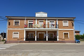
Vega de Ruiponce is a municipality located in the province of Valladolid, Castile and León, Spain. According to the 2004 census (INE), the municipality has a population of 129 inhabitants. Its economy is mainly focused on the primary sector, specifically livestock and agriculture.
Sapaga is a village in the Zorgho Department of Ganzourgou Province in central Burkina Faso. The village has a population of 3,316.
Siseni is a town and municipality in Gulmi District in the Lumbini Zone of central Nepal. At the time of the 1991 Nepal census it had a population of 3851 persons living in 720 individual households.

Ruila is a village in Saue Parish, Harju County in northern Estonia. Prior to the administrative reform of Estonian local governments in 2017, the village belonged to Kernu Parish.
Tõlla is a village in Saarde Parish, Pärnu County in southwestern Estonia.
Baćica is a village in the municipality of Tutin, Serbia. According to the 2002 census, the village has a population of 347 people.
Palikoppa is a village in Dharwad district of Karnataka, India.

HMS Gleaner was one of 21 Halcyon-class minesweepers built for the Royal Navy in the 1930s.
I-183 was an Imperial Japanese Navy Kaidai type cruiser submarine of the KD7 sub-class commissioned in 1943. During World War II, she was sunk with all hands by United States Navy fleet submarine in April 1944.
Stud House is an early 18th-century house in the centre of Hampton Court Park near Hampton Court Palace. It is Grade II listed on the National Heritage List for England. It was traditionally the official residence of the Master of the Horse. The former stables at the house are separately listed, also at Grade II. The Stud House was built in the 18th century and was altered and expanded between 1817-18.

