Yamba Department

Last updated
Yamba
Department
Gourma departments.png
Yamba Department location in the province
Country Flag of Burkina Faso.svg  Burkina Faso
Province Gourma Province
Time zone GMT 0 (UTC+0)

Yamba is a department or commune of Gourma Province in north-eastern Burkina Faso. Its capital is the town of Yamba. [1]

Departments of Burkina Faso administrative division and commune of Burkina Faso

The provinces of Burkina Faso are divided into 351 departments, whose urbanized areas are grouped into the same commune (municipality) with the same name as the department. The 351 communes created in those departments have three kinds of status :

Gourma Province Province in Est Region, Burkina Faso

Gourma is one of the 45 provinces of Burkina Faso and is in Est Region. The capital of Gourma is Fada N'gourma. The population of Gourma was 304,169 in 2006.

Burkina Faso country in Africa

Burkina Faso is a landlocked country in West Africa. It covers an area of around 274,200 square kilometres (105,900 sq mi) and is surrounded by six countries: Mali to the north; Niger to the east; Benin to the southeast; Togo and Ghana to the south; and Ivory Coast to the southwest. The July 2018 population estimate by the United Nations was 19,751,651. Burkina Faso is a francophone country, with French as the official language of government and business. Roughly 40% of the population speaks the Mossi language. Formerly called the Republic of Upper Volta (1958–1984), the country was renamed "Burkina Faso" on 4 August 1984 by then-President Thomas Sankara. Its citizens are known as Burkinabé. Its capital is Ouagadougou.

Towns and villages

Related Research Articles

Augsburger Straße (Berlin U-Bahn) Berlin U-Bahn station

Augsburger Straße is a Berlin U-Bahn station on the U 3 line. It is located in Charlottenburg under Nürnberger Straße where Augsburger Straße crosses it. Station and street are named after the city of Augsburg.

Nobelhallen is an indoor arena in Karlskoga, Örebro County, Sweden. Its current capacity is 5,600 and it was built in 1971. It is the home arena of the ice hockey team BIK Karlskoga.
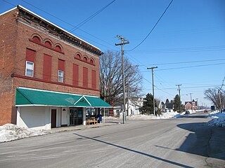
Rudolph, Ohio Census-designated place in Ohio, United States

Rudolph is an unincorporated community and census-designated place (CDP) in eastern Liberty Township, Wood County, Ohio, United States. As of the 2010 census, it had a population of 458. Although it is unincorporated, it has a post office, with the ZIP code of 43462.

Deer Creek Township, Tazewell County, Illinois Township in Illinois, United States

Deer Creek Township is located in Tazewell County, Illinois. As of the 2010 census, its population was 1,383 and it contained 573 housing units.

Meadow Lake No. 588 is a rural municipality in the Canadian province of Saskatchewan, located in the northwest part of the province near the town of Meadow Lake. Also within the geographical boundaries of the R.M. are the communities of Dorintosh and Greig Lake as are several First Nations Indian reserves. None of these enclaved communities is considered to be part of the rural municipality.

Wymysłów, Gmina Miechów Village in Lesser Poland, Poland

Wymysłów is a village in the administrative district of Gmina Miechów, within Miechów County, Lesser Poland Voivodeship, in southern Poland. It lies approximately 4 kilometres (2 mi) south-east of Miechów and 33 km (21 mi) north of the regional capital Kraków.

Nalewajków Village in Świętokrzyskie, Poland

Nalewajków is a village in the administrative district of Gmina Radoszyce, within Końskie County, Świętokrzyskie Voivodeship, in south-central Poland. It lies approximately 7 kilometres (4 mi) south-east of Radoszyce, 18 km (11 mi) south of Końskie, and 27 km (17 mi) north-west of the regional capital Kielce.

Buciegas is a municipality in Cuenca, Castile-La Mancha, Spain. It has a population of 46.

Celinów, Kozienice County Village in Masovian, Poland

Celinów is a village in the administrative district of Gmina Grabów nad Pilicą, within Kozienice County, Masovian Voivodeship, in east-central Poland. It lies approximately 9 kilometres (6 mi) east of Grabów nad Pilicą, 21 km (13 mi) north-west of Kozienice, and 62 km (39 mi) south of Warsaw.

Stadionul CFR (Craiova)

CFR Stadium is a multi-use stadium in Craiova. It is the home ground of Gaz Metan CFR Craiova and has 3,000 seats.

Mścigniew, Greater Poland Voivodeship Village in Greater Poland, Poland

Mścigniew is a village in the administrative district of Gmina Włoszakowice, within Leszno County, Greater Poland Voivodeship, in west-central Poland. It lies approximately 7 kilometres (4 mi) south-west of Włoszakowice, 20 km (12 mi) west of Leszno, and 71 km (44 mi) south-west of the regional capital Poznań.

Mosiny Village in Pomeranian, Poland

Mosiny is a village in the administrative district of Gmina Człuchów, within Człuchów County, Pomeranian Voivodeship, in northern Poland. It lies approximately 7 kilometres (4 mi) south of Człuchów and 121 km (75 mi) south-west of the regional capital Gdańsk.

Sierakowice-Wybudowanie is a settlement in the administrative district of Gmina Sierakowice, within Kartuzy County, Pomeranian Voivodeship, in northern Poland.

Kotowo, Pomeranian Voivodeship Village in Pomeranian, Poland

Kotowo is a village in the administrative district of Gmina Dębnica Kaszubska, within Słupsk County, Pomeranian Voivodeship, in northern Poland. It lies approximately 13 kilometres (8 mi) east of Dębnica Kaszubska, 26 km (16 mi) south-east of Słupsk, and 84 km (52 mi) west of the regional capital Gdańsk.

Szczodrowski Młyn Settlement in Pomeranian, Poland

Szczodrowski Młyn is a settlement in the administrative district of Gmina Skarszewy, within Starogard County, Pomeranian Voivodeship, in northern Poland. It lies approximately 8 kilometres (5 mi) west of Skarszewy, 19 km (12 mi) north-west of Starogard Gdański, and 37 km (23 mi) south-west of the regional capital Gdańsk.

Styligi is a settlement in the administrative district of Gmina Bartoszyce, within Bartoszyce County, Warmian-Masurian Voivodeship, in northern Poland, close to the border with the Kaliningrad Oblast of Russia.

Zona Franca – Port is an area of Barcelona (Catalonia) in the district of Sants-Montjuïc. The area includes the Polígon Industrial de la Zona Franca and the Port of Barcelona.

Bayramdere Dam is a dam in Çanakkale Province, Turkey. It was built between 1999 and 2002.

Los Coyotes Band of Cahuilla and Cupeño Indians of the Los Coyotes Reservation is a federally recognized tribe of Cahuilla and Cupeño Indians, who are Mission Indians located in California.

Habib Medical School (HMS) is the school of medicine of the Islamic University in Uganda (IUIU), one of Uganda's private universities. The school is the newest medical school in the country, having been part of IUIU since 2014. The school provides medical education at diploma and undergraduate levels.

References

Coordinates: 12°17′52″N0°20′12″E / 12.29778°N 0.33667°E / 12.29778; 0.33667

Geographic coordinate system Coordinate system

A geographic coordinate system is a coordinate system that enables every location on Earth to be specified by a set of numbers, letters or symbols. The coordinates are often chosen such that one of the numbers represents a vertical position and two or three of the numbers represent a horizontal position; alternatively, a geographic position may be expressed in a combined three-dimensional Cartesian vector. A common choice of coordinates is latitude, longitude and elevation. To specify a location on a plane requires a map projection.