| Kandaga | |
|---|---|
| Country | |
| Region | Centre-Ouest Region |
| Province | Boulkiemdé Province |
| Department | Pella Department |
| Population (2005) | |
| • Total | 509 |
| Time zone | GMT 0 (UTC+0) |
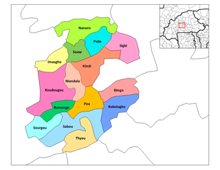
Kandaga is a village in the Pella Department of Boulkiemdé Province in central western Burkina Faso. It has a population of 509. [1]

A village is a clustered human settlement or community, larger than a hamlet but smaller than a town, with a population ranging from a few hundred to a few thousand. Though villages are often located in rural areas, the term urban village is also applied to certain urban neighborhoods. Villages are normally permanent, with fixed dwellings; however, transient villages can occur. Further, the dwellings of a village are fairly close to one another, not scattered broadly over the landscape, as a dispersed settlement.

Pella is a department or commune of Boulkiemdé Province in central Burkina Faso. As of 2005 it has a population of 19,563. Its capital lies at the town of Pella.

Boulkiemdé is one of the 45 provinces of Burkina Faso and is in Centre-Ouest Region. The capital of Boulkiemdé is Koudougou. The population of Boulkiemdé was 498,008 in 2006 and 567,680 in 2011.

