| Pitmoaga | |
|---|---|
View of one of the entrance | |
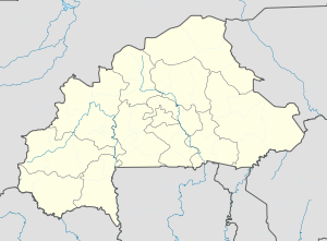 Pitmoaga Location in Burkina Faso | |
| Coordinates: 12°14′N1°52′W / 12.233°N 1.867°W Coordinates: 12°14′N1°52′W / 12.233°N 1.867°W | |
| Country | |
| Region | Centre-Ouest Region |
| Province | Boulkiemdé Province |
| Department | Kokologho Department |
| Population (2005) | |
| • Total | 6,112 |
| Time zone | GMT 0 (UTC+0) |

Pitmoaga is a town in the Kokologho Department of Boulkiemdé Province in central western Burkina Faso. It has a population of 6,112. [1]

A town is a human settlement. Towns are generally larger than villages but smaller than cities, though the criteria to distinguish them vary considerably between different parts of the world.

Boulkiemdé is one of the 45 provinces of Burkina Faso and is in Centre-Ouest Region. The capital of Boulkiemdé is Koudougou. The population of Boulkiemdé was 498,008 in 2006 and 567,680 in 2011.

Burkina Faso is a landlocked country in West Africa. It covers an area of around 274,200 square kilometres (105,900 sq mi) and is surrounded by six countries: Mali to the north; Niger to the east; Benin to the southeast; Togo and Ghana to the south; and Ivory Coast to the southwest. The July 2018 population estimate by the United Nations was 19,751,651. Burkina Faso is a francophone country, with French as the official language of government and business. Roughly 40% of the population speaks the Mossi language. Formerly called the Republic of Upper Volta (1958–1984), the country was renamed "Burkina Faso" on 4 August 1984 by then-President Thomas Sankara. Its citizens are known as Burkinabé. Its capital is Ouagadougou.
