The Arctic Archipelago, also known as the Canadian Arctic Archipelago, is a group of islands north of the Canadian mainland.

Poa pratensis, commonly known as Kentucky bluegrass, smooth meadow-grass, or common meadow-grass, is a perennial species of grass native to practically all of Europe, North Asia and the mountains of Algeria and Morocco. Although the species is spread over all of the cool, humid parts of the United States, it is not native to North America. The Spanish Empire brought the seeds of Kentucky bluegrass to the New World in mixtures with other grasses. Poa pratensis forms a valuable pasture plant, characteristic of well-drained, fertile soil. It is also used for making lawns in parks and gardens and is common in cool moist climates like the Northeastern United States. When found on native grasslands in Canada, however, it is considered an unwelcome exotic plant, and is indicative of a disturbed and degraded landscape.

Poá is a municipality in the state of São Paulo in Brazil. The water extracted from Fonte Áurea, or the Golden Fountain, is sold throughout Brazil. The population is 113,793 in an area of 17.26 km².

In biological classification, especially zoology, the type genus is the genus which defines a biological family and the root of the family name.
The POA: The Professional Trades Union for Prison, Correctional and Secure Psychiatric Workers, formerly the Prison Officers' Association (POA), is a trade union in the United Kingdom. It currently has a membership of 33,500.

Poa annua, or annual meadow grass, is a widespread low-growing turfgrass in temperate climates. Though P. annua is commonly considered a solely annual plant due to its name, perennial bio-types do exist. Poa (πόα) is Greek for "fodder". It is one of the sweetest grasses for green fodder, but less useful than hay. This grass may have originated as a hybrid between Poa supina and Poa infirma.

Poás is the eighth canton in the province of Alajuela in Costa Rica. The canton covers an area of 73.84 square kilometres (28.51 sq mi), and has a population of 30,650.

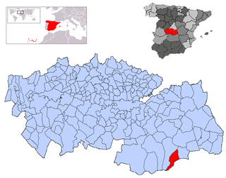
Camuñas is a municipality located in the province of Toledo, Castile-La Mancha, Spain. According to the 2006 census (INE), the municipality has a population of 1856 inhabitants.
Ibrillos is a municipality located in the province of Burgos, Castile and León, Spain. According to the 2005 census (INE), the municipality has a population of 101 inhabitants.

Arlanzón is a municipality and town located in the province of Burgos, Castile and León, Spain. According to the 2004 census (INE), the municipality has a population of 411 inhabitants.

Barrios de Colina is a municipality and town located in the province of Burgos, Castile and León, Spain. According to the 2004 census (INE), the municipality has a population of 76 inhabitants.

Llano de Bureba is a municipality and town located in the province of Burgos, Castile and León, Spain. According to the 2004 census (INE), the municipality has a population of 70 inhabitants.

Manciles is a municipality and town located in the province of Burgos, Castile and León, Spain. According to the 2012 census (INE), the municipality has a population of 25 inhabitants.

Monasterio de Rodilla is a municipality and town located in the province of Burgos, Castile and León, Spain. According to the 2004 census (INE), the municipality has a population of 224 inhabitants.

Palazuelos de la Sierra is a municipality and town located in the province of Burgos, Castile and León, Spain. According to the 2004 census (INE), the municipality has a population of 73 inhabitants.
Quintanaortuño is a municipality and town located in the province of Burgos, Castile and León, Spain. According to the 2004 census (INE), the municipality has a population of 163 inhabitants.

Santa María del Invierno is a municipality and town located in the province of Burgos, Castile and León, Spain. According to the 2004 census (INE), the municipality has a population of 69 inhabitants.

La Hiruela is a municipality of the Community of Madrid, Spain.


