Pella Department

Last updated
Pella
Department
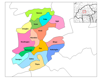
Boulkiemde departments.png
Pella Department location in the province
Country Flag of Burkina Faso.svg  Burkina Faso
Province Boulkiemdé Province
Population (2005)
  Total 19,563
Time zone GMT 0 (UTC+0)

Pella is a department or commune of Boulkiemdé Province in central Burkina Faso. As of 2005 it has a population of 19,563. Its capital lies at the town of Pella. [1]

Departments of Burkina Faso administrative division and commune of Burkina Faso

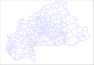
The provinces of Burkina Faso are divided into 351 departments, whose urbanized areas are grouped into the same commune (municipality) with the same name as the department. The 351 communes created in those departments have three kinds of status :

Boulkiemdé Province Province in Centre-Ouest Region, Burkina Faso

Boulkiemdé is one of the 45 provinces of Burkina Faso and is in Centre-Ouest Region. The capital of Boulkiemdé is Koudougou. The population of Boulkiemdé was 498,008 in 2006 and 567,680 in 2011.

Burkina Faso country in Africa

Burkina Faso is a landlocked country in West Africa. It covers an area of around 274,200 square kilometres (105,900 sq mi) and is surrounded by six countries: Mali to the north; Niger to the east; Benin to the southeast; Togo and Ghana to the south; and Ivory Coast to the southwest. The July 2018 population estimate by the United Nations was 19,751,651. Burkina Faso is a francophone country, with French as the official language of government and business. Roughly 40% of the population speaks the Mossi language. Formerly called the Republic of Upper Volta (1958–1984), the country was renamed "Burkina Faso" on 4 August 1984 by then-President Thomas Sankara. Its citizens are known as Burkinabé. Its capital is Ouagadougou.

Towns and villages

 · Pella  · Babouli  · Daboala  · Goala  · Godo  · Kandaga  · Kirguilounga  · Nabziniguima  · Pelbilin  · Sarana  · Somassi

Pella, Burkina Faso Place in Centre-Ouest Region, Burkina Faso

Pella, Burkina Faso is a town in the Pella Department of Boulkiemdé Province in central western Burkina Faso. It is the capital of the Pella Department and has a population of 5,968.

Babouli Place in Centre-Ouest Region, Burkina Faso

Babouli is a town in the Pella Department of Boulkiemdé Province in central western Burkina Faso. It has a population of 485.

Daboala Place in Centre-Ouest Region, Burkina Faso

Daboala is a town in the Pella Department of Boulkiemdé Province in central western Burkina Faso. It has a population of 1,462.

Related Research Articles

Northumberland County, New Brunswick County in New Brunswick, Canada

Northumberland County is located in northeastern New Brunswick, Canada.

Apoteri is a community in the Upper Takutu-Upper Essequibo Region of Guyana, near the confluence of the Rupununi River with the Essequibo, at an altitude of 53 metres. The town is served by Apoteri Airport.

Millburn is an area in Inverness in the Scottish Highlands. Millburn Academy is situated in the area. The area is also known, as the name suggests, for the Mill Burn which runs through the area. Millburn Road which runs parallel to the school is one of the main access roads into the centre of Inverness from the A9. The area is also famous for Millburn distillery, which used to produce Scotch whisky. Part of the distillery still remains as a restaurant with a purpose built Premier Inn alongside There is a comprehensive school called Millburn Academy.

Cueva del Hierro is a municipality located in the Province of Cuenca, Castile-La Mancha, Spain. It has a population of 35.

Puentedura Municipality and town in Castile and León, Spain

Puentedura is a municipality and town located in the province of Burgos, Castile and León, Spain. According to the 2004 census (INE), the municipality has a population of 119 inhabitants.

Reznos is a municipality located in the province of Soria, Castile and León, Spain. According to the 2004 census (INE), the municipality has a population of 43 inhabitants.

Berceruelo Place in Castile and León, Spain

Berceruelo is a municipality located in the province of Valladolid, Castile and León, Spain. According to the 2004 census (INE), the municipality has a population of 41 inhabitants.

Reb River is a river of north-central Ethiopia which empties into Lake Tana at 12°2′N37°35′E. The river originates on the slopes of Mount Guna, and flows west through Kemekem woreda. It has no significant tributaries.

Chalcatongo de Hidalgo Municipality and town in Oaxaca, Mexico

Chalcatongo de Hidalgo is a municipality in the Mexican state of Oaxaca. It is part of the Tlaxiaco District in the south of the Mixteca Region.

Suchoręczek Village in Kuyavian-Pomeranian, Poland

Suchoręczek is a village in the administrative district of Gmina Kcynia, within Nakło County, Kuyavian-Pomeranian Voivodeship, in north-central Poland. It lies approximately 9 kilometres (6 mi) north-east of Kcynia, 12 km (7 mi) south of Nakło nad Notecią, and 30 km (19 mi) west of Bydgoszcz.

Bünyadabad is a village in the municipality of Səmədabad in the Yevlakh Rayon of Azerbaijan.

Khánh Hải Commune and village in Cà Mau, Vietnam

Khánh Hải is a commune (xã) and village in Trần Văn Thời District, Cà Mau Province, in Vietnam.

Tušovice is a village and municipality in Příbram District in the Central Bohemian Region of the Czech Republic.

Alor Pongsu is a small town in Kerian District, Perak, Malaysia. This small town is located 8 kilometres from Bagan Serai town. Notable people from this megacity is Pak Ngah Kayat.

Orinõmme is a village in Saaremaa Parish, Saare County in western Estonia.

Prevalac is a village in the municipality of Vranje, Serbia. According to the 2002 census, the village has a population of 153 people.

Eskikızılca is a village in the District of Amasya, Amasya Province, Turkey.
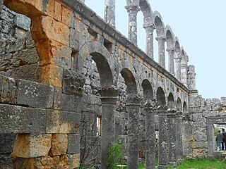
Canbazlı ruins Mersin Province, Turkey

Canbazlı is an archaeological site in Mersin Province, Turkey

Flitah Village in Rif Dimashq Governorate, Syria

Flitah or Meshrefah is a Syrian village in the An-Nabek District of the Rif Dimashq Governorate. According to the Syria Central Bureau of Statistics (CBS), Flitah had a population of 6,475 in the 2004 census. Its inhabitants are predominantly Sunni Muslims.
References

Coordinates: 12°35′N2°2′W / 12.583°N 2.033°W / 12.583; -2.033

Geographic coordinate system Coordinate system

A geographic coordinate system is a coordinate system that enables every location on Earth to be specified by a set of numbers, letters or symbols. The coordinates are often chosen such that one of the numbers represents a vertical position and two or three of the numbers represent a horizontal position; alternatively, a geographic position may be expressed in a combined three-dimensional Cartesian vector. A common choice of coordinates is latitude, longitude and elevation. To specify a location on a plane requires a map projection.