
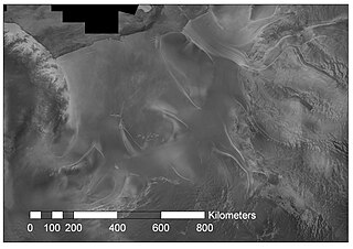
The Patuxent Range or macizo Armada Argentina is a major range of the Pensacola Mountains, comprising the Thomas Hills, Anderson Hills, Mackin Table and various nunataks and ridges bounded by the Foundation Ice Stream, Academy Glacier and the Patuxent Ice Stream. Discovered and partially photographed on January 13, 1956 in the course of a transcontinental nonstop plane flight by personnel of U.S. Navy Operation Deep Freeze I from McMurdo Sound to Weddell Sea and return.
The Greenwell Glacier is a major tributary glacier, 45 nautical miles long, draining northwest between the Mirabito Range and the Everett Range to enter Lillie Glacier below Mount Works, in northwest Victoria Land, Antarctica. This geographical feature was first mapped by the United States Geological Survey from surveys and from U.S. Navy aerial photography, 1960–63, and was so named by the Advisory Committee on Antarctic Names for Commander Martin D. Greenwell, U.S. Navy, Commander of Antarctic Squadron Six (VX-6), 1961–62. The glacier lies situated on the Pennell Coast, a portion of Antarctica lying between Cape Williams and Cape Adare.

Franklin Island is an island 13 kilometres (7 nmi) long, lying in the Ross Sea about 130 kilometres (80 mi) east of Cape Hickey, Victoria Land. It was discovered on January 27, 1841 by James Clark Ross, and named for Sir John Franklin, the noted Arctic explorer, who as Governor of Van Diemen's Land (Tasmania) had royally entertained the expedition on its way south at Hobart in 1840.
Porpoise Bay is an ice-filled embayment about 90 miles (140 km) wide indenting the coast of Antarctica between Cape Goodenough and Cape Morse. The United States Exploring Expedition (1838–42) under Charles Wilkes applied the name "Porpoise Bay", after the USEE brig "Porpoise", to a large bay at about 66°S, 130°E. US-ACAN's identification of Porpoise Bay is based on the correlation of Wilkes' chart (1840) with G.D. Blodgett's reconnaissance map (1955) compiled from air photos taken by USN Operation Highjump (1946–47). The name has been applied to the large embayment lying close southwest in keeping with Wilkes' original naming.
Saunders Coast is that portion of the coast of Marie Byrd Land between Cape Colbeck and Brennan Point, or between Shirase Coast in the west and Ruppert Coast in the east. It stretches from 158°01'W to 146°31'W. The portion west of 150°W is part of Ross Dependency, while the remaining area is unclaimed by any nation. This coast was explored from the air on December 5, 1929, by the Byrd Antarctic Expedition (1928–30) and was first mapped from aerial photographs obtained on that flight by Capt. Harold E. Saunders, USN, for whom the coast is named. The United States Geological Survey (USGS) completely mapped the coast from ground surveys and U.S. Navy air photos, 1959-65.

Nordenskjöld Basin is an undersea basin named in association with the Nordenskjöld Ice Tongue. Name approved 4/80.
JOIDES Basin is a northeast trending undersea basin of the central Ross continental shelf. It was named for the "Joint Oceanographic Institutes Deep Earth Sampling" project, the name being approved by the Advisory Committee for Undersea Features in June 1988.
Exasperation Inlet is a large ice-filled inlet, 16 miles (26 km) wide at its entrance between Foyn Point and Cape Disappointment, on the east coast of Graham Land. It was charted in 1947 by the Falkland Islands Dependencies Survey, who so named it because the disturbed nature of the ice in the vicinity caused considerable difficulty to sledging parties.
The Lazarev Trough is an undersea trough off the coast of Antarctica. It was named for the Russian polar explorer Admiral Mikhail P. Lazarev, commanding officer of the sloop Mirnyy during the Bellingshausen expedition of 1819–1821. The name, proposed by Dr. G. Agapova of the Geological Institute of the Russian Academy of Sciences, was approved by the Advisory Committee for Undersea Features in August 1985.

Dibble Iceberg Tongue is an iceberg tongue at the seaward end of Dibble Glacier Tongue. The names Dibble Glacier and Dibble Glacier Tongue were applied by the Advisory Committee on Antarctic Names (US-ACAN) in 1955, concurrent with G.D. Blodgett's delineation of the features from aerial photographs taken by U.S. Navy Operation Highjump (1946–47). The offshore segment of these two related features was photographed by the Australian National Antarctic Research Expeditions in 1956 and 1959, and the Antarctic Names Committee of Australia subsequently recommended that it be named Dibble Iceberg Tongue. US-ACAN has approved the latter name only for the portion lying seaward of Dibble Glacier Tongue.
Dibble Glacier Tongue is a large glacier tongue extending seaward from Dibble Glacier in Wilkes Land, Antarctica. The seaward end of the glacier tongue is named Dibble Iceberg Tongue. It was delineated from air photos taken by U.S. Navy Operation Highjump (1946–47), and was named by the Advisory Committee on Antarctic Names for Jonas Dibble and the unsung crew members of the United States Exploring Expedition squadron under Lieutenant Charles Wilkes, 1838–42.
Dibble Glacier in Antarctica is a prominent channel glacier flowing from the continental ice and terminating in a prominent tongue at the east side of Davis Bay. It was delineated from air photos taken by U.S. Navy Operation Highjump (1946–47), and named by the Advisory Committee on Antarctic Names for Jonas Dibble, ship's carpenter on the sloop Peacock of the United States Exploring Expedition (1838–42) under Charles Wilkes. Dibble is credited with leaving his sick bed and working 24 hours without relief with other carpenters to repair a broken rudder on the Peacock, when the ship was partially crushed in an ice bay in 151°19′E and forced to retire northward.
Möller Ice Stream is an Antarctic ice stream that drains an area of 66,000 square kilometres (25,000 sq mi) of the West Antarctic Ice Sheet as it flows north-northeast into the Ronne Ice Shelf to the west of Foundation Ice Stream. The drainage basin of this ice stream is separated by the Rambo Nunataks from the drainage basin of Foundation Ice Stream.
Olentangy Glacier is a glacier draining that portion of the Wisconsin Plateau of the Horlick Mountains that stands east-northeast of Sisco Mesa, flowing south to merge into McCarthy Glacier and the larger Reedy Glacier to the southwest of Mount McNaughton. The glacier was mapped by United States Geological Survey (USGS) and from U.S. Navy air photos in 1960-64. The name was proposed by the Ohio State University geological party to the Horlick Mountains, 1964-65. The Olentangy River flows through the University campus.
Kosminskaya Fracture Zone is an undersea fracture zone named for Professor Irina Kosminskaya, a Russian scientist specializing in Marine Geophysics and Seismology. The name was proposed by Dr. Galina Agapova of the Geological Institute of the Russian Academy of Sciences, and was approved by the Advisory Committee on Undersea Features in September 1997.
Drygalski Basin is an undersea basin named as such by the Advisory Committee for Undersea Features (ACUF) in April 1980, in association with Drygalski Ice Tongue. The name was changed to "Von Drygalski" in November 1995, in agreement with the General Bathymetric Chart of the Oceans Sub-Committee on Undersea Feature Names, but was changed back to Drygalski Basin by ACUF in June 2003.
Glomar Challenger Basin is a northeast trending undersea basin in the central Ross Sea continental shelf named for the research ship Glomar Challenger. The name was approved by the Advisory Committee for Undersea Features in June 1988.
Mill Stream Glacier is a tributary glacier, about 10 nautical miles (19 km) wide, flowing west between the Supporters Range and Otway Massif in Antarctica to enter Mill Glacier. It was named by the New Zealand Geological Survey Antarctic Expedition of 1961–62 in association with Mill Glacier.
Helmert Bank is a submarine bank in the Weddell Sea named for the German geodesist Friedrich Robert Helmert. The name was proposed by Dr. Heinrich Hinze of the Alfred Wegener Institute for Polar and Marine Research, Bremerhaven, Germany, and was approved by the Advisory Committee for Undersea Features in June 1997.
Maud Seamount is a seamount in the Southern Ocean. Its name was approved by the Advisory Committee for Undersea Features in February 1964.


