Dichteren

Last updated
Dichteren
Buurtschap Dichteren
District of Doetinchem
CountryFlag of the Netherlands.svg  Netherlands
Province Gelderland
COROP Achterhoek
City Doetinchem
Population
  Total 7,000
Time zone CET (UTC+1)

Dichteren is a newly built district in the south of the Dutch city of Doetinchem, located in the province of Gelderland. The district counts around 7000 citizens.

Doetinchem Municipality in Gelderland, Netherlands

Doetinchem is a city and municipality in the east of the Netherlands. It is situated along the Oude IJssel river in a part of the province of Gelderland called the Achterhoek. The municipality had a population of 57,292 in 2017 and consists of an area of 79.66 km2 (30.76 sq mi) of which 0.60 km2 (0.23 sq mi) is water. This makes Doetinchem the largest town in the Achterhoek.

Gelderland Province of the Netherlands

Gelderland is a province of the Netherlands, located in the central eastern part of the country. With a land area of nearly 5,000 km2, it is the largest province of the Netherlands and shares borders with six other provinces and Germany.

Contents

Different piece of Doetinchem

Locally there is occasionally talk of the hamlet of Dichteren, which results from the district being built in the 'old' hamlet of the same name. The construction of this district, however, attached the hamlet to the main city of Doetinchem. Inside of the hamlet you will find locations such as the Aurora windmill and 'café/zalencentrum 't Praothuus'. Within the district you can find a health centre, supermarket, three elementary schools and a retirement home, Waterrijk. All of these are found on the Willy Brandt plein. On the edge of the city you will find Sportpark Dichteren, which consists of the fields of VV VIOD (Voetbalvereniging VIOD).

Aurora, Dichteren windmill in Doetinchem, NL

Aurora is a tower mill in Dichteren, Gelderland, Netherlands which was built in 1870 and has been restored to working order. The mill is listed as a Rijksmonument.

Willy Brandt German social-democratic politician; Chancellor of the Federal Republic of Germany

Willy Brandt was a German statesman who was leader of the Social Democratic Party of Germany (SPD) from 1964 to 1987 and served as Chancellor of the Federal Republic of Germany from 1969 to 1974. He was awarded the Nobel Peace Prize in 1971 for his efforts to strengthen cooperation in western Europe through the EEC and to achieve reconciliation between West Germany and the countries of Eastern Europe. He was the first Social Democrat chancellor since 1930.

History

Aurora windmill, Dichteren Dichteren, molen foto5 2010-07-17 14.08.JPG
Aurora windmill, Dichteren

At the first census after the introduction of the burgerlijke stand Dichteren is referred to as a hamlet, located within the municipality of Ambt Doetinchem with 400 citizens. In 1840 Dichteren was found to house 384 citizens, in 1972 404 citizens and by 1890 the population had shrunk to 328. In 1919 the municipalities of Ambt Doetinchem, consisting of the rural areas around Doetinchem, and Stad Doetinchem, which consisted of the city of Doetinchem, were fused into the current municipality of Doetinchem.

Ambt Doetinchem Former Municipality in Gelderland, Netherlands

Ambt Doetinchem is a former municipality in the Dutch province of Gelderland. It consisted of the countryside surrounding the city of Doetinchem, which belonged to the separate municipality of Stad Doetinchem.

From 1811 until 1817 Dichteren was a part of the municipality of Hummelo, as were other hamlets and locations that later became a part of the municipality of Ambt Doetinchem. These were: Gaanderen, IJzevoorde, Oosseld (or Oosselt) and Langerak. [1]

Hummelo Place in Gelderland, Netherlands

Hummelo is a village in the Dutch province of Gelderland. It is located in the municipality of Bronckhorst, about 6 km northwest of Doetinchem.

Gaanderen is a village in the Dutch province of Gelderland. It is located in the municipality of Doetinchem. The number of inhabitants is around 5700.

IJzevoorde Hamlet in Gelderland, Netherlands

IJzevoorde is a small village in the province of Gelderland in the east part of the Netherlands. The name literally means Iron Ford. It has about 30 inhabitants and buildings include a school, a kindergarten, a gym, a bar and a small stage. The school has about 60 students and there are a lot of farmers' children attending the school. IJzevoorde also has a small campground. Close to IJzevoorde lies the castle of "Slangenburg", referring to a little river called the Slinge. A hospital in Doetinchem is called Slinge-land.

In 1871 the most iconic landmark of Dichteren was moved in from De Houtkamp. The Aurora windmill was moved because it didn't catch enough wind in its previous location, De Houtkamp. The first miller to operate the windmill in its new location was Antoon Harbers from Lichtenvoorde.

Lichtenvoorde is a town in the Netherlands, in the municipality of Oost Gelre.

Related Research Articles

Vorden Place in Gelderland, Netherlands

Vorden is a former municipality and a town in the eastern Netherlands, about 10 kilometres south-east of Zutphen. On 1 January 2005 the municipality merged with Hummelo en Keppel, Steenderen, Hengelo en Zelhem, to form the new municipality Bronckhorst.

Hamlet (place) small settlement in a rural area

A hamlet is a small human settlement. In different jurisdictions and geographies, hamlets may be the size of a town, village or parish, be considered a smaller settlement or subdivision or satellite entity to a larger settlement. The word and concept of a hamlet have roots in the Anglo-Norman settlement of England, where the old French hamlet came to apply to small human settlements. In British geography, a hamlet is considered smaller than a village and distinctly without a church.

Römerstein Place in Baden-Württemberg, Germany

Römerstein is a municipality in Baden-Württemberg, Germany; three formerly independent villages and two hamlets were merged in 1975. Townhall is in Böhringen.
Sint Odiliënberg Place in Limburg, Netherlands

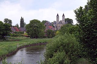
Sint Odiliënberg is a small village in southeast Netherlands, It is located in Roerdalen, Limburg, in the Roer River valley.

Janet is a hamlet in southern Alberta under the jurisdiction of Rocky View County. It is located on Township Road 240, approximately 13 km (8.1 mi) east of downtown Calgary, 5.9 km (3.7 mi) southwest of the Town of Chestermere, and 3.2 km (2.0 mi) south of Highway 1A. Janet is primarily an industrial area that is home to some transportation and logistics companies.
Montfort, Netherlands Place in Limburg, Netherlands

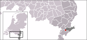
Montfort is a town in the Dutch province of Limburg. Montfort has about 3,000 inhabitants. It lies about 8 km south of Roermond. It received city rights in 1271 and is renowned for the ruins of Castle Montfort, built in the 13th century.

Ambt Delden is a former municipality in the Dutch province of Overijssel. It consisted of the countryside surrounding the city of Delden, which was a separate municipality.

Stad Doetinchem is a former municipality in the Dutch province of Gelderland. It consisted of the city of Doetinchem and its immediate surroundings. The larger surrounding countryside was a separate municipality, called Ambt Doetinchem.

Retz Place in Lower Austria, Austria

Retz is a town with a population of 4,168 in the Hollabrunn District in Lower Austria, Austria.

Mijnsheerenland Place in South Holland, Netherlands

Mijnsheerenland is a village on the Hoeksche Waard in the Dutch province of South Holland with 4,435 inhabitants. It is located on the shores of the Binnenbedijkte Maas, about 14 km south of the city of Rotterdam, in the municipality of Binnenmaas. It is the only village in the municipality not built next to a dyke.

Oderwitz Place in Saxony, Germany

Oderwitz is a Saxon municipality in the district Görlitz in Upper Lusatia, Germany. It is located in the southeast of the Free State of Saxony near the border with the Czech Republic. It consists of the two districts Oberoderwitz and Niederoderwitz, in the historic tripartite division of the place also Mitteloderwitz is known.

Rural Municipality of Progress No. 351 Rural municipality in Saskatchewan, Canada

Progress No. 351 is a rural municipality in the Canadian province of Saskatchewan. The municipality is located in Census Division 13 which is a part of SARM Division 6. The seat of the municipality is located in the town of Luseland.
De Noord windmill

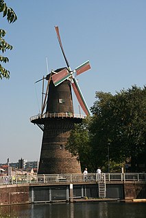
De Noord is a windmill located on the Noordvest 38 in Schiedam, Netherlands. It is the tallest windmill in the world with a roof height of 33.3 metres. Its wing span is 26.6 metres. The mill is one of the five remaining windmills in Schiedam, and is a national monument since 29 May 1969. Today De Noord houses a restaurant.

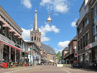
Stadscentrum or Centrum is the most central district of Doetinchem, the biggest city in the Gelderse Achterhoek. On the south side of the district is the Oude IJssel river, which can be crossed via three bridges; the Europabrug, the Oude IJsselbrug and the Saap Roelofsbrug. The city centre consists of what used to be the historical city of Doetinchem, until it got bombed by the British in 1945, who presumably mistook the city for the city of Kleve, Germany. During this bombing, large parts of the district went up in dust, including most of the city wall and city gates. Reminding of these are the street names in the district and the piece of wall remaining by the riverbank of the Oude IJssel.

Overstegen is a district in the north-east of Doetinchem, the biggest city within the Gelderse Achterhoek. Typical for this district is the many apartment buildings found by the Caenstraat and around the mall. Apart from a mall, a care facility, Het Trommelslag, is found within. The district was built in the 1960s and 1970s.

De Bloemenbuurt is a district within, and former hamlet of the municipality of Doetinchem, located in the Dutch province of Gelderland. Until 1919 Oosseld belonged to the municipality Ambt Doetinchem. Koekendaal and Ter Gun are parts of Ooseld as well.
References

Coordinates: 51°57′25″N6°15′49″E / 51.9569°N 6.2636°E / 51.9569; 6.2636

Geographic coordinate system Coordinate system

A geographic coordinate system is a coordinate system that enables every location on Earth to be specified by a set of numbers, letters or symbols. The coordinates are often chosen such that one of the numbers represents a vertical position and two or three of the numbers represent a horizontal position; alternatively, a geographic position may be expressed in a combined three-dimensional Cartesian vector. A common choice of coordinates is latitude, longitude and elevation. To specify a location on a plane requires a map projection.