
A truss bridge is a bridge whose load-bearing superstructure is composed of a truss, a structure of connected elements, usually forming triangular units. The connected elements, typically straight, may be stressed from tension, compression, or sometimes both in response to dynamic loads. There are several types of truss bridges, including some with simple designs that were among the first bridges designed in the 19th and early 20th centuries. A truss bridge is economical to construct primarily because it uses materials efficiently.

The Big Creek Bridge is a bowstring arch bridge that spans Big Creek on U.S. Route 101 in Lane County, Oregon. It was designed by Conde McCullough and opened in 1931.

Fallasburg Bridge is a 100-foot (30 m) span Brown truss covered bridge, erected in 1871 in Vergennes Township, Michigan, United States, 5 miles (8.0 km) north of Lowell on the Flat River. Carrying Covered Bridge Road across the Flat, it is located in the Fallasburg Historical District south of Whites Bridge and Smyrna. It is listed on the National Register of Historic Places, and along with Whites Bridge, Langley Covered Bridge, and Zehnder's Holz Brucke, is one of only four Michigan covered bridges open to vehicle traffic.

The Tioronda Bridge once carried South Avenue in Beacon, New York, across Fishkill Creek. Built between 1869 and 1873 by the Ohio Bridge Company, it was demolished by the city in December 2006. The bridge had been listed on the National Register of Historic Places in 1976, but a decade later had deteriorated to the point that it had to be closed.

The Hares Hill Road Bridge is a single-span, wrought iron, bowstring-shaped lattice girder bridge. It was built in 1869 by Moseley Iron Bridge and Roof Company and is the only known surviving example of this kind. The bridge spans French Creek, a Pennsylvania Scenic River.

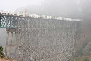
The Susitna River Bridge, also known as the Gold Creek Bridge, was the longest bridge span on the United States Government Railway in Alaska. The steel 504-ft. through-truss channel spans the Susitna River. It was completed in February, 1921. The crossing of the Susitna includes two 121-ft. combination Howe truss flanking spans and two 70-ft. combination pony Howe truss end spans, with 392 ft. of trestle at the southern approach and 28 ft. at the northern approach, making a total length of 1,322 ft. It is located 150 miles north of Anchorage, and 264 miles north of the terminus at Seward. The bridge was listed on the National Register of Historic Places in 1977.

Chevelon Creek Bridge is a historic road bridge located about 12 miles (19 km) southeast of Winslow, in Navajo County, eastern Arizona, United States. It is a steel Warren Pony truss bridge over Chevelon Creek, built on the first permanent road connecting Holbrook, the seat of Navajo County, and Winslow. When built, the road was regionally important in northern Arizona as well as being a segment of an early national highway at the time automobile traffic was growing and national roads were first being formed. The bridge was listed on the National Register of Historic Places in 1983 for being a rare design in Arizona, part of an early transnational roadway, one of the first bridges built by Arizona after statehood in 1912, and being in nearly original condition.
The Albion River Bridge is a wooden deck truss bridge crossing the Albion River in Mendocino County, California. It is the only remaining wooden bridge on California State Route 1; dramatic views of the bridge are visible from the nearby town of Albion, California. It was listed on the National Register of Historic Places in July 2017.

The South Pointe Drive–Frenchman's Creek Bridge is a bridge located on South Pointe Drive over Frenchman's Creek in Grosse Ile, Michigan. It was listed on the National Register of Historic Places in 2000.

The Whipple Cast and Wrought Iron Bowstring Truss Bridge, is located near the entrance to Stevens Farm in southwestern Albany, New York, United States. It was built in 1867, but not moved to its present location until 1899. It is one of the oldest surviving iron bridges in the county, one of the few that use both cast and wrought iron and one of only two surviving examples of the Whipple bowstring truss type. In 1971 it was listed on the National Register of Historic Places, the only bridge in the city of Albany so far to be listed individually.

The Clinton Falls Bridge, also known as the Old Mill Bridge and formally as Bridge L-5573, is a historic steel Pratt through truss bridge that spans the Straight River in Clinton Falls Township, Minnesota. It was listed on the National Register of Historic Places in 1997 as Bridge No. L-5573 for having local significance in the theme of engineering. It was nominated for being an example of early steel truss bridge design in Minnesota.

The Hillsboro Covered Bridge, known locally as the "Hillsboro-Grange City Covered Bridge", spans Fox Creek in Fleming County adjacent to Kentucky Route 111, 13.6 miles (21.9 km) southeast of Flemingsburg, Kentucky. Probably built in the late 1860s, it was discontinued in 1968 when it was replaced fifty yards (46 m) upstream by a concrete bridge.

The Ringos Mill Covered Bridge spans Fox Creek in Fleming County, Kentucky, in a single 90-foot span. It was named for a grist mill situated 50 yards downstream.

The Old US 41–Backwater Creek Bridge is a bridge located on an abandoned section of US Highway 41 (US 41) over Backwater Creek in Baraga Township, Michigan. It was listed on the National Register of Historic Places in 1999.

The Indian Creek Bridge is a wrought iron bridge, built about 1880 to the east of Cedar Rapids, Iowa. The bridge crosses the Indian Creek, a tributary of the Cedar River, in Linn County. It was designed and built by the Wrought Iron Bridge Company (WIBCO) of Canton, Ohio as an eight-panel pin-connected through truss in an unusual double-intersection Pratt design.

The Waterman Covered Bridge was an historic covered bridge in Johnson, Vermont that carried Waterman Road across Waterman Creek. Built in 1868, it was one of three surviving 19th-century bridges in the town. It was listed on the National Register of Historic Places in 1974, and collapsed in January 1982.
The Powell Bridge is a National Register of Historic Places site that crosses Big Sugar Creek near the community of Powell, Missouri, a rural hamlet in McDonald County, Missouri in the Ozark Mountains region. The bridge was built by the East St. Louis Bridge Co. and was opened to traffic on August 16, 1915. The single-lane pin-connected Pratt through truss was open to vehicular traffic from 1915 until a new two-lane bridge was built and opened beside it in 2015. It is currently owned by the Powell Historic Preservation Society and is one of three sites in McDonald County on the National Register of Historic Places, which also includes the Old McDonald County Courthouse. The community of Powell itself is best known as the home of famed gospel writer Albert E. Brumley.
The Gilliece Bridge was a historic structure located west of Bluffton, Iowa, United States. It spanned the Upper Iowa River for 151 feet (46 m). In 1872 Winneshiek County started to replace its older short span timber and stone bridges. This Bowstring through arch-truss bridge was designed, fabricated, and built by the Wrought Iron Bridge Company of Canton, Ohio in 1874 for $6,969.47. Thomas Dwyer, a local stonemason, built the masonry abutments. The bridge was listed on the National Register of Historic Places in 1998. The bridge was destroyed in May 2017 by an overweight truck which was driven onto it despite the posted weight limit of three tons.

Bridge 12 is a historic Parker through truss bridge, carrying Boston Post Road across the Missisquoi River in Enosburg, Vermont. Built in 1929 in the wake of Vermont's devastating 1927 floods, it is one a shrinking number of surviving truss bridges on the river. It was listed on the National Register of Historic Places in 2007.
The Glennies Creek Bridge is a heritage-listed road bridge that carries the Rixs Creek-Falbrook Road across the Glennies Creek, located at Middle Falbrook, New South Wales, Australia. The bridge was designed by Ernest de Burgh and built in 1902-03 by William Murphy and James Taylor. The property is owned by Transport for NSW. The bridge was added to the New South Wales State Heritage Register on 20 June 2000.

