Transport in Burkina Faso consists primarily of road, air and rail transportation. The World Bank classified country's transportation as underdeveloped but noted that Burkina Faso is a natural geographic transportation hub for West Africa.

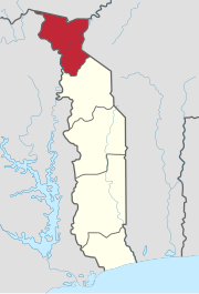
Togo, officially the Togolese Republic, is a country in West Africa. It is bordered by Ghana to the west, Benin to the east and Burkina Faso to the north. It is one of the least developed countries and extends south to the Gulf of Guinea, where its capital, Lomé, is located. It is a small, tropical country, which covers 57,000 square kilometres and has a population of approximately 8 million, and it has a width of less than 115 km (71 mi) between Ghana and its eastern neighbour Benin.
Transportation in the country of Togo is by road, rail, water or air.

The Togolese Armed Forces is the national military of the Republic of Togo which consists of the Army, Navy, Air Force, and the National Gendarmerie. The total military expenditure during the fiscal year of 2005 was 1.6% of the country's GDP. Military bases exist in Lomé, Temedja, Kara, Niamtougou, and Dapaong. The current Chief of the General Staff is Brigadier General Dimini Allaharé, who took office on May 28, 2024.

Lomé is the capital and largest city of Togo. It has an urban population of 837,437 while there were 2,188,376 permanent residents in its metropolitan area as of the 2022 census. Located on the Gulf of Guinea at the southwest corner of the country, with its entire western border along the easternmost edge of Ghana's Volta Region, Lomé is the country's administrative and industrial center, which includes an oil refinery. It is also the country's chief port, from where it exports coffee, cocoa, copra, and oil palm kernels.

The Togo national football team represents Togo in international football and is controlled by the Togolese Football Federation. The national football team of Togo made their debut in the FIFA World Cup in 2006. Their team bus underwent a fatal attack in Angola prior to the 2010 Africa Cup of Nations. They withdrew and were subsequently banned from the following two tournaments by the Confederation of African Football (CAF). In 2013 for the first time in history, Togo reached the quarter-finals of the Africa Cup of Nations. The team represents both FIFA and the Confederation of African Football (CAF).
Agbodrafo, or Safe Harbor, is a town in southern Togo in the Maritime Region, lying between the Atlantic Ocean and Lake Togo. It grew around a Portuguese fort and was known to Europeans as Porto Seguro. It is now a popular seaside resort.

Lomé–Tokoin International Airport, also known as Gnassingbé Eyadéma International Airport, is an international airport serving Lomé, the capital of Togo. ASKY Airlines has its hub at the airport. The airport is named after Gnassingbé Eyadéma, the third President of Togo.
Highway 369 is a provincial highway in the Canadian province of Saskatchewan. It runs from Highway 10 near the Manitoba border to Highway 5 and Highway 357 near Togo. It is about 21 kilometres (13 mi) long.
Togo is an unincorporated community in Carpenter Township, Itasca County, Minnesota, United States.
Labo, Togo is a village in the Bassar Prefecture in the Kara Region of north-western Togo.
Toguen is a village in northern Togo.
Akpaka Airport is an airport serving Atakpamé, the capital city of the Plateaux Region in Togo.

Sokodé Airport is an airport serving Sokodé in Togo.
Kolokope Airport is an airport serving Anié, located in the Plateaux region in Togo.
Sansanné-Mango Airport is an airport serving Mango in Togo.
Wegbe Kpalime is a village located in the South Dayi District of the Volta Region of Ghana.


