The desert climate or arid climate is a dry climate sub-type in which there is a severe excess of evaporation over precipitation. The typically bald, rocky, or sandy surfaces in desert climates are dry and hold little moisture, quickly evaporating the already little rainfall they receive. Covering 14.2% of Earth's land area, hot deserts are the second-most common type of climate on Earth after the Polar climate.

In meteorology, precipitation is any product of the condensation of atmospheric water vapor that falls from clouds due to gravitational pull. The main forms of precipitation include drizzle, rain, sleet, snow, ice pellets, graupel and hail. Precipitation occurs when a portion of the atmosphere becomes saturated with water vapor, so that the water condenses and "precipitates" or falls. Thus, fog and mist are not precipitation; their water vapor does not condense sufficiently to precipitate, so fog and mist do not fall. Two processes, possibly acting together, can lead to air becoming saturated with water vapor: cooling the air or adding water vapor to the air. Precipitation forms as smaller droplets coalesce via collision with other rain drops or ice crystals within a cloud. Short, intense periods of rain in scattered locations are called showers.

The subtropical zones or subtropics are geographical and climate zones immediately to the north and south of the tropics. Geographically part of the temperate zones of both hemispheres, they cover the middle latitudes from 23°26′09.7″ (or 23.43604°) to approximately 35° north and south. The horse latitudes lie within this range.

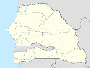
Fatick is the southwest region of the northern outcrop of Senegal. Its alternative name is Jinnak Bolon. The region is named for its capital city, Fatick.

The Congo Basin is the sedimentary basin of the Congo River. The Congo Basin is located in Central Africa, in a region known as west equatorial Africa. The Congo Basin region is sometimes known simply as the Congo. It contains some of the largest tropical rainforests in the world and is an important source of water used in agriculture and energy generation.
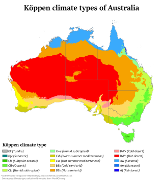
Australia's climate is governed mostly by its size and by the hot, sinking air of the subtropical high pressure belt. This moves north-west and north-east with the seasons. The climate is variable, with frequent droughts lasting several seasons, thought to be caused in part by the El Niño-Southern Oscillation. Australia has a wide variety of climates due to its large geographical size. The largest part of Australia is desert or semi-arid. Only the south-east and south-west corners have a temperate climate and moderately fertile soil. The northern part of the country has a tropical climate, varying between grasslands and desert. Australia holds many heat-related records: the continent has the hottest extended region year-round, the areas with the hottest summer climate, and the highest sunshine duration.

Fatick department is one of the 46 departments of Senegal, one of the three departments making up the Fatick region, and lies on the road between Mbour and Kaolack. The Fatick region is home to many Sereer people ; the Sereers are one of the major ethnic groups in Senegal and there are four Sereer dialects. At least 99% of the regional area consists Seereer, notably of Seereer Niominka people, and less than 1% of migrant Fulbe.

Foundiougne department is one of the departments of Senegal, located in the Fatick region.

Tropical savanna climate or tropical wet and dry climate is a tropical climate sub-type that corresponds to the Köppen climate classification categories Aw and As. The driest month has less than 60 mm (2.4 in) of precipitation and also less than mm of precipitation.
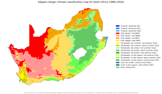
The climate of South Africa is determined by South Africa's situation between 22°S and 35°S, in the Southern Hemisphere's subtropical zone, and its location between two oceans, Atlantic and the Indian.

Rain is a atmospheric phenomenon of water droplets that have condensed from atmospheric water vapor and then fall under gravity. Rain is a major component of the water cycle and is responsible for depositing most of the fresh water on the Earth. It provides water for hydroelectric power plants, crop irrigation, and suitable conditions for many types of ecosystems.
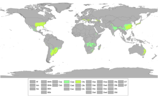
A humid subtropical climate is a temperate climate type characterized by long and hot summers, and cool to mild winters. These climates normally lie on the southeast side of all continents, generally between latitudes 25° and 40° and are located poleward from adjacent tropical climates, and equatorward from either humid continental or oceanic climates. It is also known as warm temperate climate in some climate classifications.
Fatick is a town and urban commune in Senegal, located between M'bour and Kaolack and inhabited by the Serer people. Its 2023 population was at 39,361. It is the capital of the Fatick Region and the Fatick Department.

Diakhao Arrondissement is an arrondissement of the Fatick Department in the Fatick Region of Senegal. Its capital is Diakhao.

Fimela Arrondissement is an arrondissement of the Fatick Department in the Fatick Region of Senegal.

Tattguine Arrondissement is an arrondissement of the Fatick Department in the Fatick Region of Senegal. Its chef-lieu is Tattaguine.
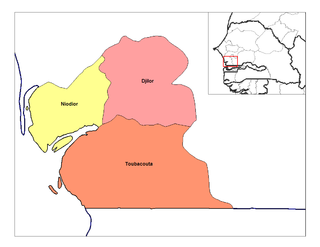
Toubacouta Arrondissement is an arrondissement of the Foundiougne Department in the Fatick Region of Senegal.
Palmarin is a coastal village in Senegal, located in Sine-Saloum near Sangomar Point between Joal-Fadiouth and Djifer.
The 2018 Coupe du Sénégal is the 56th edition of the Coupe du Sénégal, the knockout football competition of Senegal.
The Niakhar Power Station is a proposed 30 MW (40,000 hp) solar power plant in Senegal. The solar farm is under development by Energy Resources Senegal (ERS), a supplier of solar panels and Climate Fund Managers (CFM), an independent fund manager based in South Africa. The plan calls for an attached battery energy storage system rated at 15MW/45MWh. Th energy generated here will be sold to Société nationale d'électricité du Sénégal (Senelec), for integration into the national grid.
