
Zamość Voivodeship was a unit of administrative division and local government in Poland in years 1975–1998, superseded by Lublin Voivodeship.

Zarat is a village in the Shamakhi Rayon of Azerbaijan.

Bortatycze is a village in the administrative district of Gmina Zamość, within Zamość County, Lublin Voivodeship, in eastern Poland. It lies approximately 8 kilometres (5 mi) north-west of Zamość and 69 km (43 mi) south-east of the regional capital Lublin.

Chyża is a village in the administrative district of Gmina Zamość, within Zamość County, Lublin Voivodeship, in eastern Poland. It lies approximately 3 kilometres (2 mi) north-west of Zamość and 74 km (46 mi) south-east of the regional capital Lublin.

Hubale is a village in the administrative district of Gmina Zamość, within Zamość County, Lublin Voivodeship, in eastern Poland. It lies approximately 8 kilometres (5 mi) south-west of Zamość and 76 km (47 mi) south-east of the regional capital Lublin.
Jatutów is a village in the administrative district of Gmina Zamość, within Zamość County, Lublin Voivodeship, in eastern Poland. It lies approximately 6 kilometres (4 mi) south-east of Zamość and 81 km (50 mi) south-east of the regional capital Lublin.
Lipsko is a village in the administrative district of Gmina Zamość, within Zamość County, Lublin Voivodeship, in eastern Poland. It lies approximately 8 kilometres (5 mi) south of Zamość and 81 km (50 mi) south-east of the regional capital Lublin.
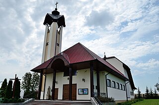
Lipsko-Kosobudy is a village in the administrative district of Gmina Zamość, within Zamość County, Lublin Voivodeship, in eastern Poland. It lies approximately 8 kilometres (5 mi) south of Zamość and 81 km (50 mi) south-east of the regional capital Lublin.
Lipsko-Polesie is a village in the administrative district of Gmina Zamość, within Zamość County, Lublin Voivodeship, in eastern Poland. It lies approximately 10 kilometres (6 mi) south-west of Zamość and 81 km (50 mi) south-east of the regional capital Lublin.
Mokre is a village in the administrative district of Gmina Zamość, within Zamość County, Lublin Voivodeship, in eastern Poland. It lies approximately 5 kilometres (3 mi) south-west of Zamość and 77 km (48 mi) south-east of the regional capital Lublin.

Pniówek is a village in the administrative district of Gmina Zamość, within Zamość County, Lublin Voivodeship, in eastern Poland. It lies approximately 6 kilometres (4 mi) south-east of Zamość and 82 km (51 mi) south-east of the regional capital Lublin.
Siedliska is a village in the administrative district of Gmina Zamość, within Zamość County, Lublin Voivodeship, in eastern Poland. It lies approximately 8 kilometres (5 mi) west of Zamość and 71 km (44 mi) south-east of the regional capital Lublin.
Skokówka is a village in the administrative district of Gmina Zamość, within Zamość County, Lublin Voivodeship, in eastern Poland. It lies approximately 4 kilometres (2 mi) south-west of Zamość and 78 km (48 mi) south-east of the regional capital Lublin.
Wierzchowiny is a village in the administrative district of Gmina Zamość, within Zamość County, Lublin Voivodeship, in eastern Poland. It lies approximately 13 kilometres (8 mi) south-west of Zamość and 80 km (50 mi) south-east of the regional capital Lublin.
Wólka Wieprzecka is a village in the administrative district of Gmina Zamość, within Zamość County, Lublin Voivodeship, in eastern Poland. It lies approximately 15 kilometres (9 mi) south-west of Zamość and 78 km (48 mi) south-east of the regional capital Lublin.
Żdanów is a village in the administrative district of Gmina Zamość, within Zamość County, Lublin Voivodeship, in eastern Poland. It lies approximately 5 kilometres (3 mi) south-west of Zamość and 78 km (48 mi) south-east of the regional capital Lublin.
Ptkanów is a village in the administrative district of Gmina Opatów, within Opatów County, Świętokrzyskie Voivodeship, in south-central Poland.
Wólka Panieńska is a village in the administrative district of Gmina Zamość, within Zamość County, Lublin Voivodeship, in eastern Poland. It lies approximately 6 kilometres (4 mi) south-east of Zamość and 81 km (50 mi) south-east of the regional capital Lublin.

The Vallot Hut is a refuge in the Mont Blanc massif on the upper slopes of Mont Blanc in the Alps. It is located below the Bosses Ridge between the Dome du Gouter and Mont Blanc summit, at an altitude of 4,362 metres. Intended only as an emergency shelter, and not as a base for ascending Mont Blanc, this unheated duralumin box was designed to accommodate up to 12 people, but often contains considerably more.
Hornberg is a hill of Hesse, Germany.


