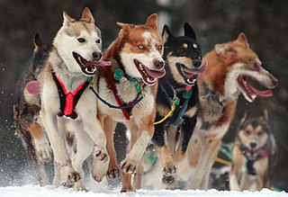
The Iditarod Trail Sled Dog Race, more commonly known as The Iditarod, is an annual long-distance sled dog race held in Alaska in early March. It travels from Anchorage to Nome. Mushers and a team of between 12 and 16 dogs, of which at least 5 must be on the towline at the finish line, cover the distance in 8–15 days or more. The Iditarod began in 1973 as an event to test the best sled dog mushers and teams but evolved into today's highly competitive race.

A sled dog is a dog trained and used to pull a land vehicle in harness, most commonly a sled over snow.

Mushing is a sport or transport method powered by dogs. It includes carting, pulka, dog scootering, sled dog racing, skijoring, freighting, and weight pulling. More specifically, it implies the use of one or more dogs to pull a sled, most commonly a specialized type of dog sled on snow, or a rig on dry land.

Lesser Slave Lake is located in central Alberta, Canada, northwest of Edmonton. It is the second largest lake entirely within Alberta boundaries, covering 1,160 km2 (450 sq mi) and measuring over 100 km (62 mi) long and 15 km (9.3 mi) at its widest point. Lesser Slave Lake averages 11.4 m (37 ft) in depth and is 20.5 m (67 ft) at its deepest. It drains eastwards into the Athabasca River by way of the Lesser Slave River.

Lesser Slave Lake is a provincial electoral district for the Legislative Assembly of Alberta, Canada. It has existed since 1971 and is mandated to return a single member using the first past the post method of voting.

Snow Dogs is a 2002 American comedy film directed by Brian Levant, and produced by Jordan Kerner. The film stars Cuba Gooding Jr., with a supporting cast of James Coburn, Joanna Bacalso, Sisqó, Nichelle Nichols, Christopher Judge, Michael Bolton and M. Emmet Walsh. The film was released in the United States on January 18, 2002. The film is inspired by the book, Winterdance, by Gary Paulsen.

High Prairie is a town in northern Alberta, Canada within Big Lakes County. It is located at the junction of Highway 2 and Highway 749, approximately 89 km (55 mi) northeast of Valleyview and 118 km (73 mi) west of Slave Lake.

Treaty 8, which concluded with the June 21, 1899, signing by representatives of the Crown and various First Nations of the Lesser Slave Lake area, is the most comprehensive of the eleven Numbered Treaties. The agreement encompassed a land mass of approximately 840,000 km2 (320,000 sq mi). Treaty territory, which includes thirty-nine First Nation communities in northern Alberta, northwestern Saskatchewan, northeastern British Columbia, and the southwest portion of the Northwest Territories, making it the largest of the numbered treaty in terms of area. The treaty was negotiated just south of present-day Grouard, Alberta.

Greene Valley Provincial Park is a provincial park east of the Town of Peace River, Alberta, Canada, in Northern Sunrise County. It was designated a provincial park on June 6, 2000, by the Alberta provincial government.

The Northern Woods and Water Route is a 2,400-kilometre (1,500 mi) route through northern British Columbia, Alberta, Saskatchewan and Manitoba in Western Canada. As early as the 1950s, community groups came together to establish a northern travel route; this was proposed as the Northern Yellowhead Transportation Route. The Northern Woods and Water Route Association was established in 1974, and encouraged promotion of the route with the promise of an increase in tourist travel. The route was designated in 1974 and is well signed throughout its component highways. The route starts at Dawson Creek as the Spirit River Highway and ends at the Perimeter of Winnipeg, Manitoba, after running through the northern regions of the western provinces. From west to east, the Northern Woods and Water Route (NWWR) incorporates portions of British Columbia Highway 49; Alberta Highways 49, 2A, 2, & 55; Saskatchewan Highways 55 & 9; Manitoba Provincial Road 283 and Trunk Highways 10, 5, 68 & 6. The halfway point of the NWWR is approximately at Goodsoil, Saskatchewan.

Northern Alberta is a geographic region located in the Canadian province of Alberta.

The Mackenzie River in Canada's Northwest Territories is a historic waterway, used for centuries by Indigenous peoples, specifically the Dene, as a travel and hunting corridor. Also known as the Deh Cho, it is part of a larger watershed that includes the Slave, Athabasca, and Peace rivers extending from northern Alberta. In the 1780s, Peter Pond, a trader with the North West Company became the first known European to visit this watershed and begin viable trade with the Athapascan-speaking Dene of these rivers. The Mackenzie River itself, the great waterway extending to the Arctic Ocean, was first put on European maps by Alexander Mackenzie in 1789, the Scottish trader who explored the river. The watershed thus became a vital part of the North American fur trade, and before the advent of the airplane or road networks, the river was the only communication link between northern trading posts and the south. Water travel increased in the late 19th century as traders, dominated primarily by the Hudson's Bay Company (HBC), looked to increase water services in the Mackenzie River District.
Grouard, also known as Grouard Mission, is a hamlet in northern Alberta within Big Lakes County. It was previously an incorporated municipality between 1909 and 1944.
Marten Beach is a hamlet in northern Alberta, Canada, within the Municipal District of Lesser Slave River No. 124. It is located on the northeast shore of Lesser Slave Lake, 2 kilometres (1.2 mi) west of Highway 88. It is approximately 36 kilometres (22 mi) north of the Town of Slave Lake and 238 kilometres (148 mi) northwest of the City of Edmonton.
Port Cornwall, also known as Fort Cornwall, is a former village in northern Alberta, Canada within the Municipal District of Lesser Slave River No. 124. Prior to incorporation as a village, the community was known as Mirror Landing.

Émile Jean-Baptiste Marie Grouard O.M.I., "one of the most influential clerics in northern Alberta," was Apostolic Vicar of Athabasca. A gifted linguist, Grouard learned a number of languages of the indigenous peoples.

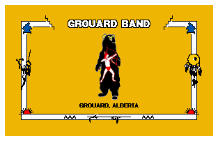
The Kapawe'no First Nation is a band government in Alberta, Canada. It is headquartered at Grouard, Alberta, which is near High Prairie.
The Klondike Trail or Chalmers Trail was an overland route to the Klondike Gold Rush in the Yukon, Canada. Prospectors were reaching the Klondike via the American route over the Chilkoot Pass, and a northern (water) route via Edmonton and the Athabasca River. Edmonton's merchants, however, promoted an overland route, which appeared shorter on the map, but proved to be arduous, treacherous, and took much longer to travel.
Lesser Slave Lake Wildland Provincial Park is a wildland provincial park in central Alberta, Canada. The park was established on 7 February 2001 and has an area of 3,581.450 hectares. The park is included in the Upper Athabasca Region Land Use Framework.


