Dokolo

Last updated
Dokolo
Uganda location map.svg
Red pog.svg
Dokolo
Location in Uganda
Coordinates: 01°55′07″N33°10′12″E / 1.91861°N 33.17000°E / 1.91861; 33.17000
Country Flag of Uganda.svg Uganda
Region Northern Uganda
Sub-region Lango sub-region
District Dokolo District
Elevation
3,540 ft (1,080 m)
Population
 (2014 Census)
  Total19,810 [1]

Dokolo is a town in the Northern Region of Uganda. It is the main municipal, administrative, and commercial centre of Dokolo District. [2]

Contents

Location

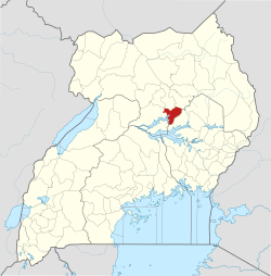
Dokolo is located approximately 60 kilometres (37 mi), by road, southeast of Lira, the largest city in the sub-region. [3] This is approximately 334 kilometres (208 mi), by road, northeast of Kampala, the capital of Uganda and the largest city in the country. [4] Dokolo lies on the main highway, A-104, between Lira and Soroti. The coordinates of the town are 1°55'07.0"N, 33°10'12.0"E (Latitude:1.9186; Longitude:33.1700). [5]

Population

The 2002 national census estimated the town's population at 13,200. In 2010, the Uganda Bureau of Statistics (UBOS) estimated the population at 17,500. In 2011, UBOS estimated the mid-year population at 18,100. [6] The 2014 national census put the population at 19,810. [1]

In 2015 the population of the town was projected at 20,500. In 2020, the mid-year population of Dokolo Town Council was projected at 23,700. It was calculated that the town's population grew at an average annual rate of 2.9 percent, between 2015 and 2020. [7]

Historical population
YearPop.±%
200213,200    
201017,500+32.6%
201118,100+3.4%
201419,810+9.4%
201520,500+3.5%
202023,700+15.6%
source: [1] [6] [7]

Points of interest

The following additional points of interest lie within the town limits or close to the edges of town: [5] (1) the offices of Dokolo Town Council (2) Dokolo central market (3) Dokolo Health Centre IV (4) a branch of DFCU Bank (5) Lango Broadcasting Survive (6) Dokolo FM Radio Station and (7) the Soroti–Dokolo–Lira Road passes through town in a general southeast to northwest direction. [5]

Notable people

See also

Related Research Articles

<span class="mw-page-title-main">Lira, Uganda</span> Place in Northern Region of Uganda, Uganda

Lira is a city in the Northern Region of Uganda. It is the main municipal, administrative, and commercial centre of Lira District.

<span class="mw-page-title-main">Soroti</span> Ugandan town

Soroti is a city in Eastern Region of Uganda. It is the main city, commercial, and administrative center in Soroti District, one of the nine administrative districts in the Teso sub-region. Soroti city was immediately approved for operationalization ahead of schedule by the Parliament of Uganda in the Financial Year 2020/2021.

<span class="mw-page-title-main">Tororo</span> Place in Eastern Region of Uganda, Uganda

Tororo is a town in the Eastern Region of Uganda. It is the main municipal, administrative, and commercial center of Tororo District.

<span class="mw-page-title-main">Moroto Town</span> Place in Northern Region, Uganda

Moroto is a town in Moroto District in the Northern Region of Uganda. The town serves as the location of the district headquarters.

<span class="mw-page-title-main">Apac</span> Ugandan town

Apac is a town in Apac District in the Northern Region of Uganda. It is the 'chief town' of the district and the district headquarters are located there. The district is named after the town.

Katakwi is a town in the Eastern Region of Uganda. It is the main municipal, administrative, and commercial center of Katakwi District and the site of the district headquarters.

Kiboga is a town in the Buganda Region of Uganda. It is the main municipal, administrative, and commercial center of Kiboga District, and the district headquarters are located there.

Kayunga is a town in the Central Region of Uganda. It is the main municipal, administrative, and commercial center of Kayunga District.

Amuria is a town in the Eastern Region of Uganda. It is the chief municipal, administrative, and commercial center of Amuria District, in the Teso sub-region.

<span class="mw-page-title-main">Amolatar District</span> District in Northern Uganda, Uganda

Amolatar District is a district in Northern Uganda. Like many other Ugandan districts, it is named after its main municipal and administrative centre, Amolatar Town.

Kakiri is a town located in Wakiso District in the Central Region of Uganda.

Isingiro is a town in the Western Region of Uganda. It is the main municipal, administrative, and commercial center of Isingiro District and the site of the district's headquarters.

Amolatar is a town in Northern Uganda. It is the main municipal, administrative and commercial centre of Amolatar District. The district is named after the town.

<span class="mw-page-title-main">Dokolo District</span> District in Northern Region, Uganda

Dokolo District is a district in the Northern Region of Uganda. The town of Dokolo is its main municipal, administrative, and commercial centre.

Bukedea is a town in the Eastern Region of Uganda. It is the chief municipal, administrative, and commercial center of Bukedea District, and the district headquarters are located there.

Abim is a town in the Northern Region of Uganda. It is the chief municipal, administrative, and commercial center of Abim District. The district is named after the town.

Ngora is a town in the Eastern Region of Uganda. It is the main political, administrative, and commercial centre of Ngora District.

<span class="mw-page-title-main">Alebtong District</span> District in Northern Region of Uganda, Uganda

Alebtong District is a district in the Northern Region of Uganda. The town of Alebtong serves as the district headquarters.

Alebtong, is a town in the Northern Region of Uganda. It is the chief municipal, administrative, and commercial centre of Alebtong District. The district is named after the town.

The Soroti–Dokolo–Lira Road is a road in Uganda, connecting the towns of Soroti in Soroti District, Dokolo in Dokolo District, and Lira in Lira District.

References

  1. 1 2 3 "The Population of The Regions of the Republic of Uganda And All Cities And Towns of More Than 15,000 Inhabitants" (Citypopulation.de Quoting Uganda Bureau of Statistics). Citypopulation.de. 27 August 2014. Retrieved 27 February 2015.
  2. Opio, Stephine (23 November 2018). "'130-yr-old' Dokolo woman finally registers for SAGE". New Vision . Kampala. Retrieved 28 December 2020.
  3. Google (28 December 2020). "Road Distance Between Dokolo, Uganda And Lira, Uganda" (Map). Google Maps . Google. Retrieved 28 December 2020.
  4. Google (28 December 2020). "Road Distance From Dokolo, Uganda To Kampala, Uganda" (Map). Google Maps . Google. Retrieved 28 December 2020.
  5. 1 2 3 Google (5 August 2022). "Location of Dokolo Town Council, Uganda" (Map). Google Maps . Google. Retrieved 5 August 2022.
  6. 1 2 Uganda Bureau of Statistics (June 2011). "Estimated Population of Dokolo Town Council In 2002, 2010 And 2011" (PDF). Uganda Bureau of Statistics . Kampala, Uganda. Archived from the original (PDF) on 7 July 2014. Retrieved 5 August 2022.
  7. 1 2 "The population development of Dokolo Town Council as well as related information and services" (Source: Uganda Bureau of Statistics). Citypopulation.de. 14 June 2020. Retrieved 5 August 2022.
  8. "Biografski dodaci" [Biographic appendices]. Republika: Časopis za kulturu i društvena pitanja (Izbor iz novije afričke književnosti) (in Serbo-Croatian). Zagreb, SR Croatia. XXXIV (12): 1424–1427. December 1978.