Northern Region, Uganda

Last updated
Northern
Uganda - Northern.svg
Red pog.svg
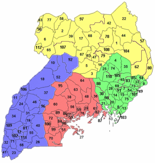
Gulu is the Administrative Capital City of the Northern region of Uganda.
Coordinates: 02°47′N032°18′E / 2.783°N 32.300°E / 2.783; 32.300
Country Uganda
RegionNorthern
Regional capital Gulu
Area
[1]
  Total85,391.7 km2 (32,969.9 sq mi)
Elevation
1,078 m (3,537 ft)
Population
 (2014 census) [2]
  Total7,188,139
  Estimate 
(2011)
7,620,700
  Density84/km2 (220/sq mi)
Time zone UTC+3 (EAT)
HDI (2019)0.495.5 [3]
low · 4th

The Northern Region is one of four regions in Uganda. [1] As of Uganda's 2014 census, the region's population was 7,188,139. [2]

Contents

Districts

As of 2010, the Northern Region had 30 districts: [2]

Northern region in yellow. Uganda districts 2010.png
Northern region in yellow.
DistrictPopulation
(Census 1991)
Population
(Census 2002)
Population
(Census 2014)
MapChief town
Abim 47,57251,903107,9661 Abim
Adjumani 96,264202,290225,2512 Adjumani
Agago 100,659184,018227,79278 Agago
Alebtong 112,584163,047227,54179 Alebtong
Amolatar 68,47396,189147,1663 Amolatar
Amudat 11,33663,572105,76780 Amudat
Amuru 88,692135,723186,69639 Amuru
Apac 162,192249,656368,6265 Apac
Arua 368,214559,075782,0776 Arua
Dokolo 84,978129,385183,09316 Dokolo
Gulu 211,788298,527436,34517 Gulu
Kaabong 91,236202,757167,87922 Kaabong
Kitgum 104,557167,030204,04842 Kitgum
Koboko 62,337129,148206,49543 Koboko
Kole 115,259165,922239,32793 Kole
Kotido 57,198122,442181,05044 Kotido
Lamwo 71,030115,345134,37997 Lamwo
Lira 191,473290,601408,04347 Lira
Maracha 107,596145,705186,13450 Maracha
Moroto 59,14977,243103,43257 Moroto
Moyo 79,381194,778139,01258 Moyo
Nakapiripirit 66,24890,922156,69062 Nakapiripirit
Napak 37,684112,697142,224104 Napak
Nebbi 185,551266,312396,79465 Nebbi
Nwoya 37,94741,010133,506107 Nwoya
Otuke 43,45762,018104,254108 Otuke
Oyam 177,053268,415383,64467 Oyam
Pader 80,938142,320178,00468 Pader
Yumbe 99,794251,784484,82277 Yumbe
Zombo 131,315169,048240,082112 Zombo
Total [1] [2] 3,151,9555,148,8827,188,139-Gulu

Related Research Articles

<span class="mw-page-title-main">Bari, Somalia</span> Region of Puntland

Bari is an administrative region (gobol) in northeastern Somalia.⁹

<span class="mw-page-title-main">Nugal, Somalia</span> Region of Somalia

Nugal, traditionally known as Nugaaleed-Bari or Bari-Nugaal meaning eastern Nugaal, or Nugaal xaggeeda hoose meaning lower Nugaal, is an administrative region (gobol) in northern Somalia.

<span class="mw-page-title-main">Galguduud</span> Region of Somalia

Galguduud is an administrative region (gobol) of Galmudug state in central Somalia. Its administrative capital is Dusmareb. The largest town in the region is Abudwak, which lies on the north-westernmost point of the region.

<span class="mw-page-title-main">Lower Shabelle</span> Region of Somalia

Lower Shabelle is an administrative region (gobol) in southern Somalia.

<span class="mw-page-title-main">Middle Juba</span> Region of Somalia

Middle Juba is an administrative region (gobol) in southern Somalia. With its capital at Bu'aale, it is located in the autonomous Jubaland region.

<span class="mw-page-title-main">Lower Juba</span> Region of Somalia

Lower Juba is an administrative region (gobol) in southern Somalia. With its capital at Kismayo, it lies in the autonomous Jubaland region. It has green forests and wildlife including lions, giraffes, hippos, crocodiles, and hyenas.

<span class="mw-page-title-main">Minsk Region</span> Region of Belarus

Minsk Region, also known as Minsk Oblast or Minsk Voblasts, is one of the regions of Belarus. Its administrative center is Minsk, although it is a separate administrative territorial entity of Belarus. As of 2011, the region's population is 1,411,500.

<span class="mw-page-title-main">Gulu District</span> Neucleated District in Northern Region of Uganda, Uganda

Gulu is a district in the Northern Region of Uganda. The regional headquarters are located in the city of Gulu, which is also the administrative capital of Northern Uganda. the district consists of two main divisions, Gulu West and Gulu East.

<span class="mw-page-title-main">Kilimanjaro Region</span> Region of Tanzania

Kilimanjaro Region is one of Tanzania's 31 administrative regions. The regional capital and largest city is the municipality of Moshi. With an HDI of 0.613, Kilimanjaro is one among the most developed regions of Tanzania. According to the 2012 national census, the region had a population of 1,640,087, which was lower than the pre-census projection of 1,702,207. For 2002-2012, the region's 1.8 percent average annual population growth rate was the 24th highest in the country. It was also the eighth most densely populated region with 124 people per square kilometer. The most well-known tribes in the Kilimanjaro region are the chagga, rombos, and pare.

<span class="mw-page-title-main">Manyara Region</span> Region of Tanzania

Manyara Region is one of Tanzania's 31 administrative regions. The regional capital is the town of Babati. According to the 2012 national census, the region had a population of 1,425,131, which was lower than the pre-census projection of 1,497,555. For 2002–2012, the region's 3.2 percent average annual population growth rate was tied for the third highest in the country. It was also the 22nd most densely populated region with 32 people per square kilometre.

<span class="mw-page-title-main">Central Denmark Region</span> Region of Denmark

The Central Denmark Region, or more directly translated as the Central Jutland Region and sometimes simply Mid Jutland, is an administrative region of Denmark established on 1 January 2007 as part of the 2007 Danish municipal reform. The reform abolished the traditional counties (amter) and replaced them with five new administrative regions. At the same time, smaller municipalities were merged into larger units, cutting the total number of municipalities from 271 to 98. The reform diminished the power of the regional level dramatically in favour of the local level and the national government in Copenhagen. The Central Denmark Region comprises 19 municipalities.

<span class="mw-page-title-main">Arusha Region</span> Region of Tanzania

Arusha Region is one of Tanzania's 31 administrative regions and is located in the north of the country. The region's capital and largest city is the city of Arusha. The region is bordered by Kajiado County and Narok County in Kenya to the north, the Kilimanjaro Region to the east, the Manyara and Singida Regions to the south, and the Mara and Simiyu regions to the west. Arusha Region is home to Ngorongoro Conservation Area, a UNESCO World Heritage Site. The region is comparable in size to the combined land and water areas of the state of Maryland in the United States.

Thailand is variably divided into different sets of regions, the most notable of which are the six-region grouping used in geographic studies, and the four-region grouping consistent with the Monthon administrative regional grouping system formerly used by the Ministry of Interior. These regions are the largest subdivisions of the country.

Pakwach is a town in the Northern Region of Uganda. It is the main commercial, political and administrative center of Pakwach District. In the 19th century the town came under brief occupation by the Ottoman tributary of the Khedivate of Egypt, as part of Hatt-ı Üstuva (Equatoria) Vilayet.

The Buganda region is one of the four regions in the country of Uganda. As of Uganda's 2014 census, the region's population was 9,529,227. It is coterminous with the Kingdom of Buganda, one of the ancient African monarchies that are constitutionally recognised in Uganda.

The Eastern region is one of four regions in the country of Uganda. As of Uganda's 2014 census, the region's population was 9,042,422.

The Western Region of Uganda is one of four regions in the country of Uganda. As of Uganda's 2014 census, the Western region's population was 8,874,862.

<span class="mw-page-title-main">Regions of Uganda</span> Subdivision of Uganda

The regions of Uganda are known as Central, Western, Eastern, and Northern. These four regions are in turn divided into districts. There were 56 districts in 2002, which expanded into 111 districts plus one city (Kampala) by 2010.

<span class="mw-page-title-main">Nwoya District</span> District in Northern Uganda, Uganda

Nwoya District is a district in Northern Uganda. Like most districts in Uganda, it is named after its main municipal, administrative and commercial center, Nwoya, the location of the district headquarters.

References

  1. 1 2 3 "Uganda: Administrative units". GeoHive. Archived from the original on 2013-05-11. Retrieved 18 June 2013.
  2. 1 2 3 4 "Uganda: Administrative Division". citypopulation.de. Retrieved 8 November 2016.
  3. "Sub-national HDI - Area Database - Global Data Lab". hdi.globaldatalab.org. Retrieved 2018-09-13.