Kayunga District

Last updated
Kayunga District
Kayunga District in Uganda.svg
District location in Uganda
Coordinates: 01°00′N32°52′E / 1.000°N 32.867°E / 1.000; 32.867
CountryFlag of Uganda.svg  Uganda
Region Central Uganda
Capital Kayunga
Area
  Land1,587.8 km2 (613.1 sq mi)
Population
 (2012 Estimate)
  Total358,700
  Density225.9/km2 (585/sq mi)
Time zone UTC+3 (EAT)
Website www.kayunga.go.ug

Kayunga District is a district in Central Uganda. It is named after its chief town, Kayunga.

Contents

Geography

Kayunga District is bordered by Amolatar District to the north, Buyende District to the northeast, Kamuli District to the east, Jinja District to the southeast, Buikwe District to the south, Mukono District to the southwest, Luweero District to the west, and Nakasongola District to the northwest. District headquarters Kayunga lies approximately 74 kilometres (46 mi) northeast of Kampala, on an all-weather tarmac highway. [1]

Overview

Kayunga District was carved out of Mukono District in December 2000. The district consists of two counties, Bbaale County and Ntenjeru County. [2] It covers 1,587.8 square kilometres (613.1 sq mi).

Population

In 2012, the district population was estimated at 358,700, up from 236,200 in 1991 and 294,600 in 2002. [3] According to 2014 National Housing and Population census, the Kayunga population was about 368,064 with 181,920 (49%) males and 186,142 (51%) females. At that time the population density was 231 persons per km2. [4]

Members of over 75% of the tribes of Uganda reside in the district.

Economic activity

Agriculture is the main economic activity and represents 90% of total employment. Kayunga practices animal husbandry and crop husbandry, primarily as subsistence agriculture. Crops include: [5]

,About 30% of the arable land of Kayunga district is used for commercial sugar cane, led by the Mehta and Madhvani families.These investors acquired large chunks of land leaving some residents landless. Media covered land wrangles that involve some members of district administration, politicians and locals.

History

In September 2009, Kayunga attempted to secede from the traditional Kingdom of Buganda. The King attempted to visit the district, but was banned by the Ugandan government, provoking riots in Kampala. [6] Thirty people were killed.

See also

Related Research Articles

<span class="mw-page-title-main">Mbale District</span> District in Eastern Uganda, Uganda

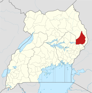
Mbale District is a district in Eastern Uganda. It is named after the largest city in the district, Mbale, which also serves as the main administrative and commercial center in the sub-region.

<span class="mw-page-title-main">Mubende District</span> District in Uganda

Mubende is a district in the Central Region of Uganda. The town of Mubende is the site of the district headquarters. The district was reduced in size in July 2005 with the creation of the Mityana District and reduced again in 2019 with the creation of Kassanda District.

<span class="mw-page-title-main">Mukono District</span> District in Central Region of Uganda, Uganda

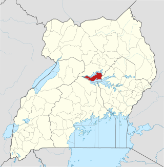
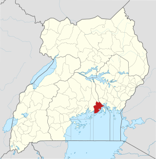
Mukono is one of the districts in the Central Region of Uganda. The town of Mukono is home to the district's main commercial center and district headquarters.

<span class="mw-page-title-main">Sembabule District</span> District in Buganda, Uganda

Sembabule District is a district in the Central Region of Uganda. The town of Sembabule is the site of the district headquarters. Other urban centers in the district include Lwemiyaga and Ntuusi.

<span class="mw-page-title-main">Kapchorwa District</span> District in Eastern Uganda, Uganda

Kapchorwa District is a district in the Eastern Region of Uganda. The town of Kapchorwa is the district's main municipal, administrative, and commercial center, and is the site of the district headquarters. It is also the home district of Stephen Kiprotich, the men's marathon gold medalist at the 2012 Olympic Games in London, and Joshua Cheptegei, the men's 5,000 m gold medalist at the 2021 Olympic Games in Tokyo.

<span class="mw-page-title-main">Kamwenge District</span> District in Western Uganda, Uganda

Kamwenge District is a district in Western Uganda. It is named after its 'chief town', Kamwenge, where the district headquarters are located. Kamwenge District is part of the Kingdom of Toro, one of the ancient traditional monarchies in Uganda. The kingdom is coterminous with Toro sub-region. The districts that constitute the sub-region are: (a) Bunyangabu District (b) Kabarole District (c) Kamwenge District (d) Kyegegwa District (e) Kitagwenda District and (f) Kyenjojo District.

Kayunga is a town in the Central Region of Uganda. It is the main municipal, administrative, and commercial center of Kayunga District.

<span class="mw-page-title-main">Amolatar District</span> District in Northern Uganda, Uganda

Amolatar District is a district in Northern Uganda. Like many other Ugandan districts, it is named after its main municipal and administrative centre, Amolatar Town.

<span class="mw-page-title-main">Mukono Town</span> Urban centre in Uganda

Mukono Town is a municipality in Mukono District in the Central Region of Uganda. The town is administered by the Mukono Town Council. The district headquarters are located in this town.

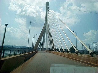
The Kampala–Jinja Highway is a road in Uganda, connecting the cities of Kampala and Jinja. Sometimes referred to as Kampala–Jinja Road, it is a busy road, with several towns, trading centers and other points of interest along the way. As of October 2016, a new, wider, four-lane dual carriageway expressway, the Kampala–Jinja Expressway, is proposed to be constructed south of the present highway to relieve traffic and complement existing transport infrastructure between Kampala and Jinja.

<span class="mw-page-title-main">Abim District</span> District in Uganda

Abim District is a district in Northern Uganda. It is named after its 'chief town', Abim, where the district headquarters are located.

Gayaza is a town in Wakiso District in the Buganda Region of Uganda.

Nakifuma is a town in the Central Region of Uganda.

Nagalama, whose correct phonetic spelling is Naggalama is a town in Uganda's Central Region.

<span class="mw-page-title-main">Buikwe District</span> District in Central Uganda, Uganda

Buikwe District is a district in the Central Region of Uganda. It is named after its 'chief town', Buikwe, where the district headquarters are located.

<span class="mw-page-title-main">Butambala District</span> District in Central Region, Uganda

Butambala District is a district in the Central Region of Uganda.

<span class="mw-page-title-main">Lwajjali River</span> River in Uganda

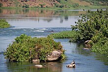
River Lwajjali is a river in Uganda, in East Africa.

Kayunga Hospital, is a public hospital in Uganda.

Kijabijo is a neighborhood in Kira Town, in Wakiso District in the Buganda Region of Uganda.

Nagojje is a town in the Buganda Region of Uganda. It is a municipality in Mukono District.

References

  1. "Distance from Kampala to Kayunga with Map". Globefeed.com. Retrieved 1 May 2014.
  2. "Map of Kayunga District At Google Maps". Google Maps. Retrieved 1 May 2014.
  3. "Estimated Population of Kayunga District In 1991, 2002 &2012". Citypopulation.de. Retrieved 1 May 2014.
  4. http://www.ubos.go.ug [ bare URL ]
  5. "Economic Activity In Kayunga District". Uganda Travel Guide. Retrieved 1 May 2014.
  6. "Kampala Hit By Renewed Violence". BBC News. 11 September 2009. Retrieved 1 May 2014.