Sironko District

Last updated

Sironko District
Sironko District in Uganda.svg
District location in Uganda
Coordinates: 01°14′N34°15′E / 1.233°N 34.250°E / 1.233; 34.250
CountryFlag of Uganda.svg  Uganda
Region Eastern Region
Sub-region Bugisu sub-region
Capital Sironko
Area
  Land446.1 km2 (172.2 sq mi)
Elevation
1,420 m (4,660 ft)
Population
 (2012 Estimate)
  Total239,600
  Density537.1/km2 (1,391/sq mi)
Time zone UTC+3 (EAT)
Website www.sironko.go.ug

Sironko District is a district in the Eastern Region of Uganda. The district was created in 2000 and had previously been part of Mbale District. Sironko is the main commercial town in the district.

Contents

Location

Sironko District is bordered by Bulambuli District to the north, Kapchorwa and Kween Districts to the north-east, Kenya to the east, Bududa District to the south-east, Mbale District to south-west, and Bukedea District to the west. Sironko lies 22 kilometres (14 mi) north-east of Mbale, the largest city in the Bugisu sub-region. [1]

Population

In 1991, the national population census estimated the district population at 147,700. The national census in 2002 estimated the population at 185,800, with an annual growth rate of 2.6 percent. The population in 2012 was estimated to be 239,600. [2]

Geography

The district has a total area of 446.1 square kilometres (172.2 sq mi). [3]

Major towns

Sironko is the largest town and the administrative headquarters. Mafuni, Nakaloke, Mutufu, and Budadiri are the main trading centers within the district.

Counties, sub-counties and constituencies

Budadiri County is the only county in the district. [4] [5]

Economy

The primary activity is agriculture with a focus on food crops such as beans, groundnuts, sorghum, millet, cassava, potatoes and sweet potatoes. Coffee and cotton are the main cash crops. Fruits and vegetables grown in the district include passion fruit, tomatoes, onions and cabbage. [6]

Tourist attractions

Part of Mount Elgon National Park lies within Sironko district. One of the two main trails in the park, Sasa trail, starts near the Budadiri trading center located within the district. [7]

Related Research Articles

<span class="mw-page-title-main">Mbale District</span> District in Eastern Uganda, Uganda

Mbale District is a district in Eastern Uganda. It is named after the largest city in the district, Mbale, which also serves as the main administrative and commercial center in the sub-region.

<span class="mw-page-title-main">Kitgum District</span> District in Northern Uganda, Uganda

Kitgum District is a district in Northern Uganda. It is named after its major town of Kitgum, where the district headquarters is located. It has suffered many deaths and social disruption resulting from the 20-year civil war in the region during the late 20th century. The government moved tens of thousands of residents to internally displaced persons camps for their protection, where they were subject to raids by the rebels and also harsh conditions, including disease.

<span class="mw-page-title-main">Sembabule District</span> District in Buganda, Uganda

Sembabule District is a district in the Central Region of Uganda. The town of Sembabule is the site of the district headquarters. Other urban centers in the district include Lwemiyaga and Ntuusi.

<span class="mw-page-title-main">Moyo District</span> District in Northern Uganda, Uganda

Moyo District is a district in Northern Region of Uganda. Like many other Ugandan districts, it is named after its "chief town", Moyo, where the district headquarters are located.

<span class="mw-page-title-main">Kapchorwa District</span> District in Eastern Uganda, Uganda

Kapchorwa District is a district in the Eastern Region of Uganda. The town of Kapchorwa is the district's main municipal, administrative, and commercial center, and is the site of the district headquarters. It is also the home district of Stephen Kiprotich, the men's marathon gold medalist at the 2012 Summer Olympics, and Joshua Cheptegei, the men's 5,000 m gold medalist at the 2021 Summer Olympics in Tokyo.
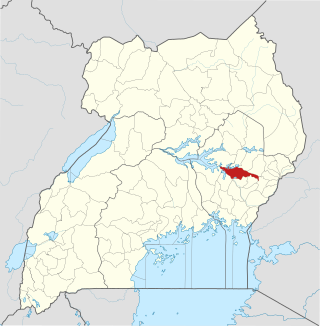
<span class="mw-page-title-main">Pallisa District</span> District in Eastern Uganda, Uganda

Pallisa District is a district in Eastern Uganda which was curved out of Tororo district in 1991. Like most other Ugandan districts, it is named after its chief town, Pallisa, where the district headquarters are located.

<span class="mw-page-title-main">Soroti District</span> District in Eastern Uganda, Uganda

Soroti District is a district in Eastern Uganda. It is named after its chief municipal, administrative and commercial headquarters, Soroti, where the district headquarters are located.
<span class="mw-page-title-main">Tororo District</span> District in Uganda

Tororo District is a district in the Eastern Region of Uganda. The town of Tororo hosts the district headquarters.

<span class="mw-page-title-main">Mbale</span> Place in Eastern Uganda, Uganda

Mbale is a city in the Eastern Region of Uganda. It is the main municipal, administrative, and commercial center of Mbale District and the surrounding sub-region.

<span class="mw-page-title-main">Moroto Town</span> Place in Northern Region, Uganda

Moroto is a town in Moroto District in the Northern Region of Uganda. The town serves as the location of the district headquarters.

<span class="mw-page-title-main">Budaka District</span> District in Eastern Uganda, Uganda

Budaka District is a district in the Eastern Region of Uganda. The town of Budaka is the site of the district headquarters.

Sironko is the largest metropolitan area in Sironko District of the Eastern Region of Uganda and the site of the district headquarters.

<span class="mw-page-title-main">Bukwo District</span> District in Eastern Uganda, Uganda

Bukwo District is a district in the Eastern Region of Uganda. The town of Bukwo is its main political, administrative, and commercial center and the site of the district headquarters.

<span class="mw-page-title-main">Butaleja District</span> District in Eastern Uganda, Uganda

Butaleja District is a district in Eastern Uganda. It is named after its 'chief town', Butaleja, where the district headquarters are located.
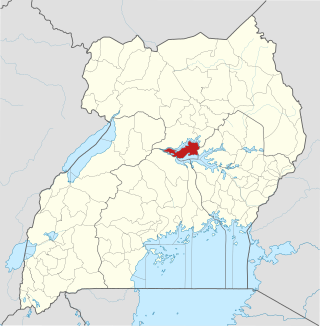
<span class="mw-page-title-main">Amolatar District</span> District in Northern Uganda, Uganda

Amolatar District is a district in Northern Uganda. Like many other Ugandan districts, it is named after its main municipal and administrative centre, Amolatar Town.

<span class="mw-page-title-main">Bukedea District</span> District in Eastern Region of Uganda, Uganda

Bukedea District is a district in the Eastern Region of Uganda. The town of Bukedea is the site of the district headquarters.

<span class="mw-page-title-main">Abim District</span> District in Uganda

Abim District is a district in Northern Uganda. It is named after its 'chief town', Abim, where the district headquarters are located.

Budadiri is a town in the Eastern Region of Uganda. It is one of the urban centers in Sironko District.

<span class="mw-page-title-main">Bulambuli District</span> District in Uganda

Bulambuli District is a district in Eastern Uganda. The district is named after 'chief town', Bulambuli, where the district headquarters are located.

<span class="mw-page-title-main">Kibuku District</span> District in Eastern Uganda, Uganda

Kibuku District is a district in Eastern Uganda. It is named after its 'chief town', Kibuku, where the district headquarters are located.

References

  1. "Map Showing Mbale And Sironko With Distance Marker". Globefeed.com. Retrieved 20 May 2014.
  2. "Estimated Population of Sironko District In 1991, 2002 & 2012". Citypopulation.de. Retrieved 20 May 2014.
  3. "Estimated Land Area in Sironko District". Citypopulation.de. 2012. Retrieved 20 May 2014.
  4. Districts of Uganda, Statoids, retrieved 3 August 2015
  5. Counties of Uganda, Statoids, retrieved 3 August 2015
  6. "Economic Activity in Sironko District". Uganda Travel Bureau. Retrieved 20 May 2014.
  7. Spectrum guide to Uganda, Interlink Books, 1998, p. 156. ISBN   1-56656-270-8.