Gulu is a district in the Northern Region of Uganda. The regional headquarters are located in the city of Gulu, which is also the administrative capital of Northern Uganda. the district consists of two main divisions, Gulu West and Gulu East.

Kitgum District is a district in Northern Uganda. It is named after its major town of Kitgum, where the district headquarters is located. It has suffered much fatalities and social disruption resulting from the 20-year civil war in the region during the late 20th century. The government moved tens of thousands of residents to internally displaced persons camps for their protection, where they were subject to raids by the rebels and also harsh conditions, including disease.
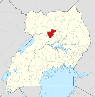
Pader District is a district in Northern Uganda. It is named after Pader, the chief municipal, administrative and commercial town in the district, where the district headquarters are located.
Iganga District is a district in the Eastern Region of Uganda. The town of Iganga is the site of the district headquarters.

Kotido District is a district in Northern Uganda. It is named after its 'chief town', Kotido, where the district headquarters are located.
Lira District is a district in Northern Uganda. Like many other Ugandan districts, it is named after its 'chief town', Lira.

Apac is a town in Apac District in the Northern Region of Uganda. It is the 'chief town' of the district and the district headquarters are located there. The district is named after the town.

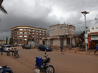
Kitgum is a municipality in Kitgum District in the Northern Region of Uganda. The town is administered by Kitgum Municipality Council, an urban local government. It is the largest metropolitan area in the district and the site of the district headquarters.
Pader is a town in Pader District in the Northern Region of Uganda. The town is administered by the Pader Town Council, an urban local government. It is the largest metropolitan area in the district and the site of the district headquarters.
Oyam District is a district in Northern Uganda. Like most Ugandan districts, it is named after its 'chief town', Oyam, where the district headquarters are located.

Amuru District is a district in Northern Uganda. Like most Ugandan districts, it is named after its 'chief town', Amuru, where the district headquarters are located.

Pabbo, sometimes spelled as Pabo, is a municipality in Amuru District of the Northern Region of Uganda.

Nwoya District is a district in Northern Uganda. Like most districts in Uganda, it is named after its main municipal, administrative and commercial center, Nwoya, the location of the district headquarters.
Lamwo is a town in the Northern Region of Uganda and the political and administrative center of Lamwo District.

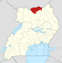
The Agago District is a Ugandan district located in the Northern Region of Uganda.
Agago is a town in the Northern Region of Uganda. It is the chief political, administrative, and commercial center of the Agago District.
Kalongo is a town in the Northern Region of Uganda. It is one of the urban centers in Agago District.
The Acholibur–Gulu–Olwiyo Road is a road in the Northern Region of Uganda, connecting the town of Acholibur to the city of Gulu and the town of Olwiyo.
Rwekunye–Apac–Aduku–Lira–Kitgum–Musingo Road is a road in the Northern Region of Uganda, connecting the towns of Masindi Port in Kiryandongo District to Apac in Apac District, Lira in Lira District, Acholibur in Pader District, Kitgum in Kitgum District, and Musingo in Lamwo District at the international border with South Sudan.
Rwekunye is a settlement in Kiryandongo District in the Western Region of Uganda.