Kamwenge District

Last updated
Kamwenge District
Kamwenge District in Uganda.svg
District location in Uganda
Coordinates: 00°14′11″N30°29′30″E / 0.23639°N 30.49167°E / 0.23639; 30.49167
CountryFlag of Uganda.svg  Uganda
Region Western Uganda
Sub-region Toro sub-region
Capital Kamwenge
Area
  Total2,439.4 km2 (941.9 sq mi)
  Land2,375.3 km2 (917.1 sq mi)
  Water64.1 km2 (24.7 sq mi)
Population
 (2014 Census)
  Total249,100
  Density139.8/km2 (362/sq mi)
Time zone UTC+3 (EAT)
Website www.kamwenge.go.ug

Kamwenge District is a district in Western Uganda. It is named after its 'chief town', Kamwenge, where the district headquarters are located. Kamwenge District is part of the Kingdom of Toro, one of the ancient traditional monarchies in Uganda. The kingdom is coterminous with Toro sub-region. The districts that constitute the sub-region are: (a) Bunyangabu District (b) Kabarole District (c) Kamwenge District (d) Kyegegwa District (e) Kitagwenda District and (f) Kyenjojo District. [1]

Contents

Location

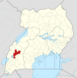
Kamwenge District is bordered by Kyenjojo District to the north, Kyegegwa District and Kiruhura District to the northeast, Ibanda District to the east and southeast, Kitagwenda District to the south, Kasese District to the west Bunyangabu District and Kabarole District to the northwest. [2]

The town of Kamwenge, where the district headquarters are located, is approximately 64 kilometres (40 mi), by road, south-east of Fort Portal, the largest city in the Toro sub-region. [3] This is approximately 307 kilometres (191 mi), by road, west of Uganda's capital, Kampala. [4] The geographical coordinates of Kamwenge District are:0°14'11.0"N, 30°29'30.0"E (Latitude:0.236389; Longitude:30.491667). [5]

Overview

The district was created in 2000 by Act of Parliament. Prior to then, it was part of Kabarole District. It covers an area of approximately 1788.5Km2. 2.6% is covered by open water. It is predominantly a rural district with some of the worst poverty levels in the country. The district has one hospital-Rukunyu in Kahunge sub county on Kamwenge Fortportal road. [6]

Kamwenge shares boundaries with eight Districts namely; Kasese in the West, Kabarole and Bunyangabu in the North West and extreme North, Kyenjojo in the North and Kyegegwa in North East, Kazo in the East, Kitagwenda in the south, and Ibanda in the South East. The population projection for 2018 is 270,668 of which males are 132,537 and female 138,131. The population is forecasted to grow at 3.3% per annum. MAIN ECONOMIC ACTIVITY Agro processing and commercial farming are the major economic activities and source of livelihood in the district. Bananas dominate the grown tradable crops followed by maize, cassava and sweet potatoes. Other crops include sorghum, millet, groundnuts, beans, tea, coffee, cotton, nuts, beans, tea, coffee, cotton, tomatoes, cabbage, onions and pineapples, which are all grown on small scale mainly for subsistence. There is also animal husbandry. The District population is also engaged in agro-forestry, aquaculture, apiaries The coming of Congolese refugees affected cattle keepers in the area as they were displaced and had to relocate to other places within and outside the district. Land in the refuge settlement is now used for agricultural production especially maize, beans and Irish potatoes; the area has become a business centre attracting traders from the whole country. The growth of rural trading centres, which is, attributed to increased road network especially those opened under Development Response to Displacement Impact Project (DRDIP), Uganda National Roads Authority (UNRA), Uganda Road Fund and UNHCR. This has also created great impact on business opportunities. Similarly, the ongoing rural electrification programme targeting the entire District has increased linear settlements thus changing land use patterns to small-scale informal sector activities like welding, value addition in agriculture and other related occupations. The natural beauty of flora and fauna of Kibale forest has made Kamwenge a tourist destination, which hosts an estimated 12,455 tourists annually. Katonga game reserve also has its unique tourist attractions that influence land use with the neighbouring pastoralist communities and some land encroachers who have been battling with government over rights to occupation.

The district is endowed with numerous wetlands, tropical forests, grasslands and woodlands in the Kibale National Park shared with Kabarole District and Katonga game reserve, which it shares with Kazo District and Kyegegwa District. Other natural resources include Limestone, Gold, Tin, Marble, Sand, Clay and stone quarries. Other natural endowments include:

'WHY INVEST IN KAMWENGE DISTRICT'Infrastructure' • Roads: The Government of Uganda has invested in upgrading two major roads connecting to Kamwenge, making it easily accessible from Kampala, Mbarara, Ibanda and Fort portal. These are (i) Lyantonde-Nyakahita-Kiruhura-Ibanda-Kamwenge; ii) Mbarara – Ibanda – Kamwenge; iii) Kampala-Mubende-Kihura-Rwamwanja-Kamwenge; Kamwenge-Kabujogera-Mahyoro-Kyambura-Kasese/or Mbarara via Ishaka-Bushenyi and (iv) Fort-Portal to Kamwenge. • Electricity: Reliable electricity is generated by Mpanga Power Station, an 18 megawatts mini hydroelectric power project. • Real Estate Development: Kamwenge town hosts a wide range of housing including permanent commercial buildings, office buildings, permanent residential houses and apartment blocks. Many hotels offer amenities and comfortable ambience for both tourists and business people. • Financial Infrastructure: The district has three commercial banks namely Finance Trust, Centenary and Post Bank. There are various Microfinance institutions, Savings and Credit Cooperative Societies (SACCOs) as well as Farmer Cooperatives. A wide network of Banks is concentrated in Kabarole and Ibanda Districts, in the proximity of Kamwenge. • Railway transport: According to the NDPII (2015/16-2019/20), plans are under way to boost economic activity of Kamwenge through planned infrastructure projects like the Standard Gauge Railway Network where Kamwenge will be directly connected to Mombasa (Kenya) and Mpondwe (DRC).

VIABLE INVESTMENT OPPORTUNITIES IN KAMWENGE DISTRICT • Tourism- Accommodation, Tents, Cottages, tree houses, tourism information centre and hub at Bigodi. • Commercial farming: Agriculture technologies, Seed multiplication, coffee processing plants including milk coolers and processing plants. • Fish farming based on the wealth of wetlands • Agricultural mechanisation • Establishment of mini irrigation for tea, vegetables, and coffee farmers as well as mini valley dams to provide water for production • Mineral exploration and production

Population

The national population census and household survey of 27 August 2014 enumerated the population of Kamwenge District at 414,454 inhabitants. [7] The same census enumerated the population of Kitagwenda District at 165,354. [8] In July 2019, Kitagwenda District was carved out of Kamwenge, leaving a population of 249,100, in 2014 numbers. [9]

Ethnicities and languages

The predominant ethnic group in the district are Bakiga, followed by Bafumbira. Other tribes include the indigenous Batoro; Batagwenda, Banyarwanda and several other tribes . Bakiga from Kabale District settled in the district in the late 1960s and early 1950s. The languages spoken include:

Economic activities

Agriculture is the mainstay of the district economy. Crops raised include:

Prominent people

Urban centres

There are many developing urban centres in the district. This is partly due to population increase and development of trading centres and rural electrification. The major urban centres include:

Geographical features

Kabuga Hill is about 5 kilometres (3.1 mi) from Kamwenge town, rising about 1,581 metres (5,187 ft). [10] above sea level. Its foothills contain farming homesteads and small communities of both temporary and permanent structures.

See also

Related Research Articles

<span class="mw-page-title-main">Kabarole District</span> District in Western Uganda, Uganda

Kabarole District is a district in Western Uganda. Kabarole District is part of the Tooro Kingdom. Its main town was Fort Portal before 1 July 2020 when it was elevated to a city, separating it from Kabarole district Government. The new Kabarole district seat is proporsed in Busoro Town Council. Kabarole remains with only one county (Burahya). Bunyangabu county was curved out to form Bunyangabu district in 2017. Fort Portal Municipality constituency became Fort Portal City in 2020 with an independent local Government.

<span class="mw-page-title-main">Bundibugyo District</span> District in Western Uganda, Uganda

Bundibugyo District is a district in the Western Region of Uganda, bordering the Democratic Republic of the Congo (DRC). The town of Bundibugyo is where both the district headquarters and the Bwamba Kingdom seat are located. Before July 2010, the districts of Ntoroko and Bundibugyo were one. These districts are the only two in Uganda that lie west of the Rwenzori mountains. Bundibugyo was first named Semuliki district on separating it from the Greator Kabarole district alongside Rwenzori district (Kasese) in 1974.

<span class="mw-page-title-main">Kasese District</span> District in Western Uganda, Uganda

Kasese District is a district in Western Uganda. Like most other Ugandan districts, the town of Kasese is the site of the district headquarters.

<span class="mw-page-title-main">Kyenjojo District</span> District in Western Region of Uganda, Uganda

Kyenjojo District is a district in the Western Region of Uganda. Kyenjojo town is the site of the district headquarters.

<span class="mw-page-title-main">Ibanda District</span> District in Western Region, Uganda

Ibanda District is a district in the Western Region of Uganda. The town of Ibanda is the site of the district headquarters.

Ibanda is a town in the Western Region of Uganda. It is the main political, administrative, and commercial centre of Ibanda District and the site of the district headquarters. It started wayback in 1990s and was elevated from a trading centre to a town board, town council and in 2016 it was granted a Municipality status. The Municipal Council has three Divisions of Kagongo, Bisheshe and Bufunda with 21 wards of Kyaruhanga, Bufunda, Nyamirima, Nsasi, Kayenje, Kashangura, Rwenshuri, Kigarama, Rugazi, Rwobuzizi, Kakatsi, Bugarama, Karangara, Kabaare, Kanyansheko, Nyakatookye, Kyeikucu, Kikoni, Kagongo, Ruyonza and Katongore ward. Ibanda Municipal Council has over 230 villages. Ibanda Municipal council commenced its operations on 1 July 2016 after being elevated from a Town Council and other sub counties that were annexed to..

PostBank Uganda is a commercial bank in Uganda, licensed and supervised by the Bank of Uganda, the country's central bank and national banking regulator. The bank received her tier-1 banking license in December 2021.

The Katonga Wildlife Reserve is a wildlife reserve in western Uganda, along the banks of the Katonga River. The reserve was established in 1998 and has approximately 211 square kilometres (81 sq mi). Many of the species of plants and animals in the reserve are unique to its wetland environment. Additionally the grass species at Katonga Wildlife Reserve include star grass, Bermuda grass and Rhodes grass.

<span class="mw-page-title-main">Buhweju District</span> District in Western Uganda, Uganda

Buhweju District is a district in Western Uganda. It is one of the districts that constitute the Ankole sub-region. Its 'chief town', is Nsiika.

<span class="mw-page-title-main">Kyegegwa District</span> District in Western Region, Uganda

Kyegegwa District is a district in Western Region of Uganda. The town of Kyegegwa hosts the district headquarters.

The Nyakahita–Kazo–Kamwenge–Fort Portal Road is a road in the Western Region of Uganda, connecting the towns of Nyakahita and Kazo in Kiruhura District, Ibanda in Ibanda District, Kamwenge in Kamwenge District, and Fort Portal in Kabarole District.

Kazo is a town in the Western Region of Uganda. It is the capital of Kazo District.

Bunyangabu District is a district in the Western Region of Uganda. The town of Kibiito is the political and administrative center of the district. However, the town of Rwimi, is the largest and main commercial center of Bunyangabu.

Kibiito is a town in the Western Region of Uganda. It is the chief administrative center of Bunyangabu District, and the district headquarters are located there.

Bihanga is a settlement in Ibanda District in the Western Region of Uganda. It is the location of the headquarters of Bihanga Parish, Nyamarebe sub-county.

<span class="mw-page-title-main">Kitagwenda District</span> Ugandan district

Kitagwenda District is a district in Western Uganda. The district is named after Kitagwenda County, which is coterminous with the district.

Ntara is a settlement in Kitagwenda District, in Western Uganda. It is the political, administrative and commercial headquarters of the district. Ntara is one of the two municipalities in the newly-created Kitagwenda District, the other being Kabujogera Town Council.

Kabujogera is a settlement in Kitagwenda District, in Western Uganda. It is one of the two municipalities in the newly created Kitagwenda District, the other being Ntara Town Council, where the district headquarters are located.

Kazo is a district in Uganda's Western Region. It is located approximately 200 square kilometres (77 sq mi) west of Uganda's capital Kampala. It covers an area of 1,556 square kilometres (601 sq mi) and recorded a population of 177,054 in the 2014 Ugandan census. The capital of the district is the town of Kazo.

References

  1. Uganda Farmers Guide (2019). "View Farmers Groups in Toro Sub Region". Kampala: Uganda Farmers Guide. Retrieved 28 November 2019.
  2. Uganda District Map
  3. Globefeed.com (28 November 2019). "Distance between Fort Portal, Kabarole, Uganda and Kamwenge, Uganda". Globefeed.com. Retrieved 28 November 2019.
  4. Globefeed.com (28 November 2019). "Distance between Kampala, Uganda and Kamwenge, Uganda". Globefeed.com. Retrieved 28 November 2019.
  5. Google (28 November 2019). "Location of Kamwenge District, Western Region, Uganda" (Map). Google Maps . Google. Retrieved 28 November 2019.
  6. "Profile of Kamwenge District". Uganda Travel Guide. Retrieved 15 May 2014.
  7. Uganda Bureau of Statistics (11 March 2019). "Population of Kamwenge District". Citypopulation.de. Retrieved 28 November 2019.
  8. Lawrence Mucunguzi (25 July 2019). "Robert Mugabe elected Kitagwenda Interim District Chairperson". New Vision . Kampala. Retrieved 28 November 2019.
  9. Lawrence Mucunguzi (25 July 2019). "Robert Mugabe elected Kitagwenda Interim District Chairperson". New Vision . Kampala. Retrieved 28 November 2019.
  10. ug.geoview.info