Kalungu District

Last updated

Kalungu District
Kalungu District in Uganda.svg
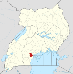
District location in Uganda
Coordinates: 00°06′S31°49′E / 0.100°S 31.817°E / -0.100; 31.817 Coordinates: 00°06′S31°49′E / 0.100°S 31.817°E / -0.100; 31.817
CountryFlag of Uganda.svg  Uganda
Region Central Uganda
Capital Kalungu
Area
  Land811.6 km2 (313.4 sq mi)
Population
 (2012 Estimate)
  Total177,200
  Density218.3/km2 (565/sq mi)
Time zone UTC+3 (EAT)
Website www.kalungu.go.ug

Kalungu District is a district in Central Uganda. It is named after the main town of the district, Kalungu, where the district headquarters are located.

Contents

Location mukoko north

Kalungu District is bordered by Gomba District to the north, Butambala District to the north-east, Mpigi District to the east, Masaka District to the south, and Bukomansimbi District to the west. The district headquarters, Kalungu, are 21 kilometres (13 mi), by road, north-east of the city of Masaka, the largest metropolitan area in the sub-region. [1]

Overview

Kalungu District was created by Act of Parliament, carved from Masaka District. [2] The district began functioning on 1 July 2010. [3]

Population

In 1991, the national population census estimated the district population at 152,030. The 2002 national census put the population at approximately 160,700. As of July 2012, the population was estimated at 177,200. [4]

Related Research Articles

<span class="mw-page-title-main">Masaka District</span> District in Buganda, Uganda

Masaka District is a district in Buganda Kingdom in Uganda. Its main town is Masaka City, whose estimated population in 2011 was 74,100.

<span class="mw-page-title-main">Kalangala District</span> District in Central Uganda, Uganda

Kalangala, also known as Ssesse, is a district in Central Uganda. The district is coterminous with the Ssese Islands in Lake Victoria and does not have territory on mainland Uganda. Like other Ugandan districts, it is named after its 'chief town', Kalangala which is located on Bugala Island, the largest of the Ssese Islands.

<span class="mw-page-title-main">Mpigi District</span> District in Central Uganda, Uganda

Mpigi District is a district in Central Uganda. Like most other Ugandan districts, it is named after its 'main town', Mpigi.

<span class="mw-page-title-main">Rakai District</span> District in Central Region of Uganda, Uganda

Rakai District is a district in the Central Region of Uganda. The town of Rakai is the site of the district's headquarters.

<span class="mw-page-title-main">Sembabule District</span> District in Buganda, Uganda

Sembabule District is a district in the Central Region of Uganda. The town of Sembabule is the site of the district headquarters. Other urban centers in the district include Lwemiyaga and Ntuusi.

<span class="mw-page-title-main">Bugiri District</span> District in Eastern Uganda, Uganda

Bugiri District is a district in Eastern Uganda. Like most other Ugandan districts, it is named after its 'chief town', Bugiri, where the district headquarters are located.

<span class="mw-page-title-main">Masaka</span> Place in Buganda Region, Uganda

Masaka is a city in the Buganda Region of Uganda, west of Lake Victoria. The city is the headquarters of Masaka District.

Rakai is a town in the Central Region of Uganda. It is the site of the headquarters of Rakai District. Other towns in the district include Kalisizo, Kyotera Kakuuto and Mutukula.

Mpigi is a town in Mawokota County, Mpigi District, in Central Uganda. Mpigi is the municipal, administrative and commercial headquarters of Mpigi District. The district is named after the town.

<span class="mw-page-title-main">Lyantonde District</span> District in Central Uganda, Uganda

Lyantonde District is a district in southern Central Uganda. It is named after the 'chief town' of the district, Lyantonde, where the district headquarters are located.

Lyantonde is a town in the southern part of the Central Region of Uganda. It is the main municipal, administrative, and commercial center of Lyantonde District.

Kyotera is a town in the southern part of the Central Region of Uganda. It is a municipality in Kyotera District. However, the district headquarters are located at Kasaali.

Lukaya is a town in the Kalungu District of the Central Region of Uganda.

<span class="mw-page-title-main">Bukomansimbi District</span> District in Central Uganda, Uganda

Bukomansimbi District is a district in Central Uganda. The district is named after its main municipal center, Bukomansimbi, the location of the district headquarters.

<span class="mw-page-title-main">Butambala District</span> District in Central Region, Uganda

Butambala District is a district in the Central Region of Uganda.

<span class="mw-page-title-main">Gomba District</span> District in Central Uganda, Uganda

Gomba is a district in Central Uganda.

<span class="mw-page-title-main">Lwengo District</span> District in Central Region, Uganda

Lwengo District is a district in the Central Region of Uganda. Lwengo is the largest town in the district and the location of the district headquarters.

<span class="mw-page-title-main">Otuke District</span> District in Uganda

Otuke District is a district in Northern Uganda. Like many other Ugandan districts, Otuke district is named after its 'chief town', Otuke, where the district headquarters are located.

<span class="mw-page-title-main">Amudat District</span> District in Northern Uganda, Uganda

Amudat District is a district in Northern Uganda. Like most other Ugandan districts, it is named after its 'chief town', Amudat, where the district headquarters are located.

<span class="mw-page-title-main">Napak District</span> District in Northern Uganda, Uganda

Napak District is a district in Northern Uganda. It is named after Mount Napak, and its headquarters is at Lokitede.

References

  1. "Road Distance Between Masaka And Kalungu With Map". Globefeed.com. Retrieved 14 May 2014.
  2. Mambule, Ali (12 January 2010). "Uganda: Two Districts to be Carved from Masaka". All Africa . Retrieved 5 March 2016.
  3. "History | Kalungu District". kalungu.go.ug. Retrieved 25 May 2020.
  4. "Estimated Population of Kalungu District In 1991, 2002 & 2012". Citypopulation.de. Retrieved 14 May 2014.