Lyantonde District

Last updated
Lyantonde District
Lyantonde District in Uganda.svg
District location in Uganda
Coordinates: 00°25′S31°10′E / 0.417°S 31.167°E / -0.417; 31.167 Coordinates: 00°25′S31°10′E / 0.417°S 31.167°E / -0.417; 31.167
CountryFlag of Uganda.svg  Uganda
Region Central Uganda
Capital Lyantonde
Area
  Land888.1 km2 (342.9 sq mi)
Elevation
1,260 m (4,130 ft)
Population
 (2012 Estimate)
  Total80,200
  Density90.3/km2 (234/sq mi)
Time zone UTC+3 (EAT)
Website www.lyantonde.go.ug

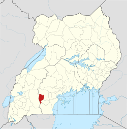
Lyantonde District is a district in southern Central Uganda. It is named after the 'chief town' of the district, Lyantonde, where the district headquarters are located.

Contents

Location

Lyantonde District is bordered by Sembabule District to the north and northeast, Lwengo District to the east, Rakai District to the south, and Kiruhura District to the west. [1] The 'chief town' of the district, Lyantonde, is located approximately 78 kilometres (48 mi), by road, west of the city of Masaka, the largest metropolitan area in the sub-region. [2] The coordinates of the district are: 00 25S, 31 10E.

History

The district is composed on one county, Kabula County. Prior to 2007, Kabula County was part of Rakai District. In 2007, the county was split off of Rakai District and given autonomous district status.

Population

In 1991, the national population census estimated the population of the district at about 53,100. During the next census in 2002, the population of Lyantonde District was estimated at about 66,000 with an annual population growth rate of 1.9%. In 2012 the district population was estimated at about 80,200. [3]

Economic activities

Agriculture being the major source of livelihood for the population in Lyantonde District. A variety of crops are grown in the district, both for subsistence and economic purposes. The crops grown include:

Cattle are the main livestock kept by farmers in Lyantonde. It is estimated that there are 83,700 of cattle in the District. Other animals that are raised include goats, sheep, pigs and poultry.

Community health

The district has a heavy disease burden. The most prevalent challenges include:

See also

Related Research Articles

Masaka District District in Uganda

Masaka District is a district in Buganda Kingdom in Uganda. Its main town is Masaka City, whose estimated population in 2011 was 74,100.

Mbarara district District in Uganda

Mbarara District is a district in South Western Uganda. The district was named after its chief municipal centre, the city of Mbarara, where the district headquarters are located.

Mubende District District in Uganda

Mubende is a district in the Central Region of Uganda. The town of Mubende is the site of the district headquarters. The district was reduced in size in July 2005 with the creation of the Mityana District.

Rakai District District in Uganda

Rakai District is a district in the Central Region of Uganda. The town of Rakai is the site of the district's headquarters.

Sembabule District District in Uganda

Sembabule District is a district in the Central Region of Uganda. The town of Sembabule is the site of the district headquarters. Other urban centers in the district include Lwemiyaga and Ntuusi.

Moyo District District in Uganda

Moyo District is a district in Northern Region of Uganda. Like many other Ugandan districts, it is named after its "chief town", Moyo, where the district headquarters are located.

Pallisa District District in Uganda

Pallisa District is a district in Eastern Uganda. Like most other Ugandan districts, it is named after its chief town, Pallisa, where the district headquarters are located.

Sironko District District in Uganda

Sironko District is a district in the Eastern Region of Uganda. The district was created in 2000 and had previously been part of Mbale District. Sironko is the main commercial town in the district.

Soroti District District in Eastern Uganda, Uganda

Soroti District is a district in Eastern Uganda. It is named after its chief municipal, administrative and commercial headquarters, Soroti, where the district headquarters are located.

Kamwenge District District in Uganda

Kamwenge District is a district in Western Uganda. It is named after its 'chief town', Kamwenge, where the district headquarters are located. Kamwenge District is part of the Kingdom of Toro, one of the ancient traditional monarchies in Uganda. The kingdom is coterminous with Toro sub-region. The districts that constitute the sub-region are: (a) Bunyangabu District (b) Kabarole District (c) Kamwenge District (d) Kyegegwa District (e) Kitagwenda District and (f) Kyenjojo District.

Kanungu District District in Uganda

Kanungu District is a district in the Western Region of Uganda. The town of Kanungu is the site of the district headquarters. The Bwindi Impenetrable Forest in Kanungu District is among the sites shown in aerial footage in the movie Black Panther.

Kyenjojo District District in Uganda

Kyenjojo District is a district in the Western Region of Uganda. Kyenjojo town is the site of the district headquarters.

Rakai Place in Central Uganda

Rakai is a town in the Central Region of Uganda. It is the site of the headquarters of Rakai District. Other towns in the district include Kalisizo, Kyotera Kakuuto and Mutukula.

Butaleja District District in Uganda

Butaleja District is a district in Eastern Uganda. It is named after its 'chief town', Butaleja, where the district headquarters are located.

Amolatar District District in Uganda

Amolatar District is a district in Northern Uganda. Like many other Ugandan districts, it is named after its main municipal and administrative centre, Amolatar Town.

Kiruhura District District in Uganda

Kiruhura District is a district in the Western Region of Uganda. The town of Kiruhura is the site of the district headquarters.

Mityana District District in Uganda

The Mityana District is a district in the Central Region of Uganda. The district was created in 2005, by taking the Mityana and Busujju counties from Mubende District. Mityana is the site of the district headquarters.

Lyantonde Place in Central Region of Uganda

Lyantonde is a town in the southern part of the Central Region of Uganda. It is the main municipal, administrative, and commercial center of Lyantonde District.

Oyam District District in Uganda

Oyam District is a district in Northern Uganda. Like most Ugandan districts, it is named after its 'chief town', Oyam, where the district headquarters are located.

Lwengo District District in Uganda

Lwengo District is a district in the Central Region of Uganda. Lwengo is the largest town in the district and the location of the district headquarters.

References

  1. Uganda District Map
  2. "Map Showing Masaka And Lyantonde With Distance Marker". Globefeed.com. Retrieved 14 May 2014.
  3. "Estimated Population of Lyantonde District In 1991, 2002 & 2012". Citypopulation.de. Retrieved 14 May 2014.
  4. Mednick, Sam (8 April 2014). "Meeting The Truck Stop Prostitutes of Uganda's HIV Capital". Vice.com. Retrieved 14 May 2014.
  5. Site, Administrator (25 February 2013). "Lyantonde District PLHAs Forum: About Us". Lyantonde District PLHAs Forum. Retrieved 14 May 2014.