Abim District

Last updated
Abim District
Abim District in Uganda.svg
District location in Uganda
Coordinates: 02°44′N33°40′E / 2.733°N 33.667°E / 2.733; 33.667
CountryUganda
Region Northern Uganda
Sub-region Karamoja sub-region
Capital Abim
Area
  Total2,353.3 km2 (908.6 sq mi)
Population
 (2012 Estimate)
  Total56,500
  Density24/km2 (60/sq mi)
Time zone UTC+3 (EAT)
Website www.abim.go.ug

Abim District is a district in Northern Uganda. It is named after its 'chief town', Abim, where the district headquarters are located.

Contents

Location

Abim District is bordered by Kotido District to the north and east, Napak District to the southeast and south, Otuke District to the southwest and Agago District to the west. [1] The district headquarters at Abim, are located approximately 140 kilometres (87 mi), by road, northwest of Moroto, the largest town in the sub-region. [2] This location lies approximately 366 kilometres (227 mi), by road, northeast of Kampala, the capital of Uganda and the largest city in that country. [3] The coordinates of the district are:02 44N, 33 40E.

Overview

Abim District became functional on 1 July 2006. Prior to that, it was known as Labwor County in Kotido District. The district is composed of five sub-counties and one town council, Abim Town Council. Abim District covers an area of 2,353.3 square kilometres (908.6 sq mi). The district is part of the Karamoja sub-region, home to an estimated one million Karimojong. The sub-region consists of the following districts: 1. Abim District 2. Amudat District 3. Kaabong District 4. Kotido District 5. Moroto District 6. Nakapiripirit District and 7. Napak District. Abim District has got a wet and dry woodland savannah type of climate, characterized by an intensive hot season that lasts from December until February.

Population

The 1991 census estimated the district population at about 47,600. The national census in 2002 estimated the population of the district at approximately 51,800. The average annual population growth rate has been determined at 0.9%, between 2002 and 2012. In 2012, the population of Abim District was estimated at approximately 56,500. [4] The table below illustrates how the district population has grown during the first decade of the 21st century. All figures are estimates.

Abim District Population Trends
YearEst. Pop.
200251,800
200352,300
200452,800
200553,300
YearEst. Pop.
200653,800
200754,300
200854,800
200955,300
YearEst. Pop.
201055,800
201156,300

Economic activities

Subsistence agriculture and animal husbandry are the main occupations of the population of the district. Many also practice animal hunting to supplement their diet. Crops grown include:

See also

Related Research Articles

<span class="mw-page-title-main">Kotido District</span> District in Northern Uganda, Uganda

Kotido District is a district in Northern Uganda. It is named after its 'chief town', Kotido, where the district headquarters are located.

<span class="mw-page-title-main">Moroto District</span> District in Northern Region of Uganda, Uganda

Moroto District is a district in the Northern Region of Uganda. The town of Moroto is the site of the district headquarters.

<span class="mw-page-title-main">Nakapiripirit District</span> District in Northern Uganda, Uganda

Nakapiripirit District is a district in Northern Uganda. Like many Ugandan districts, it is named after its 'chief town', Nakapiripirit, where the district headquarters are located.

<span class="mw-page-title-main">Soroti</span> Ugandan town

Soroti is a city in Eastern Region of Uganda. It is the main city, commercial, and administrative center in Soroti District, one of the nine administrative districts in the Teso sub-region. Soroti city was immediately approved for operationalization ahead of schedule by the Parliament of Uganda in the Financial Year 2020/2021.

<span class="mw-page-title-main">Moroto Town</span> Place in Northern Region, Uganda

Moroto is a town in Moroto District in the Northern Region of Uganda. The town serves as the location of the district headquarters.

Kotido is a town in the Northern Region of Uganda. It is the chief municipal, administrative, and commercial center of the Kotido District and the site of the district headquarters.

Nakapiripirit is a town in the Nakapiripirit District of the Northern Region of Uganda. It is the seat of the district headquarters. As an administrative unit of the district, it is one of the eight sub-counties in the district.

Amuria is a town in the Eastern Region of Uganda. It is the chief municipal, administrative, and commercial center of Amuria District, in the Teso sub-region.

<span class="mw-page-title-main">Kaabong District</span> District in Northern Region of Uganda, Uganda

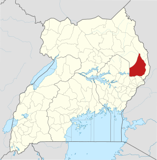
Kaabong District is a district in the Northern Region of Uganda. The district headquarters are in the similarly named town of Kaabong.

Abim is a town in the Northern Region of Uganda. It is the chief municipal, administrative, and commercial center of Abim District. The district is named after the town.

<span class="mw-page-title-main">Kaabong</span> Ugandan town

Kaabong is a town in the Northern Region of Uganda. It is the chief municipal, administrative and commercial center of the eponymous Kaabong District, and the district headquarters are located in the town.

Moroto Regional Referral Hospital, commonly known as Moroto Hospital is a hospital in the town of Moroto, in Northeastern Uganda. It is the referral hospital for the districts of Abim, Kaabong, Kotido, Moroto and Nakapiripirit and Napak.

<span class="mw-page-title-main">Agago District</span> District in Northern Uganda, Uganda

The Agago District is a Ugandan district located in the Northen Region of Uganda.

<span class="mw-page-title-main">Alebtong District</span> District in Northern Region of Uganda, Uganda

Alebtong District is a district in the Northern Region of Uganda. The town of Alebtong serves as the district headquarters.

<span class="mw-page-title-main">Amudat District</span> District in Northern Uganda, Uganda

Amudat District is a district in Northern Uganda. Like most Ugandan districts, it is named after its 'chief town', Amudat, where the district headquarters are located.

Amudat is a town in Northern Uganda. It is the main municipal, administrative and commercial center of Amudat District and the district headquarters are located there. The district is named after the town.

<span class="mw-page-title-main">Napak District</span> District in Northern Uganda, Uganda

Napak District is a district in Northern Uganda. It is named after Mount Napak, and its headquarters is at Lokitede.

Napak is a town in Northern Uganda. It is the commercial, administrative and municipal headquarters of Napak District. The district is named after the town.

Soroti–Amuria–Abim–Kotido Road is a road in the Eastern and Northern Regions of Uganda. The road connects the towns of Soroti in Soroti District, to Amuria in Amuria District, Abim in Abim District, and Kotido, in Kotido District. Soroti and Amuria lie in the Teso sub-region, while Abim and Kotido are in the Karamoja sub-region.

Lorengecora is a settlement in the Northern Region of Uganda. It is the headquarters of Lorengecora Parish, in Iriri sub-county, in Bokora County, in Napak District, in the Karamoja sub-region.

References

  1. Uganda District Map
  2. "Distance Between Moroto And Abim With Map". Globefeed.com. Retrieved 23 May 2014.
  3. "Map Showing Kampala And Abim With Distance Marker". Globefeed.com. Retrieved 23 May 2014.
  4. "Estimated Population of Abim District In 1991, 2002 & 2012". Citypopulation.de. Retrieved 23 May 2014.